Planning Naked | May 2015 by Dr. Mark David Major, AICP, CNU-A, The Outlaw Urbanist contributor
Observations on the May 2015 issue of Planning Magazine.
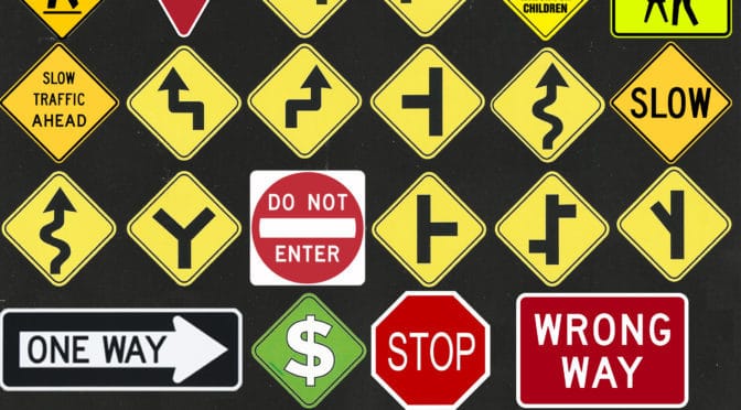
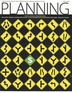
1. I cannot believe the cover of this Special Issue on Transportation from Planning: The Magazine of the American Planning Association. The message could not be any clearer:
At first, I thought – finally – APA has developed a satirical perspective on its own profession. Yeah, that was wishful thinking. The cover is insidious, especially given the contrary content of this month’s issue on road design, reduced parking requirements, etc. Let’s ‘fix’ this cover.
2. “The Mathematics of Urban Productivity” (pp. 9) has an exciting and really important finding buried in the text. “Human settlements are, first and foremost, social networks embedded in space (our emphasis),” wrote Scott Ortman, assistant professor of anthropology at the University of Colorado-Boulder in a paper published in Science Advances about a study of productivity in the Aztec city Teōtīhuacān (modern day Mexico City), “the productivity of cities depends… on their role as containers for social interaction.”
3. Despite (seemingly) editorial efforts to change the emphasis to police enforcement from road design, the message of “The Safest Streets: Vision Zero aims to eliminate all traffic fatalities” by Jay Walljasper (pp. 14) still comes through loud and clear. “Research shows that lowering a speed limit without other improvements like road design changes or improved police enforcement doesn’t work to slow traffc – it’s the roadway design (our emphasis) that affects the speed” (Charlie Zegger, UNC Pedestrian and Bicycle Information Center). It’s not an enforcement problem, it’s a design problem. This provides an especially galling contrast compared to the “pro-car, make money” message of this month’s Planning Magazine cover. Two steps forward, one step back.
4. Another good article “Releasing the Parking Brake on Economic Development” by Brian Canepa and Joshua Karlin-Resnick (pp. 22). “A recent study by the Transportation Research Board found that parking was oversupplied in mixed use district by an average of 65 percent.” It’s not only in mixed use districts and you don’t really need a study to see the obvious, just open your eyes and look. Accommodating parking for 2-3 days of the year (shopping days before Christmas) is just stupid. The example cited in Sacramento makes a clearcut case of how the real problem is created and perpetuated by the regulatory regime itself.
5. The logical conclusion of the above article and Donald Shoup’s excellent “Putting the Cap on Parking Requirements” article is the Buffalo model: complete eradication of minimum parking requirements in regulatory codes and allowing the market to determine what is needed on a case-by-case basis. The planning profession is not ready to adopt such a radical approach but they better start getting ready.
6. “Road (Funding) Rage” by Jon Davis – in combination with the insidious cover – reveals the real agenda of the American Planning Association and American Association of State Highway and Transportation Officials (AASHTO), which is organizations greedily sucking at the teat of the government (preferably Federal but State and local will do as well). Approximately one-third on the content (excluding advertisements) in this special issue is dedicated to funding, taxes, and cars.
7. “Towards a grounded theory of sustainable zoning” by Reid Ewing from the University of Utah in the Research You Can Use section advocates the concept of grounded or qualitative theory, which is really just normative theory because it is not testable or refutable, meaning it’s not theory at all in the scientific sense of the word. For normative theory, see Modernism planning.
8. It’s hard to know where to begin with Elizabeth Wood’s Viewpoint Article, “Celebrity Culture Meets Planning Culture”. I am guessing People Magazine passed on this article. According to Wood, Idina Menzel (the “the one and only, Adele Dazeem”, per John Travolta) plays a planner in the Broadway musical If/Then, she sang on Disney’s Frozen and has “millions of young Frozen fans”, ergo we can expect a “bumper crop of new planners” in the next generation. I guess I can see her point. I mean Madonna did play Eva Peron in Andrew Lloyd Weber’s Evita in 1996, Madonna had millions of young fans at the time, and now we are inundated with a bumper crop of ambitious young women who want to be the second wife of South American oligarchs… And that is how you do satire, APA *mic drop*.
Planning Naked is an article with observations and comments about a recent issue of Planning: The Magazine of the American Planning Association.
Planning Naked | April 2015 by Dr. Mark David Major, AICP, CNU-A, The Outlaw Urbanist contributor
Observations on the April 2015 issue of Planning Magazine.
1. APA President William Anderson in the Guest Column on page 5 says “that planning is relevant, alive, and needed now more than ever.” Planning, generic? Instead, what about saying we need goodplanning now more than ever? Bad planning is a waste of time and effort. The good intentions of “dedicated and earnest planners” are not enough. The road is Hell is paved with good intentions. Leadership is about setting a high standard for the profession and advocating to achieve that standard. Planners should always lead, not only “sometimes”. Let’s stop playing small ball with our language.
2. Man, there are a LOT of advertisements in this month’s issue. It’s like flipping through pages and pages of Cosmopolitan in search of that interview with Anna Kendrick, which is the only reason you bought the issue…. oh, OK… and the quiz about improving your sex life.
3. Zones for Economic Development and Employment (ZEDEs) are discussed in the article “Honduras Tries Charter Cities”. This is an intriguing concept that appears to merge early 20th century New Towns in the UK with 19th century company town models in the USA into a new 21st century application. The article admits the track record of ZEDEs around the world is a mixed bag. Like everything else, the devil is in the details.
4. Pamela Ko and Patricia Salkin discuss incorporating the Health Impact Assessment (HIA) into land-use planning decisions in the “Legal Lessons” article. The word ‘walking’ is oddly absent from their article, which suggests HIAs (and the authors do discuss in terms of) are really a tool of exclusionary zoning. Let the buyer beware.
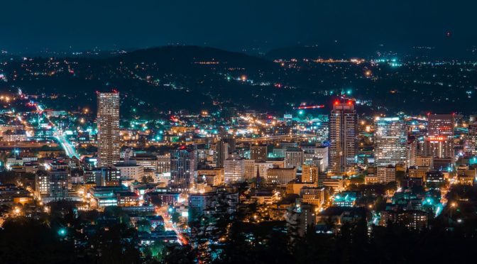
5. Goodness, that looks like a space syntax model of Portland, Oregon on page 27 in the “Big Data” article!!! I don’t think it is but it looks like someone has been reading about space syntax.
6. Any article that starts off with a rhetorical “what is planning?” question from The Editors (!) of Planning Magazine (page 36, 2015 National Planning Awards), I’m inclined to immediately skip. However, I glanced through the award winners and found them – for the most part – underwhelming.
7. C. Gregory Dale’s “Findings of Fact for Planning Commissioners” article presents an off-putting straw man public hearing scenario to jump into some otherwise good points. A good planning staff writes the finding of facts for approval AND denial on behalf of the Planning Commission. It’s the single most important tool that planning staffs have in their toolkit to guide their commissions to the best planning decisions.
8. Review of Poor Richard: Another Almanac for Architects and Planners by Mark David Major on page 69-70. Awesome sauce! This review is decidedly neutral but that’s OK since Volume 2 has more content about architects, architecture, and building than urban planning compared to Volume 1.
9. Jon Arason’s Viewpoint article about “The Planner’s Lament: Night Meetings” is only funny because it is true! I once did the same calculation about the amount of additional hours of unpaid work at night meetings while serving as a Senior Planner for a local Florida county. The revelation sent me straight into the private sector for good!
Planning Naked is a regular feature with observations and comments about a recent issue of Planning: The Magazine of the American Planning Association.
Rejcel Harbert’s Under Neons (2010), 16″ x 20″, acrylic on stretched canvas, Art by Rejcel.
Bathe in New Light | The City in Art By Dr. Mark David Major, AICP, CNU-A
Neon, noun,ne·on,ˈnē-ˌän – a colorless odorless mostly inert gaseous element that is found in minute amounts in air and used in electric lamps. From the Greek, neuter of neos new, first Known Use: 1898.
Art is rarely or merely about the physical representation of the thing but instead about light, shadow and reflection as represented in counter pose to the physical reality of the thing itself.
This is a widespread tradition that can be traced back to long before Modernism with artists such as Leonardo da Vinci, Caravaggio, and Jan van Eyck. For example, Jan van Eyck’sThe Arnolfini Portrait (1434, National Gallery, London) where the artist paints his own reflection in the mirror located on the back wall behind his subjects (see below).
In Under Neons, Harbert paints the city as bathed in neon light, as if physicality of the thing itself did not have an objective existence until awash in shadows and reflections birthed by the light itself. In the same tradition as Georgia O’Keefe’s Radiator Building-Night, New York (1927) and Harbert’s The Blue City(2012), the artist encourages us to see the city in a new and different way; not merely as a physical entity but also as an abstract reality bathed in its all-consuming light. This is given urgent power by the artist through the use of primary colors (reds, yellows, and blues) and blacks/whites, which hint at Piet Mondrian’s famous abstract paintings of New York. However, the control and preciseness found Mondrian’s abstract formalism is sacrificed in favor of a kinetic energy – of vibrant motion – painted in the light and dark of the city. Of course, Under Neons immediately suggests the city we most associate with neon spectacle: Las Vegas. However, this could be any city. This could be our city, given life anew in the light.
About Rejcel Harbert
Rejcel Harbert has over ten years of experience as the owner of Art by Rejcel, where she sells photographic services, paintings, and abstract and expressionistic acrylic arts. She received her bachelor of arts in business, economics, and Spanish from Jacksonville University in 2001. She is a member of the Business Fraternity Alpha Kappa Psi, the Honor Society Phi Kappa Phi, and received an award from the Women’s Business Organization for Achievement. Ms. Harbert does religious volunteer work including construction and repair work for community members in need. For more information on Art by Rejcel, visit www.rejcel.com.
The City in Art is a series by The Outlaw Urbanist. The purpose is to present and discuss artistic depictions of the city that can help us, as professionals, learn to better see the city in ways that are invisible to others. Before the 20th century, most artistic representations of the city broadly fell into, more or less, three categories: literalism, pastoral romanticism, and impressionism, or some variation thereof. Generally, these artistic representations of the city lack a certain amount of substantive interest for the modern world. The City in Art series places particular emphasis on art and photography from the dawn of the 20th century to the present day.
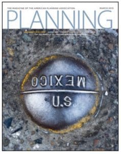
Planning Naked | March 2015
by Dr. Mark David Major, AICP, CNU-A, The Outlaw Urbanist contributor
Observations on the March 2015 issue of Planning Magazine.
1. The absence of the Congress for New Urbanism (CNU) in this month’s op-ed, “Developing Partnerships”, by APA Executive Director James M. Drinan, JD is a conspicuous omission.
2. Informative “Legal Lessons” column by former New Jersey Supreme Court judge, Peter Buchsbaum, on brevity in land use law: 1) speak plain English; 2) avoid invective (e.g. abusive or “purple prose”) language; 3) be concise; 4) the record is king (i.e. proof); and, 5) planning is visual (e.g. show, don’t tell). Judges “want facts and reasoned arguments” (pp. 11).
3. Excellent article on “Putting Berlin Back Together” by Katherine Burgess, AICP with informative maps of spatial information and research & design-oriented approaches in planning policy in the city after re-unification. The article provides a stark contrast to the predecessor articles in this issue on immigration (‘more resources”) and super TIFs (“capture state taxes”), which, once you drill down, are really about feeding on the public purse.
4. Which is immediately followed by an article romancing Sea Ranch, California, “From Romance to Reality” by Christine Kreyling, celebrating the “sublime” supposed environmental sensitivity of a prototypical far-flung mid-twentieth century “utopia” sprawl development with “an average density of one dwelling unit per acre” composed of a 10-mile long maze of cul-de-sacs two hours north of San Francisco along the coastal highway.
5. APA apparently doesn’t like gambling much judging by “When Casinos Are Too Much of a Good Thing” by Jake Blumgart, unless it’s gambling with the public’s money, of course. The benefits of casinos are “uncertain and uneven” but can you name any business or industry where the benefits are certain and even?
6. “Recycling to the Max: Earthship structures cause conundrums for planning departments” by Kristen Pope is a perfect example of a 1st world problem where the industry is ahead of a profession too focused enforcing the rules instead of creating solutions. “Planning departments may have to develop guidelines as various situations arise” as “other communities do not have clear standards for Earthship building” (pp. 46). Jeez.
7. “Golden age of street design” by Reid Ewing in the Research You Can Use section is short and sweet. This should have been given priority over the Sea Ranch, California article.
8. Kimberly Burton’s Viewpoint article, “Planning from Scratch” on travel etiquette on Ghana’s streets is an implicit endorsement of the shared space concept for streets.
Planning Naked is an article with observations and comments about a recent issue of Planning: The Magazine of the American Planning Association.
Las Vegas is a source of fascination. It has been since the publication of Learning from Las Vegas in 1972. Some say Las Vegas is “the way you’d imagine heaven must look at night.” Norman Mailer describes the city thus; “the night before I left Las Vegas I walked out in the desert to look at the moon. There was a jeweled city on the horizon, spires rising in the night, but the jewels were diadems of electric and the spires were the neon of signs ten stories high.” Alistair Cooke observes, “Las Vegas is Everyman’s cut-rate Babylon… (there was) a roadside lunch counter and over it a sign proclaiming in three words that a Roman emperor’s orgy is now a democratic institution: Topless Pizza Lunch.” Cooke implies waitresses were serving pizza sans clothing but it could have meant the roadside lunch counter was serving its pizza lunch sans toppings, i.e. Margherita. Given Las Vegas’ reputation, it is probably wise to assume both options were on the menu. In any case, architects and urban planners have shared this fascination with the ‘Modern Babylon’ of Western civilization.
Learning from Las Vegas narrowed its arguments against the precepts of Modernism in favor of a new theoretical approach. The emergence of Post-Modernism as a distinctive architectural style overshadowed some of the most remarkable things in that book. This unsurprising since the point of examining the “phenomenon of architectural communication” where the “symbol in space (comes)
Urban Pattern in the 1960s: Figure-ground representation of building footprints along the Las Vegas Strip during the late 1960 (Venturi, et. al, 1972).
before form in space” in Las Vegas and, specifically the famous Strip, was to expand to the urban level a theory Robert Venturi had already outlined in 1966’s Complexity and Contradiction in Architecture. The preoccupation with the semantics of architectural form in Post-Modernism – and its successor, Deconstructivism – took to heart what Learning from Las Vegas showed us to the exclusion of what was said. For example, there is an implicit acknowledgement of a spatial dimension to the pattern of urban functions in Las Vegas. Namely, “a set of intertwined activities that form a pattern on the land… the Las Vegas Strip is not a chaotic sprawl but a set of activities whose pattern, as with other cities, depends on the technology of movement and communication and the economic value of land.” The book also extensively uses plan representations such as figure-grounds to reveal crucial information about the functional structure of urban space in Las Vegas during the late 1960s.
Las Vegas Today: Parks, airports, and interstate highways overlaying a space syntax model of Las Vegas street network.
This is a little remarked upon yet still remarkable concession, i.e. more than semantics is going on in Las Vegas. Albert Pope seizes on this concession in Ladders (1996) to argue the “urbanism of the Strip was itself structured on a relentless linear armature… in contrast to the original Las Vegas gridiron and the pedestrian ‘strip’ of Fremont Street, the organization of the upper strip was a discrete and reductive axis of development – a complete linear city.”
In hindsight, the flaw of Learning from Las Vegas is taking an urban object as a subject before its time. Las Vegas is more fascinating today than five decades ago because it represents a quintessential example of American development during the post-war period. We say this because the city is spatially transcendental. This means first, the city is characterized by congruent spatial networks occupying (grossly) the same point in space/time and second, these spatial networks exist a priori and emerge as a consequence to urban growth. By congruent, we mean coinciding at all points in terms of location since one is super-imposed over the other. The a priori conditions are a consequence of the pattern of land division imposed by the 1785 Land Ordinance. Using computer modeling such as the configurational software of space syntax, we can ‘peel’ these congruent spatial systems apart and examine their role in Las Vegas; much like peeling layers off an onion and examining the individual layers (we know together they form an onion). The results are fascinating. First, Las Vegas has a well-defined, center-to-edge spatial pattern, the focus of which is not the Las Vegas Strip (though it is partially in the core) but the historic area/Central Business District (CBD). Second, a congruent, large-scale orthogonal spatial pattern emerging from the pattern of land division over time characterizes Las Vegas. This orthogonal grid pattern did not exist in the early 20th century (though we can infer its outline from section lines) and only began to emerge during the 1950s and 1960s before fully manifesting in the late 20th century.
Las Vegas Yesterday: Las Vegas in 1908 (left) and 1952 (right) (Source: US Geological Survey).
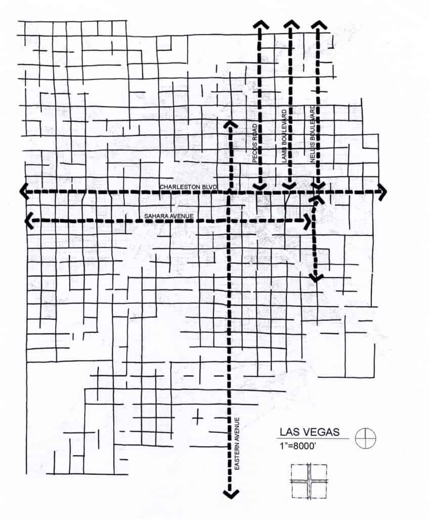
Urban form in Las Vegas has evolved over time to privilege the CBD/historic area so there is a micro-scale urban fabric that includes the historical diagonal routes from the CBD to the edges of the city in addition to this macro-scale orthogonal grid logic arising from the national grid system. We can demonstrate this by identifying all orthogonal routes aligned to cardinal directions arising from the pattern of land division. Some of these streets are long and highly connected (such as Charleston Boulevard). Others are not but all are evenly spaced apart in terms of metric distance arising from a historical process (subdivide the section, township, etc.) previously described by John Reps in The Making of Urban American/Cities of the American West. These streets represent the “strong prescriptive order” (using Pope’s terminology) of the national grid system as realized on the ground over time in the urban object. A portion of the ‘holistic’ Las Vegas super grid is composed of these large-scale orthogonal streets. This includes highly integrated routes such as Charleston Boulevard (east-west) and the southern segment of Las Vegas Boulevard (north-south).
Orthogonal Las Vegas: All orthogonal routes emerging from the pattern of land division imposed by the 1785 Land Ordinance.
However, this orthogonal logic is imperfectly realized. There are two reasons. First, the national grid system is a conceptual division of the land. The process Reps describes of section lines becoming main roads and so forth did not always occur for every tract of land. Second, the national grid system lays over the circumstance of the Earth. Bill Bryson succinctly summarizes the problem this causes for surveyors. “One problem with such a set-up is that a spherical planet does not lend itself to square corners. As you move near the poles, the closer the lines of longitude grow… (so) to get around this problem, longitudinal lines were adjusted every twenty-four miles… (which) explains why north-south streets… so often taken a mysterious jag” (136). This appears to be evident in diversions along the length of some north-south streets in Las Vegas. Peeling off this large-scale orthogonal street network reveals the underlying variation in the Las Vegas urban layout including a striking center-to-edge pattern formed by the historical diagonal routes and micro-scale street network. This shows how movement might utilize the urban grid, independently of the large-scale orthogonal streets.
Las Vegas’ Privileged Center: Center-to-edge urban pattern privileging the CBD/historic area.
The effect of the micro-scale street network is to privilege Las Vegas’ CBD/historical area. Configurational analysis using space syntax demonstrates this micro-scale street network is more closely related (significantly so) to the Las Vegas urban grid as a whole than the macro-scale network. This should be unsurprising. The crucial relationship for movement/urban functions in a city is center-to-edge. Edge-to-edge movement (for example, passing through Las Vegas in going from one city to another, i.e. Denver to Los Angeles) is nominally the function of the interstate highways. Instead, the macro-scale network operates as super-integrators since these streets are about six times more connected into the network compared to the average in Las Vegas.
The macro-scale network is reminiscent of a hierarchy imposed on the urban fabric by large-scale historic interventions: for example, Haussmann’s 19th century boulevards in Paris. However, there are key differences. First, the national grid system is an a priori conceptual order. Development allows this hierarchy to emerge during the growth of American cities. It is not a later remedial correction to the urban fabric. Second, it is distinct from the Las Vegas super grid. Some streets compose both but the most important are the diagonals of Las Vegas Boulevard, Main Street, Fremont Street, and Rancho Drive. If we removed the super grid in a similar experiment, then the urban fabric would disintegrate into discrete elements in the absence of these diagonals. Finally, there are highly segregated interstitial areas of the urban grid. These are suburban-type developments poorly connected into the urban grid except via the large-scale orthogonal streets defining their perimeters. We can describe this as discrete separation by linear segregation. Often, the only connection from neighborhood-to-neighborhood is via parallel curb cuts into separate developments (with at least one development somewhere having a minimum of two entry roads). This has nothing to do with inter-connectivity and everything to do with traffic management of vehicular turning actions.
This emergent hierarchy in Las Vegas and other cities characterized by post-war growth in the 20th century (such as Phoenix and Orlando) derives from modern transportation planning. Regulatory requirements mandate the design of roads including street width, stopping distance, frequency of curb cuts, turning radius, and so on based on traffic speeds/volumes projected to utilize the streets using origin and destination gravity models Local governments have adopted these standards into their development review regulations, having a profound impact on American urban form since the mid-twentieth century. Planning to ‘minimum requirements’ gives rise to a spatial hierarchy that becomes embedded in the urban pattern. Borrowing from Christopher Alexander, Las Vegas proves that, in part, a city can be a tree. It is a different question whether it makes good urban form.
Based on excerpts from forthcoming The Syntax of City Space: American Urban Grids by Mark David Major.
Share the knowledge!
Blogging about architecture, urbanism, and culture…

 Planning Naked | May 2015

 Planning Naked | April 2015
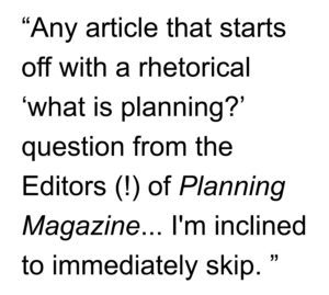 5. Goodness, that looks like a space syntax model of Portland, Oregon on page 27 in the “Big Data” article!!! I don’t think it is but it looks like someone has been reading about space syntax.


 About Rejcel Harbert
 Planning Naked | March 2015
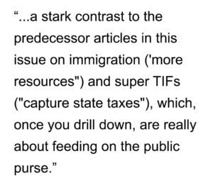

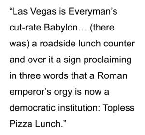 Cooke implies waitresses were serving pizza sans clothing but it could have meant the roadside lunch counter was serving its pizza lunch sans toppings, i.e. Margherita. Given Las Vegas’ reputation, it is probably wise to assume both options were on the menu. In any case, architects and urban planners have shared this fascination with the ‘Modern Babylon’ of Western civilization.
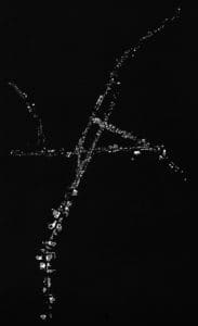
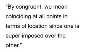 The a priori conditions are a consequence of the pattern of land division imposed by the 1785 Land Ordinance. Using computer modeling such as the configurational software of space syntax, we can ‘peel’ these congruent spatial systems apart and examine their role in Las Vegas; much like peeling layers off an onion and examining the individual layers (we know together they form an onion). The results are fascinating. First, Las Vegas has a well-defined, center-to-edge spatial pattern, the focus of which is not the Las Vegas Strip (though it is partially in the core) but the historic area/Central Business District (CBD). Second, a congruent, large-scale orthogonal spatial pattern emerging from the pattern of land division over time characterizes Las Vegas. This orthogonal grid pattern did not exist in the early 20th century (though we can infer its outline from section lines) and only began to emerge during the 1950s and 1960s before fully manifesting in the late 20th century.
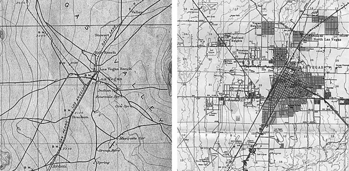
 cuts into separate developments (with at least one development somewhere having a minimum of two entry roads). This has nothing to do with inter-connectivity and everything to do with traffic management of vehicular turning actions.