UPDATE: Dr. Mark David Major is scheduled to speak at SSS10 on Tuesday, July 14th at 12 Noon during the “Urban Morphology” session in the Leolin Price Lecture Theatre.
Dr. Mark David Major, AICP, CNU-A, founder of The Outlaw Urbanist and author of the Poor Richard Almanac series for architects and planners, will be speaking at the 10th Space Syntax Symposium (SSS10) held in London from 13 to 17 July 2015 at University College London, Bloomsbury. Major was the Symposium Organizer for the inaugural 1997 conference in London and generally regarded as the founder of Space Syntax Symposia, which is now approaching its twentieth year.
Major will be speaking about “The Hidden Corruption of American Regular Grids: why space syntax doesn’t work in the United States, when it looks like it should”. Read the abstract below for a sneak preview:
ABSTRACT
Space syntax has made remarkable progress in practice and research around the world over the last 40 years. However, this is not the case in the United States. Space syntax remains on the fringes of the American planning and development process. This is odd since there appear to be several inherent advantages for the widespread application of space syntax in an American context, i.e. continuing large-scale urban growth, an established research programme at one of the country’s leading universities, and seemingly ‘natural’ allies in professional practice.
The paper outlines the financial, institutional, and legal hurdles and pitfalls confronting space syntax in the American market, especially in the private sector. Using a series of ‘back-of-the-napkin’ financial calculations common to the American planning and development process, the paper demonstrates how these challenges can transform into a distinct advantage for advocating the cause of the space syntax in the United States. Given this, the paper concludes by discussing the enormous challenges and opportunities for space syntax in America today.
My ‘Secret’ Life as an Anonymous Source by Dr. Mark David Major, AICP, CNU-A, The Outlaw Urbanist contributor
Sorry, this post is quirky and not nearly as salacious as the title might suggest otherwise. However, enough time has passed (15 years) that I can now reveal one of the more interesting episodes in my professional career. This is my ‘secret’ life as an anonymous source for the free-wheeling British press involving a story about London Transport, the Metropolitan Police and, ultimately, the British Prime Minister Tony Blair and his still-young-at-the-time Labour government.
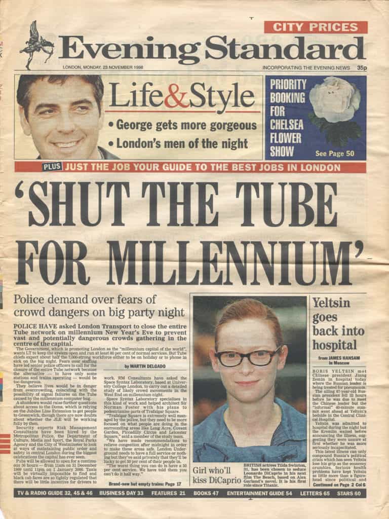
On November 23, 1998, London’s Evening Standard printed a front-page article by Martin Delgado with the screaming headline “SHUT THE TUBE FOR MILLENNIUM.” The story was about London Transport’s public claims that they would operate between 70% and 80% of the London Underground services for the Millennium New Year’s Eve celebration on December 31, 1999. However, as part of the crowds study group, London Transport was privately reporting they would be lucky to run services at 50% capacity on the night. At the time, there was a three-year crowds study group tasked with preparing Central London for the large number of people expected to attend the celebrations consisting of the Metropolitan Police, London Transport, Department of Culture, Media and Sport, City of Westminster, and their consultants Risk Management Consultants and Space Syntax Ltd.
Front cover of the 23 November 1998 issue of the Evening Standard.
The London Metropolitan Police was extremely concerned about London Transport’s plans to operate at only 50% capacity on the night and leaked the story to the Evening Standard. Delgado’s story quoted an anonymous source in Space Syntax Ltd. to support the position of the Metropolitan Police.
I was the anonymous source.
As I recall, a crowds study group member of the Metropolitan Police referred Mr. Delgado to me to support their position by providing some background information about the study. It was only years later that learned my mistake was asking for an “off the record” conversation ; not realizing this meant I could still be quoted as an anonymous source. In hindsight, I should have asked for a conversation “on background.” Oh well, live and learn. Initially, I took some grief inside Space Syntax for my role in this story but less than you might think because what I said was accurate and correct. The reaction inside Space Syntax about my role later evolved into bewildered amusement because of what next happened.
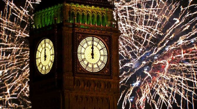
The story briefly caused a firestorm, which required Tony Blair to respond to Ministers of Parliament during Prime Minister’s Question Time. The story eventually led to the Labour government making wholesale changes to government preparations by refocusing the Millennium celebrations on the River Thames. This was not our idea but it was a darn good one in hindsight because it helped to spread the expected crowds over a much larger area of central London. A change that also required London Underground to operate nearer to full capacity on the night since people would be arriving and leaving via more underground stations. At the time, the concern of crowds study group about this change was our crowd observations were focused around Trafalgar Square, Leicester Square, and Piccadilly Circus on New Year’s Eve in 1996, 1997 and 1998.
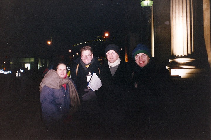
1:00 am, January 1, 1999 outside Canada House in Trafalgar Square after (very cold) New Year’s Eve crowd observations (from left to right): Beatriz Campos, François Dufaux, Mark David Major, and Tim Stonor.
We worried about missing something since we could not observe crowd movement and space use under the same circumstances before the actual night. However, the Millennium celebrations were a great success, going off without a hitch other than some minor incidents involving stupidity and chance, with no serious injuries due to overcrowding on the streets of central London. I like to think Space Syntax’s role as a consultant on the crowds study – and mine, in particular, as the Space Syntax project manager and anonymous source to this Evening Standard story – helped to ensure public safety on December 31, 1999.
If you are interested in more details about our crowds study, you can read about it here:
Major MD, A. Penn , G. Spiliopoulou, N. Spende, M. Doxa, and P. Fong, 2000, ‘Following the Crowd: Spatial Layout and Crowd Behaviour’, arq Architectural Research Quarterly, Volume 4, Number 3, Cambridge University Press, pp. 257-264, ISBN 0-521-79412-9.
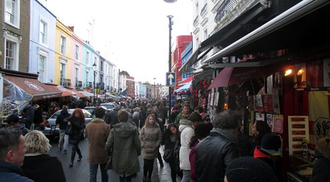
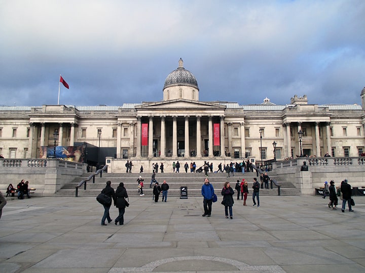
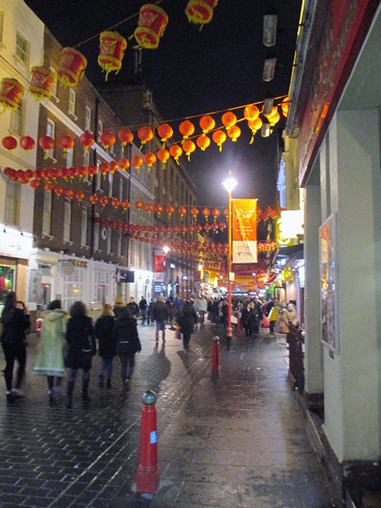
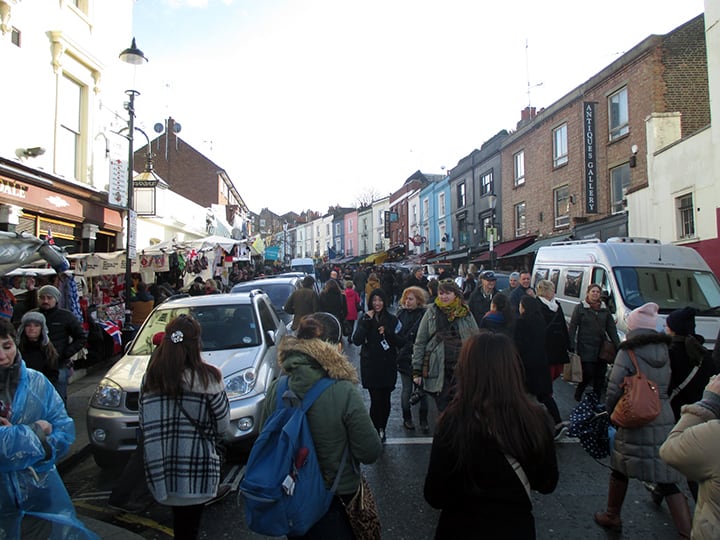
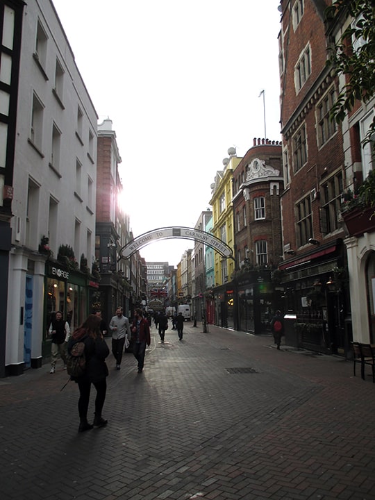
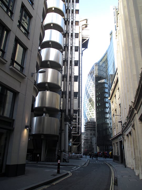
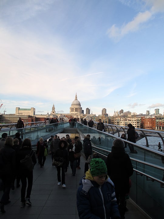
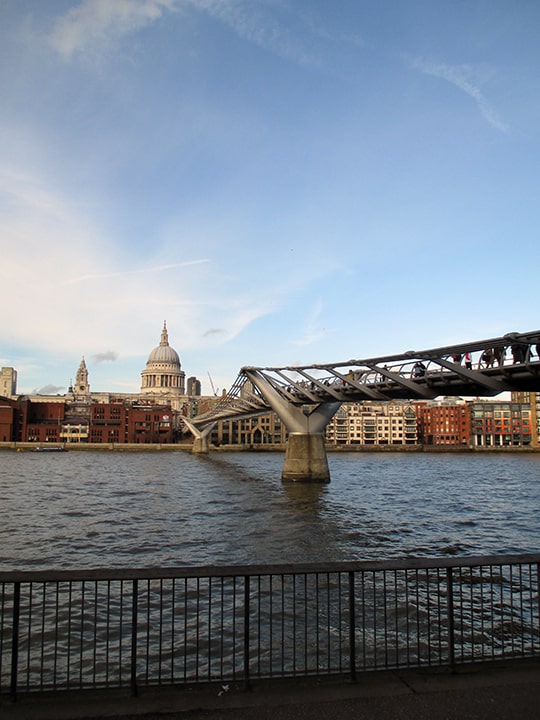
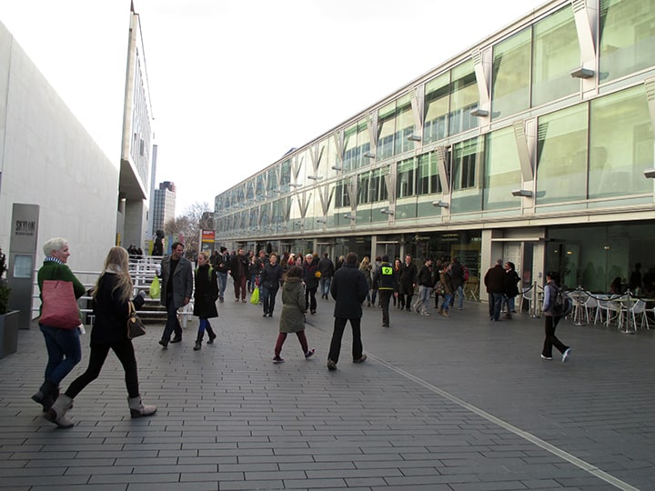
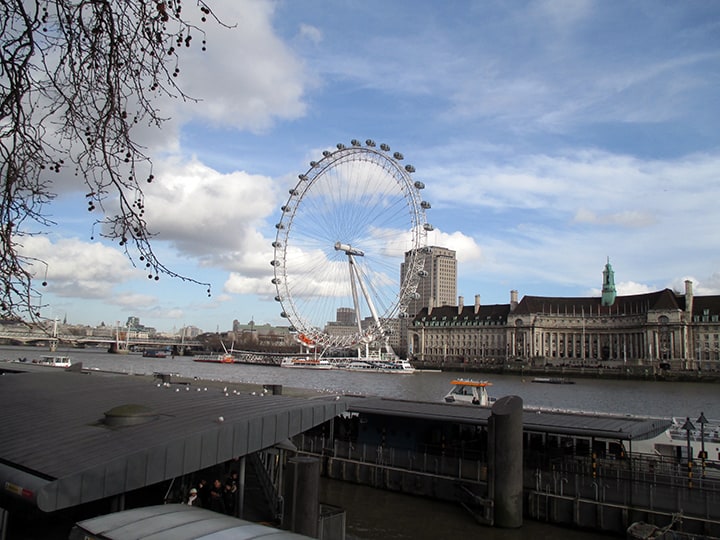
Remodeled steps into Trafalgar Square and pedestrianized area in front of the National Gallery, London (Image: Mark David Major).Gerrard Street in Chinatown at night in the West End, London (Image: Mark David Major).The street ballet looking north at the Portobello Road Market in Notting Hill, London (Image: Mark David Major).Carnaby Street in the West End on an early Monday morning (Image: Mark David Major).Looking north along the Lime Street line of sight (just sneaking through) pass Lloyds of London (by Lord Richard Rogers) to the Gherkin (by Lord Norman Foster) in the City of London (Image: Mark David Major).Millennium (or Bankside) Bridge by Lord Norman Foster looking north towards St. Paul’s Cathedral and the City of London (Image: Mark David Major).Millennium (or Bankside) Bridge by Lord Norman Foster from the south embankment. A London landmark that might not exist if it weren’t for space syntax analysis (Image: Mark David Major).Part of the remodeled South Bank Centre. The building adjacent and running parallel to the Charing Cross railroad tracks (to the right) would not exist if it weren’t for space syntax analysis of pedestrian movement patterns in the area (Image: Mark David Major).View east along the River Thames in London. The London Eye is to the right. Returning to London nearly 15 years later, I was pleasantly surprised by the amount of life on the river (Image: Mark David Major).
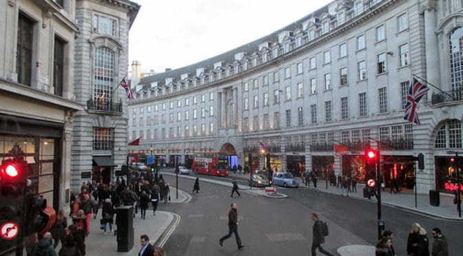
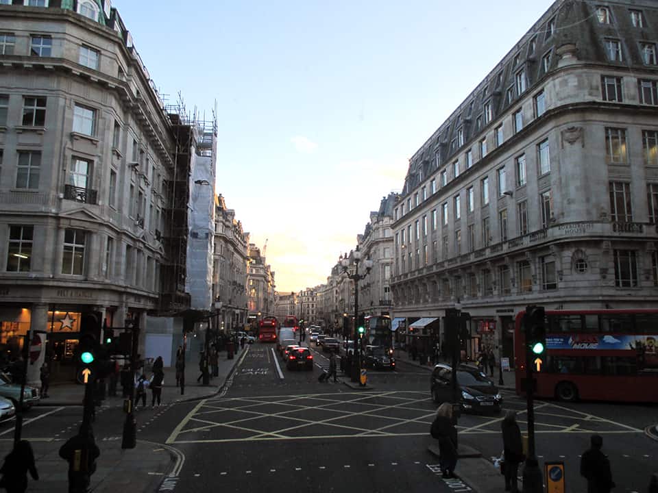
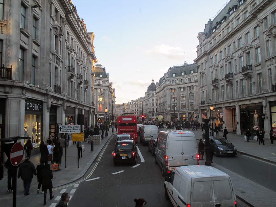
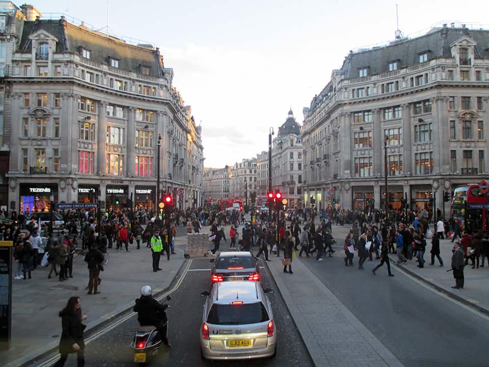
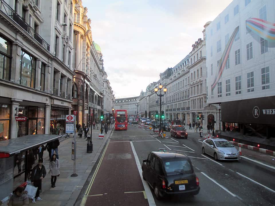
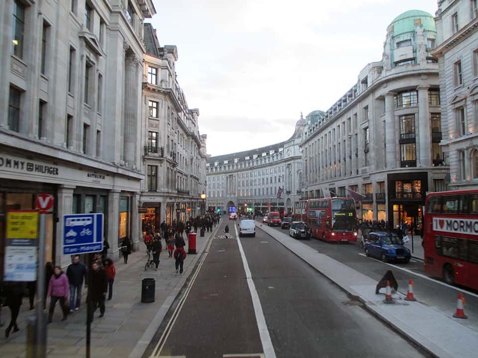
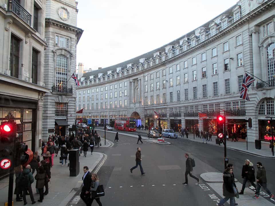
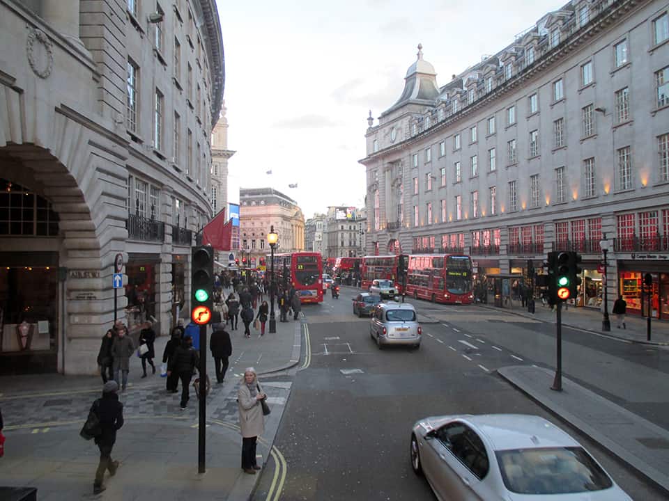
Regent Street is a major shopping street in the West End of London. It is named after George, the Prince Regent (later George IV) and was built under the direction of the architect John Nash. The street runs from Waterloo Place in St James’s at the southern end, through Piccadilly Circus and Oxford Circus, to All Souls Church. From there Langham Place and Portland Place continue the route to Regent’s Park. The street was completed in 1825 and was an early example of town planning in England, replacing a number of earlier roads including Swallow Street. Nash’s street layout has survived, although all the original buildings except All Souls Church have been replaced following reconstruction in the late 19th century. The street is known for its flagship retail stores, including Liberty, Hamleys, Jaeger and the Apple Store. The Royal Polytechnic Institution, now the University of Westminster, has been based on Regent Street since 1838 (Source: Wikipedia).
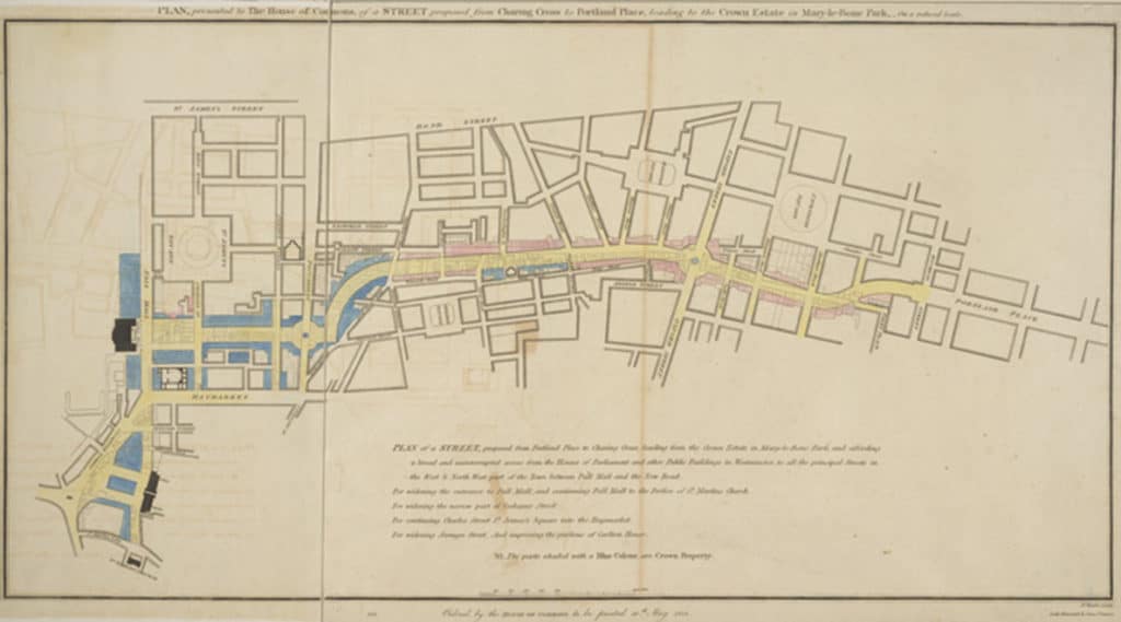
Regent Street proposal, published 1813, titled “PLAN, presented to the House of Commons, of a STREET proposed from CHARING CROSS to PORTLAND PLACE, leading to the Crown Estate in Marylebone Park” (Source: Wikipedia).
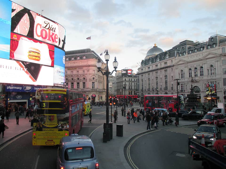
Upper Regent Street, London (Image: Mark David Major).Upper Regent Street, London (Image: Mark David Major).Oxford Circus, intersection of Oxford Street and Regent Street, London (Image: Mark David Major).Lower Regent Street, London. Carnaby Street is located two blocks to the east (left) of this intersection (Image: Mark David Major).Lower Regent Street, London (Image: Mark David Major).Lower Regent Street, London (Image: Mark David Major).Lower Regent Street looking toward Piccadilly Circus (right around the bend), London (Image: Mark David Major).Piccadilly Circus, London (Image: Mark David Major).
“London calling, yes I was there too,
An’ you know what they said — well some of it was true!” — London Calling, The Clash
Urban Patterns | London, United Kingdom by Dr. Mark David Major, AICP, CNU-A
London is the capital and most populous city of England and the United Kingdom. Standing on the River Thames in the southeast of the island of Great Britain, London has been a major settlement for two millennia. It was founded by the Romans, who named it Londinium. London’s ancient core, the City of London, largely retains its +square-mile medieval boundaries. Since at least the 19th century, “London” has also referred to the metropolis around this core, historically split between Middlesex, Essex, Surrey, Kent, and Hertfordshire, which today largely makes up Greater London, governed by the Mayor of London and the London Assembly. London is a leading global city in the arts, commerce, education, entertainment, fashion, finance, healthcare, media, professional services, research and development, tourism, and transportation. London has a diverse range of people and cultures, and more than 300 languages are spoken in the region. The estimated mid-2015 municipal population (corresponding to Greater London) was 8,673,713, which is the largest of any city in the European Union, and accounting for 12.5% of the UK population (Source: Wikipedia).
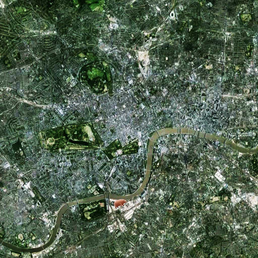
Archaeological discoveries in the London area have found evidence of structures that date back as far as 4,500 B.C., indicating humans have occupied the area far longer than previously thought. However, the founding of London by the Romans in 43 AD still marks the first large-scale settlement in the area. This settlement was founded in the location of the modern “Square Mile” of the City of London (to the right of the below satellite view, north of the River Thames where there are five bridges).
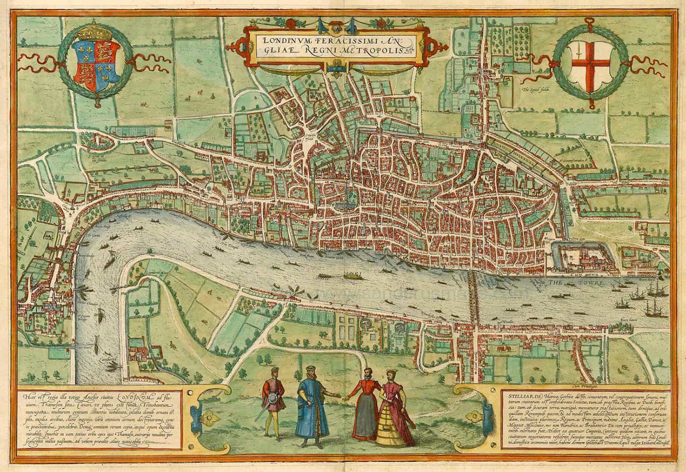
1572 Braun & Hogenberg’s 1572 map of London showing the City of London (center) and the early origins of the City of Westminster (far left) and the Bankside area (bottom center, south of the River Thames).
The City of Westminister (west and south of St. James Park along the River Thames where it has a – more or less – north-south alignment at this location) predates the Norman Conquest of England in 1066. The two distinct settlements only began to merge together during the 16th century (see above).
Satellite view of central London from 15 km (Source: Google Earth).
This created a new urban focus in what is now called the West End (the exact center of this image, which is focused on Piccadilly Circus, adjacent to Hyde Park) and, specifically, Oxford Street (the clearly visible, long east-west street at the center of the image). The City of London is characterized by a small-scale, deformed grid pattern of small blocks and short streets (in relative terms, though not nearly as small-scale as during the Medieval period).
Pink Floyd’s Animals album cover illustration of a pig flying over Battersea Power Station.
In fact, all of London has a deformed grid pattern radiating outward from center-to-edge whereby the scale of the grid became larger for street lengths and block sizes (such as in the West End) during the growth of the city in order to mediate the relationship between the center and its ever-expanding edges.
NOTE: As any Pink Floyd fan might expect, the flying pig marks the location of Battersea Power Station, currently and finally being redeveloped.
(Updated: June 16, 2017)
Urban Patterns is a series of posts from The Outlaw Urbanist presenting interesting examples of terrestrial patterns shaped by human intervention in the urban landscape over time.
Share the knowledge!
Blogging about architecture, urbanism, and culture…
 UPDATE: Dr. Mark David Major is scheduled to speak at SSS10 on Tuesday, July 14th at 12 Noon during the “Urban Morphology” session in the Leolin Price Lecture Theatre.
 work in the United States, when it looks like it should”. Read the abstract below for a sneak preview:
 The paper outlines the financial, institutional, and legal hurdles and pitfalls confronting space syntax in the American market, especially in the private sector. Using a series of ‘back-of-the-napkin’ financial calculations common to the American planning and development process, the paper demonstrates how these challenges can transform into a distinct advantage for advocating the cause of the space syntax in the United States. Given this, the paper concludes by discussing the enormous challenges and opportunities for space syntax in America today.