“Ya’ know that, this town’s like a painted desert
Dead heat, movin’ in the city, I’m lost in a painted desert.”
— Painted Desert, Pat Benatar
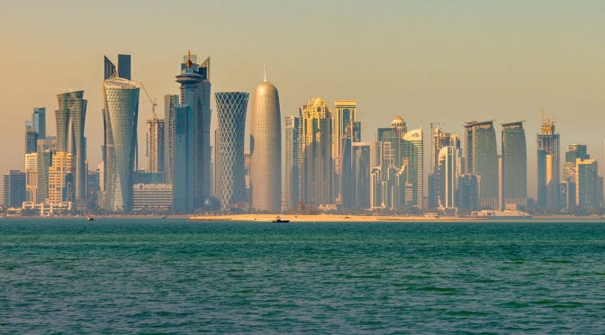
Urban Patterns | Doha, Qatar
by Dr. Mark David Major, AICP, CNU-A
Doha (Arabic: الدوحة, ad-Dawḥa or ad-Dōḥa) — literally meaning “the big tree” but, locally, “rounded bays” — is the capital city and most populous city in the State of Qatar. Doha has a population of 1,351,000 in the city proper with a metropolitan population close to 1.5 million. The city is located on the coast of the Persian Gulf in the east of the country. It is Qatar’s fastest growing city with over 50% of the nation’s population living in Doha or its surrounding suburbs. It is the economic center of the country. Doha was founded in the 1820s as an offshoot of Al Bidda. It was officially declared as the country’s capital in 1971 when Qatar gained independence from being a British Protectorate. As the commercial capital of Qatar and one of the emergent financial centers in the Middle East, Doha is considered a world city by the Globalization and World Cities Research Network. The city of Doha was formed after seceding from another local settlement known as Al Bidda. The earliest documented mention of Al Bidda was made in 1681 by the Carmelite Convent in an account, which chronicles several settlements in Qatar. In the record, the ruler and a fort in the confines of Al Bidda are alluded to. Carsten Niebuhr, a European explorer who visited the Arabian Peninsula, created one of the first maps to depict the settlement in 1765 in which he labeled it as ‘Guttur’ (Source: Wikipedia).
Recently, UCL Qatar created a new interactive map to explore the history of Doha from the late 1940s to the present day here. The Origins of Doha is a UCL Qatar research project, supported by the Qatar National Research Fund, which aims to explore the foundation and historic growth of Doha, its transformation to a modern city, and the lives and experiences of its people through a combination of archaeological investigation, historical research, and oral testimony (Source: UCL Qatar).
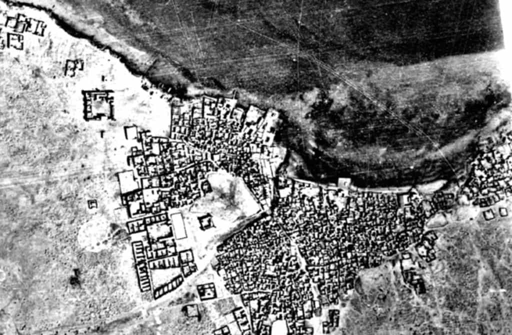
What we see in this 1947 aerial photograph (see above) is a very compact settlement gathered along the shoreline of the Doha Port on the Persian Gulf. The settlement is so compact that it is difficult to discern its spatial structure. However, if you focus on the center of the image, then look slightly southwards and eastwards, you can see a clear ring of circulation around a large block possessing an intricate street network. From this ring of circulation, we can discern at least four (4) diagonal streets radiating outwards in all directions. Given the rapid growth in Doha over the last 30 years, it is extremely difficult to assign modern day names to these places but it appears, more or less, consistent with the modern ‘downtown’ area. The older town of Al Bidda appears to be eastward of this area.
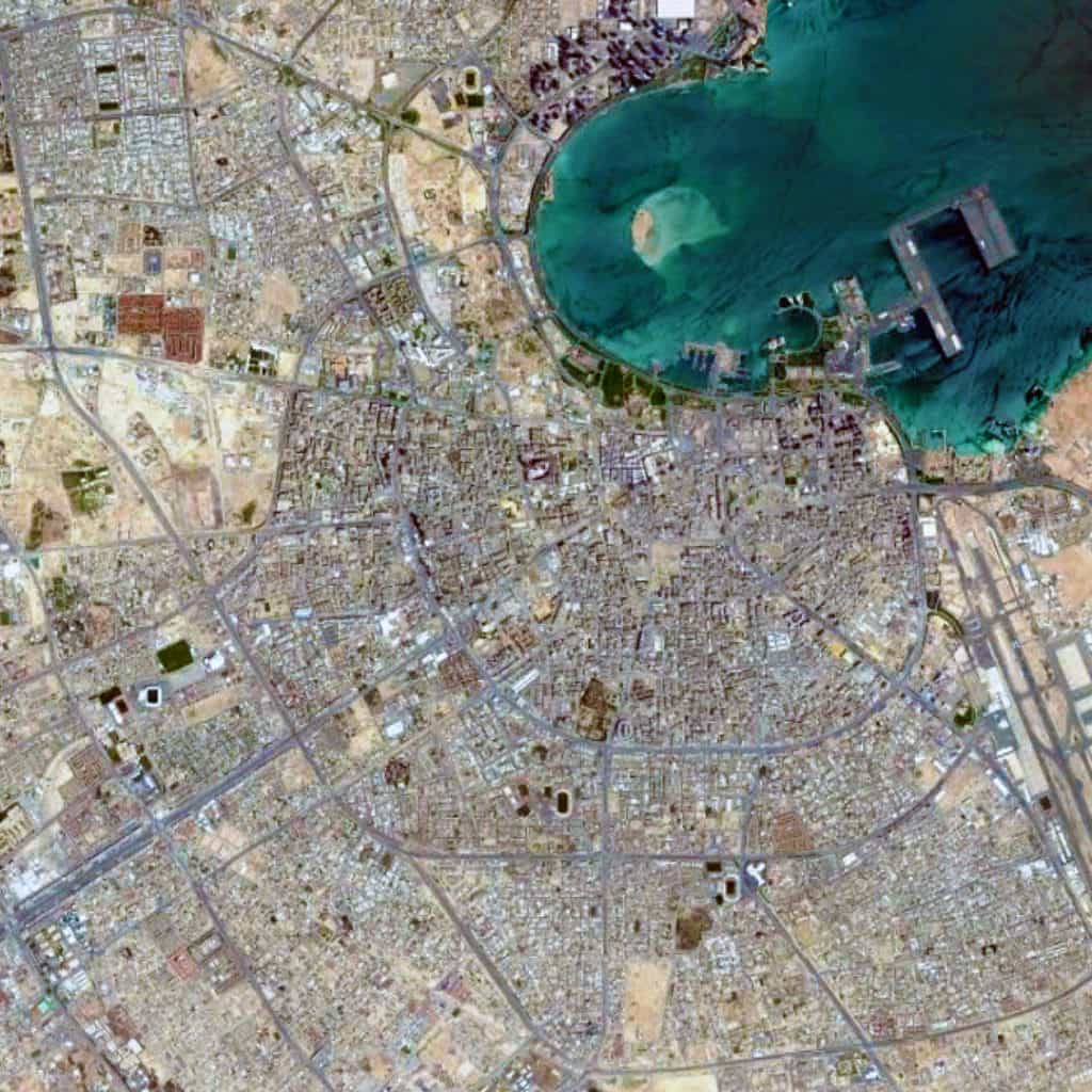
If we examine the urban pattern of Doha at the large scale (see the satellite view from 15 km above), then there is a distinctive ‘deformed wheel’ structure of diagonal streets radiating outward in most directions from the port. This network is connected together by a series of orbital roads, which encircle the city based on an increasing radii, as measured from the shoreline of the port. At this scale, the Doha urban pattern appears to be composed of massive ‘super blocks.’ However, this is misleading. The network of publicly-accessible space is more intricate than this, indicating an attempt to somewhat separate large-scale vehicular traffic from more localized types of traffic in these ‘super blocks.’
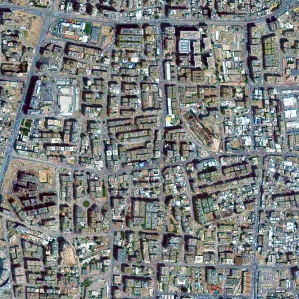
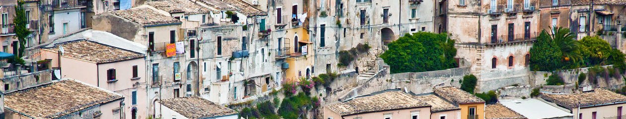
This is more apparent if we zoom on one of these ‘super blocks’ (see the satellite view from 2 km above). We can discern the prototypical pattern you might in some older Middle Eastern settlements with narrower streets and a marginal offsetting of blocks, designed to subtly deter through traffic in the area. Functionally, this is more akin to Olmsted’s efforts to do the same in the Riverside suburb of Chicago, though representing a much different geometrical strategy. In fact, this is more practical than the modern suburbia model of massive blocks of nebulous shape and minimal street connections, which you will find in many post-war suburbs of the United States, especially those constructed over the last 40 years. It seems likely these attempts to retain a traditional type of urban pattern while still accommodating the requirements of a modern vehicular traffic system has resulted in a tension in the urban street network, especially due to the rapid growth during the early 21st century.
Urban Patterns is a series of posts from The Outlaw Urbanist presenting interesting examples of terrestrial patterns shaped by human intervention in the urban landscape over time.
