Tag Archives: Photographic Essay

PHOTO ESSAY | Savannah, Georgia USA

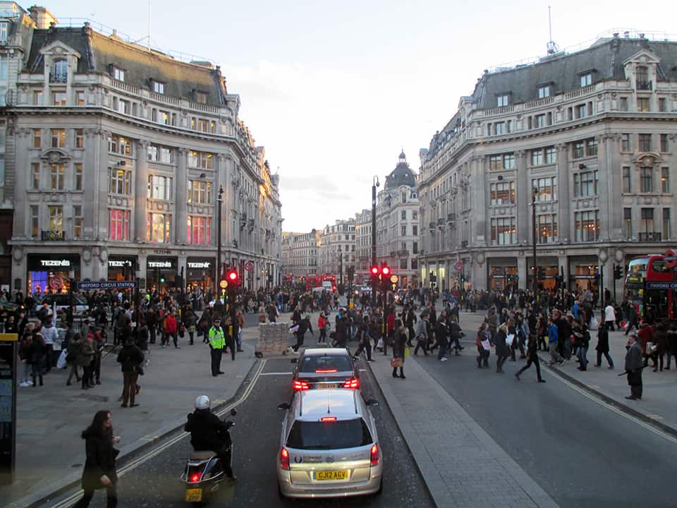
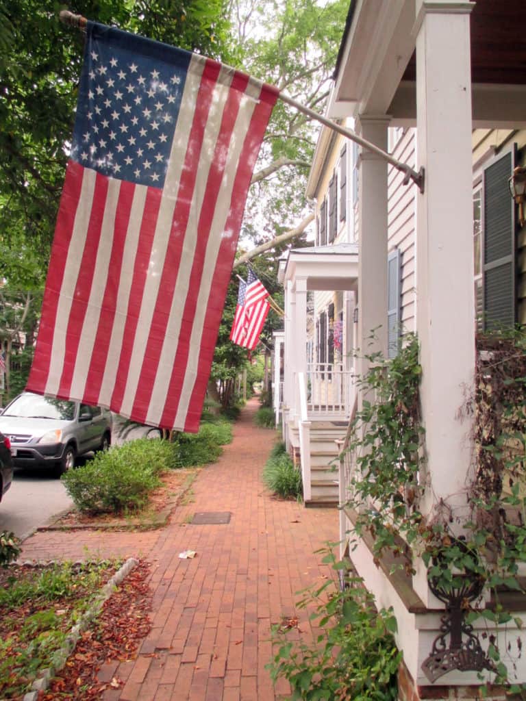
It has been said that ‘Savannah is all about its squares.’ This is inaccurate. The spatial logic of Savannah is all about the historical loading of front doors along east-west streets in the ward plan. This generates a spatial hierarchy in the plan between ‘outsiders’ (i.e. visitors) principally using north-south streets to enter the town (historically from the port, later via vehicular traffic) before assimilating along the east-west streets primarily used by ‘insiders’ (i.e. residents) (Anderson, 1986 and 1993; Kostof, 1991; Major, 2001 and 2014).

John Reps’ famous 1959 drawing of the historical growth of the Savannah, Georgia ward plan from 1733-1856 (Reps, 1965; 201).
View southeast down West River Street: an east-west street in Savannah (Photograph: Mark David Major).
View southwest from West River Street to Williamson Street showing the dramatic change in elevation from the bank of the Savannah River (Photograph: Mark David Major).
View northwest across Oglethorpe Square (Photograph: Mark David Major).
View northeast from Johnson Square down Bull Street to Savannah City Hall (Photograph: Mark David Major).
North-south streets, mostly barren of trees or front doors, bear the weight of moving high-speed (in relative terms) traffic through Savannah’s ward plan (Photograph: Mark David Major).
(Photograph: Mark David Major)

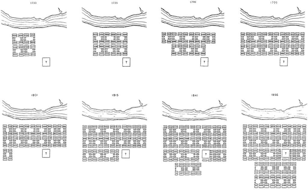
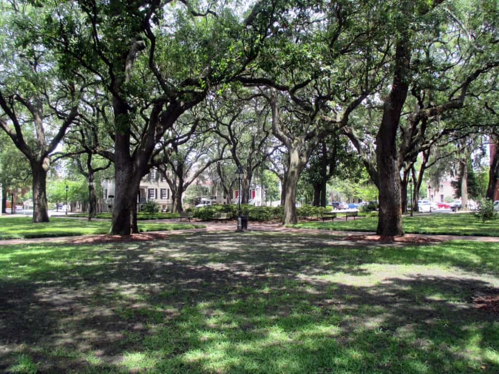
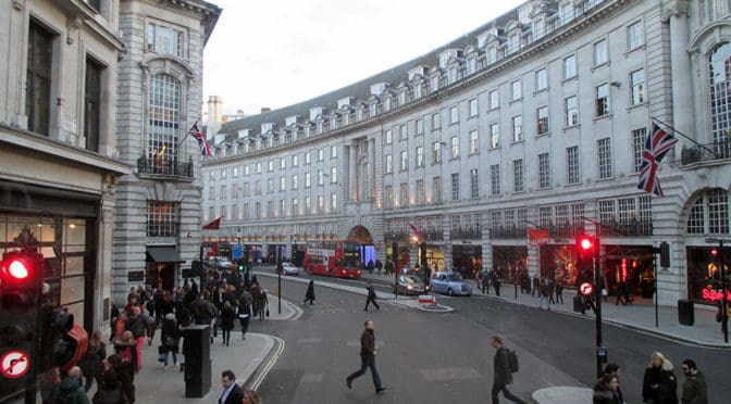
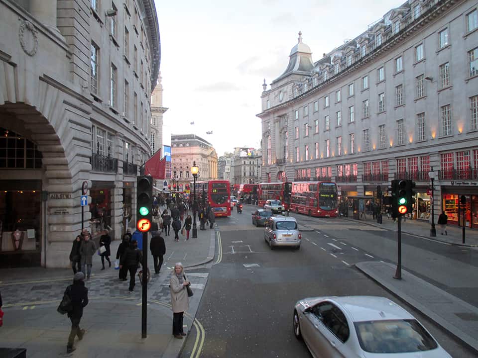
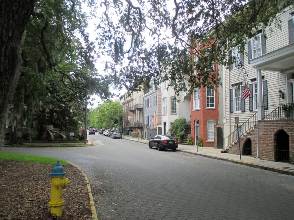
The spatial logic of the ward plan is imminently serviceable for managing moving traffic, treating most squares as enlarged roundabouts and filtering through traffic mostly along north-south streets such as this one. Over time, constitution (i.e. dwelling entrances) has emerged in a spotty fashion along these north-south streets but not enough (to date) to deteriorate the logic of loading front doors along east-west streets.

(Photograph: Mark David Major)

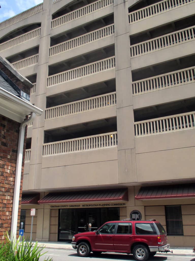
Despite this, Savannah’s ward plan is suffering under the weight of storing parked vehicles. There are parking garages located on at least four of the squares and two sides of Orleans Square is constituted by surface parking for the convention center. The wall constructed to ‘hide’ this surface parking does nothing to support the functioning of the ward plan or Orleans Square itself. This photo shows the Chatham County-Savannah Metropolitan Planning Commission offices occupying a ground level retail space (not a bad idea but poorly designed frontage) on Oglethorpe Square at the base of a seven-story parking garage (metaphorically-speaking, being crushed under the weight of parked vehicles).

Loading of front doors along an east-west street in Savannah’s ward plan (Photograph: Mark David Major).
Loading of front doors (including double-loading at ground level and second-floor entries) on an east-west street defining the northern edge of Oglethorpe Square in Savannah (Photograph: Mark David Major).
(Photograph: Mark David Major)

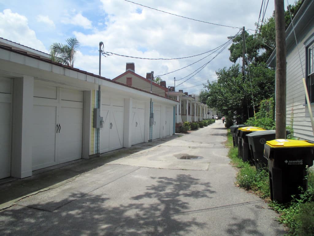
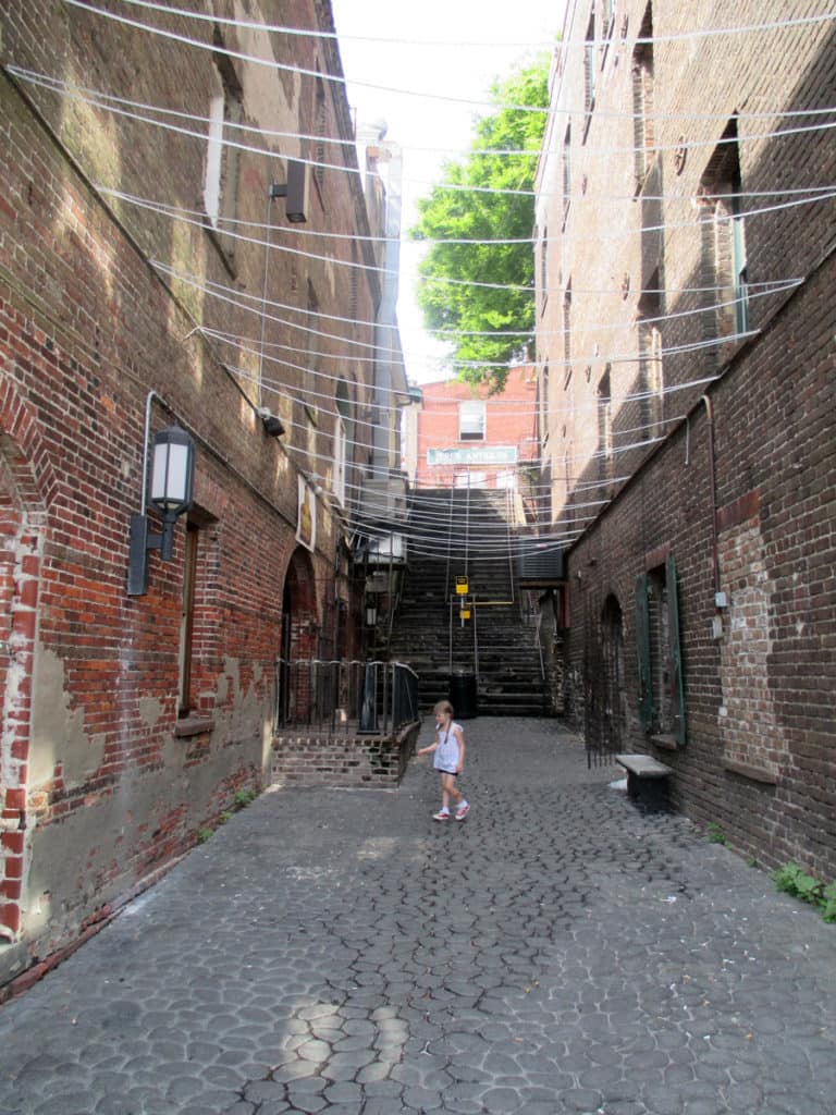
Some modern in-fill development adheres to the nuances of how Savannah’s ward plan was historically designed to function (front doors loaded on this east-west street in the development in the background) whereas some actively retards that functioning (garages loaded on east-west street in the development in the foreground, turning this portion of the space into an alleyway with trash cans).

References
Anderson, Stanford. 1993. “Savannah and the Issue of Precedent: City Plan as Resource”, Settlements in the Americas: Cross-Cultural Perspectives (Ed. Ralph Bennett). Newark: University of Delaware Press.

Anderson Stanford. 1986. “Studies towards an Ecological Model of Urban Environment”, On Streets (Ed. Stanford Anderson). Cambridge, Massachusetts: MIT Press.

Kostof, Spiro. 1991. The City Shaped: Urban Patterns and Meaning Through History. London: Thames and Hudson, Ltd.

Major, Mark David. 2015. Relentless Magnificence: The American Urban Grid. Ph.D. Thesis. Copies available from University College London.

Major, Mark David. 2001. “When is a door more than a door? The role of constitution in strongly geometric configurations”,  Third International Space Syntax Symposium Proceedings (Eds. J. Peponis, J. Wineman, S. Bafna), 37.1-37.14.

Reps, John W. 1965. The Making of Urban America: A History of City Planning in the United States. Princeton, NJ: Princeton University Press.

Share the knowledge!
Share

PHOTO ESSAY | Regent Street | London

PHOTO ESSAY | Regent Street | London

Regent Street is a major shopping street in the West End of London. It is named after George, the Prince Regent (later George IV) and was built under the direction of the architect John Nash. The street runs from Waterloo Place in St James’s at the southern end, through Piccadilly Circus and Oxford Circus, to All Souls Church. From there Langham Place and Portland Place continue the route to Regent’s Park. The street was completed in 1825 and was an early example of town planning in England, replacing a number of earlier roads including Swallow Street. Nash’s street layout has survived, although all the original buildings except All Souls Church have been replaced following reconstruction in the late 19th century. The street is known for its flagship retail stores, including Liberty, Hamleys, Jaeger and the Apple Store. The Royal Polytechnic Institution, now the University of Westminster, has been based on Regent Street since 1838 (Source: Wikipedia).

Regent Street proposal, published 1813, titled “PLAN, presented to the House of Commons, of a STREET proposed from CHARING CROSS to PORTLAND PLACE, leading to the Crown Estate in Marylebone Park” (Source: Wikipedia).

Upper Regent Street, London (Image: Mark David Major).
Oxford Circus, intersection of Oxford Street and Regent Street, London (Image: Mark David Major).
Lower Regent Street, London. Carnaby Street is located two blocks to the east (left) of this intersection (Image: Mark David Major).
Lower Regent Street, London (Image: Mark David Major).
Lower Regent Street looking toward Piccadilly Circus (right around the bend), London (Image: Mark David Major).
Piccadilly Circus, London (Image: Mark David Major).
Share the knowledge!
Share

PHOTO ESSAY | Havana, Cuba | Part 2

PHOTO ESSAY | Havana, Cuba | Part 2
Photographs by Concrete Blonde

Part 2 of a brief photographic essay of architecture and urban space in Havana, Cuba courtesy of Concrete Blonde. Again, the urban vocabulary of Havana is remarkably consistent: the street life of urban balconies, the use of balcony gardens in softening the urban streetscape, rooftop terraces, abundant use of urban sidewalk arcades, and the use of color.

Looking over a Havana neighborhood through an open window with the harbor in the distance.
Havana street life above and below, courtesy of a ground-level retail shop and second floor balconies.
A narrow shopping street in Havana, Cuba.
A lavishly-vegetated garden in the courtyard of a public building in Havana, Cuba.
Vegetation hanging from a second floor balcony soften the hard edges of the urban streetscape in Havana, Cuba.
Upper-level balconies introduce additional street constitution and casual surveillance of the street in the urban environment of Havana, Cuba.
Balconies and sidewalk arcades defining the street vocabulary of Havana, Cuba.
A street space well-used by pedestrians in Havana, Cuba.
A narrow street width in Havana, Cuba.
Finally, a light well made of empty bottles at a local restaurant in Havana, Cuba; included here only because it’s so ingeniously cool.
Share the knowledge!
Share

PHOTO ESSAY | Havana, Cuba | Part 1

PHOTO ESSAY | Havana, Cuba | Part 1
Photographs by Concrete Blonde

Part 1 of a brief photographic essay of architecture and urban space in Havana, Cuba courtesy of Concrete Blonde. In terms of urbanism, the most interesting aspects of these photographs are: the street life of urban balconies, the use of balcony gardens in softening the urban streetscape, rooftop terraces, abundant use of urban sidewalk arcades, and the use of color. In terms of political ideology, it seems symbolic that many of the cars (most likely of origin in Eastern Europe) and best architecture (at least, in terms of design if not actual age) predates the Communist Revolution lead by Fidel Castro in 1959; make of that what you will. However, the result is an urban treasure trove awaiting re-discovery and historic rehabilitation.

Havana streetscape showing sidewalk arcades and second-level balconies.
Rooftop terraces in Havana, Cuba.
Heavily-vegetated balconies in Havana, Cuba.
From this perspective, notice how the line of sight sneaks pass the corner of buildings to continue along the space of the street. Architects and planners ignore such nuances of the urban pattern at their peril.
Fantastic mural incorporated into the design of an otherwise mundane Modern building.
Contemporary pedestrian plaza, probably a conversion of an old tram/rail line running down the middle of the street. Though beautifully done, notice how empty the plaza appears during the middle of the day due to the generous street width, especially in comparison to the following photo of a heavily-populated street in Havana with a narrower street width.
A typical street scene in Havana, Cuba.
Churchyard plaza in Havana, Cuba.
Urban balconies defining the facade of an early twentieth century (1930s?) building in Havana, Cuba.
Sidewalk arcades, balconies, and rooftop terraces on another street in Havana, Cuba.

Stay tuned for Part 2 of the Havana, Cuba Photographic Essay coming soon on The Outlaw Urbanist!

Share the knowledge!
Share