“Sent to spy on a Cuban talent show, First stop- Havana au go-go,
I used to make a living, man, Pickin’ the banana, Hooray for Havana!”
— Havana Affair, The Ramones
Urban Patterns | Havana, Cuba
by Dr. Mark David Major, AICP, CNU-A
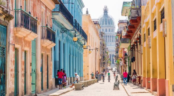
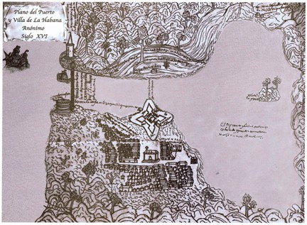
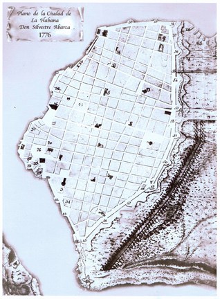
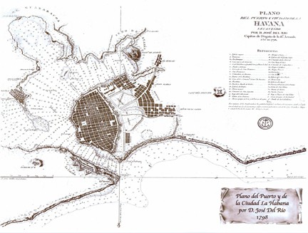
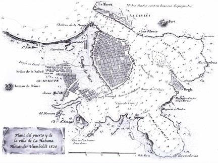
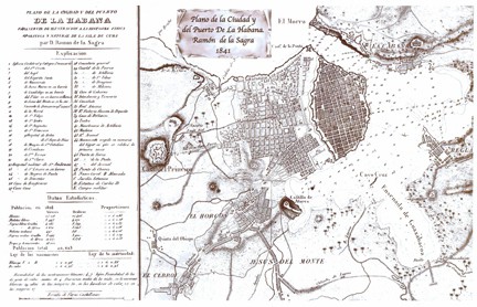
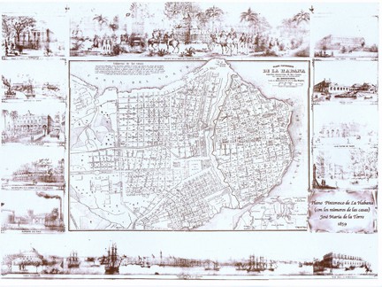
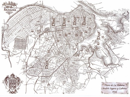
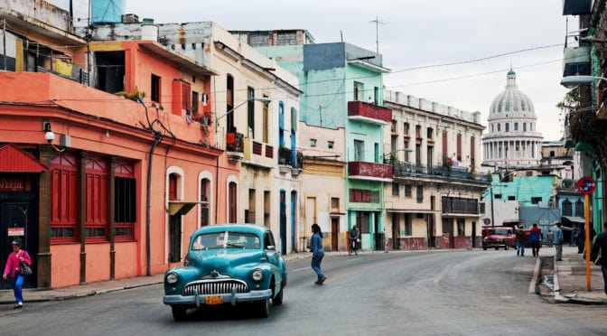
Havana is the capital city, major port, and leading commercial center of Cuba. The city proper has a population of 2.1 million inhabitants and it spans a total of 728 square kilometers (281 square miles), making it the largest city by area, most populous city, and third largest metropolitan area in the Caribbean region. Havana lies on the northern coast of Cuba, south of the Florida Keys, where the Gulf of Mexico joins the Caribbean. The city extends mostly westward and southward from the bay, which is entered through a narrow inlet and divides into three main harbors: Marimelena, Guanabacoa, and Atarés. Havana was founded by the Spanish in the 16th century and, due to its strategic location, served as a springboard for the Spanish conquest of South America, becoming a stopping point for treasure-laden Spanish Galleons on the crossing between the New World and Old World. King Philip II of Spain granted Havana the title of City in 1592. Walls and forts were built to protect the old city. Contemporary Havana can essentially be described as three cities in one: Old Havana, Vedado, and the newer suburban districts. Old Havana, with its narrow streets and overhanging balconies, is the traditional center of Havana’s commerce, industry, and entertainment as well as being a residential area. To the north and west a newer section – centered on the uptown area known as Vedado – has become the rival of Old Havana for commercial activity and nightlife. Centro Habana, sometimes described as part of Vedado, is mainly a shopping district that lies between Vedado and Old Havana. Chinatown and the Real Fabrica de Tabacos Partagás, one of Cuba’s oldest cigar factories, is located in the area. A third Havana is that of the more affluent residential and industrial districts that spread out mostly to the west. Among these is Marianao, one of the newer parts of the city, dating mainly from the 1920s (Source: Wikipedia).
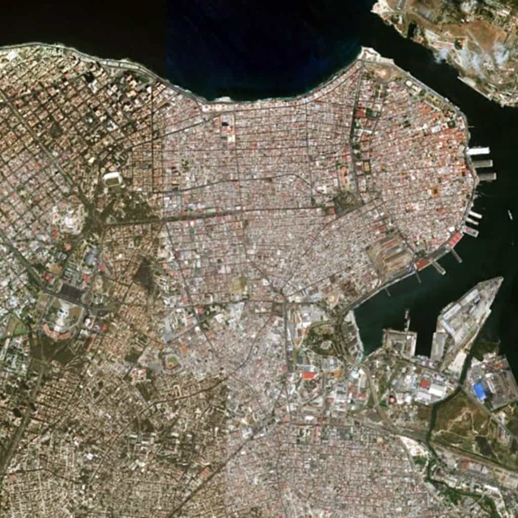
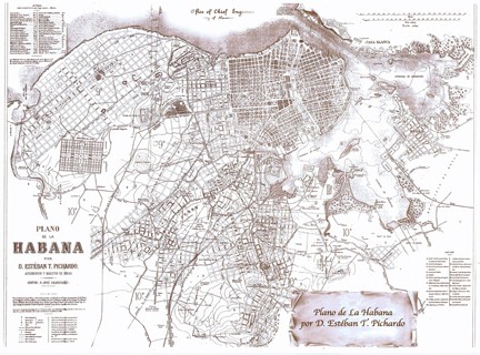
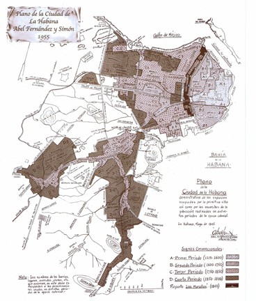
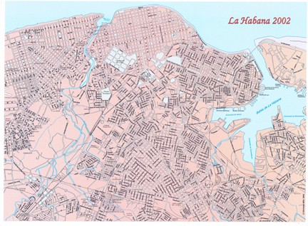
The urban pattern of Havana, Cuba can be best described as a patchwork of regular and regular-like grids that vary in scale in terms of the length and width of streets and block sizes. Most streets in Havana can be fairly described as straight. Their lengths tend to vary based on the local grid pattern and whether any particular street is carried through and embedded within another adjacent grid or terminates at the edges of its own grid. In this sense, the urban pattern of Havana appears remarkably similar to that of Athens, Greece, which is also composed of a patchwork of small-scale (mostly) regular grids. There appears to be the pattern of scale in the urban grid related to the age of a local area, forming a somewhat radial pattern from the harbor to the southerly and (more so) westerly direction. For example, Old Havana has the smallest scale regular-like grid in the city (smaller blocks, shorter streets) though the overall geometric order of the urban grid in this area is less consistent than in younger areas of the city. For example, contrast this with the increase in scale of the regular grid in the Vedado area to the west of Old Havana or the generous scale of block sizes, street lengths and widths in the highly geometrical grid of Marianao area along a different cardinal alignment in relation to the shoreline of the coast to the extreme west (partially visible at the left edge of the above satellite image).
(Updated: July 12, 2017)
Urban Patterns is a series of posts from The Outlaw Urbanist presenting interesting examples of terrestrial patterns shaped by human intervention in the urban landscape over time.