“Look around, leaves are brown
And the sky is a hazy shade of winter.”
— Hazy Shade of Winter, Simon & Garfunkel
Admit it: most of us prefer the 1987 version by The Bangles.
Urban Patterns | Nuuk, Greenland
by Dr. Mark David Major, AICP, CNU-A
NOTE: Urban Patterns is focusing on more obscure and/or extreme locations in a number of posts over the next few weeks.

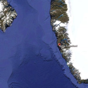
Nuuk, Greenland is the capital city of Greenland. It is located at the end of the Nuup Kangerlua fjord on the eastern shore of the Labrador Sea. The area around Nuuk has a long history of habitation dating as far back to 2,200 BC including the ancient pre-Inuit, Vikings/Norse, Norwegian, and Danish people. The colony founded in 1728 by the Dano-Norwegian Crown consisted of mutinous soldiers, convicts, and prostitutes; most of whom died within the first year of scurvy and other ailments. Today, it has a population of approximately 16,500 people and over a third of Greenland’s total population lives in the Nuuk Greater Metropolitan area. The town has steadily grown over the last two decades with the population increasing by over a third relative to the 1990 levels, and by over 22% relative to the 2000 levels. Nuuk has developed trade, business, shipping, and other industries. It began as a small fishing settlement with a harbor but, as the economy developed rapidly during the 1970s and 1980s, the fishing industry declined. However, seafood including fish, seal, and so forth is still sold in abundance in Nuuk and the capital contains a number of fish markets. Minerals such as zinc, gold, and so forth have significantly contributed to the development of Nuuk’s economy. The city, like much of Greenland, is heavily dependent upon Danish funding and investment (Source: Wikipedia).

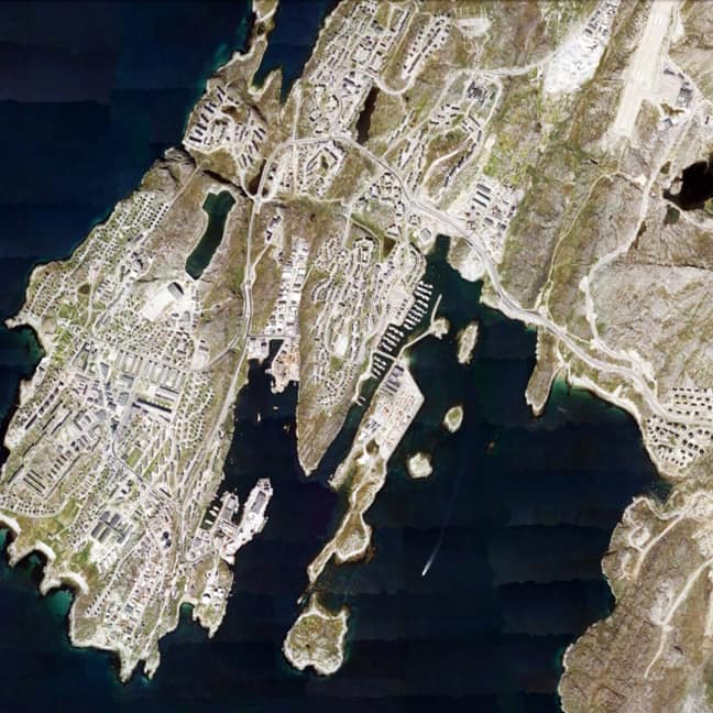
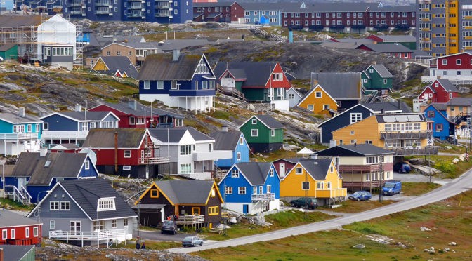
The urban grid of Nuuk is somewhat unexpected. Given the extreme polar climate, one might expect a more compact layout to promote energy and heat efficiency in the settlement. However, the town has more of a dispersed deformed grid layout, perhaps somewhat more characteristic of Inuit settlements in the horizontal dimension whilst much of the architecture reflects a Danish/European influence in the vertical dimension (see the header image). The dispersed nature of the urban grid might also be reflective of the rapid growth occurring in the town over the previous three decades. Some areas of the urban grid are laid out in a manner consistent with American suburban sprawl patterns, especially to the east and north of the town. The somewhat hilly terrain of the town probably plays a role in this settlement form as well. Given its location in Greenland, several things about Nuuk might, at first glance, strike some people as odd: for example, Nuuk has its own golf club and course, which is adjacent to the University of Greenland campus (yes, there is a university but only 150 students); there is the Greenland National Museum, a National Library, and a Greenland National Bank; and, even two stadia located in the town, a futbol stadium with a seating capacity of 2,000 people and a handball stadium that can hold 1,000 people. Nuuk, Greenland is so unexpected in many ways, which it is utterly fascinating.
(Updated: July 4, 2017)
Urban Patterns is a series of posts from The Outlaw Urbanist presenting interesting examples of terrestrial patterns shaped by human intervention in the urban landscape over time.

