“Take me to the river, drop me in the water,
Take me to the river, dip me in the water,
Washing me down, washing me down.”
— Take Me to the River, Talking Heads
Urban Patterns | Olmsted’s Riverside Suburb in Chicago
by Dr. Mark David Major, AICP, CNU-A
We are not anti-suburbia. In fact, quite the opposite. By definition, cities grow at their edges and suburbs have played a vitally important role in the growth of cities over thousands of years even if the modern use of the term ‘suburb’ only first emerged during the 19th century. We are against badly designed suburbs. We are against the proliferation of cheap, badly designed suburbs that have spread across the American landscape like an infection since 1926 but, especially, during the post-war period, i.e. suburban sprawl. By cheap, we really mean flimsy vertical (usually baloon-frame) constructions instead of merely low-cost in gross terms, though this is also often an aspect of the suburban sprawl model. So, what does a well-designed suburb look like?

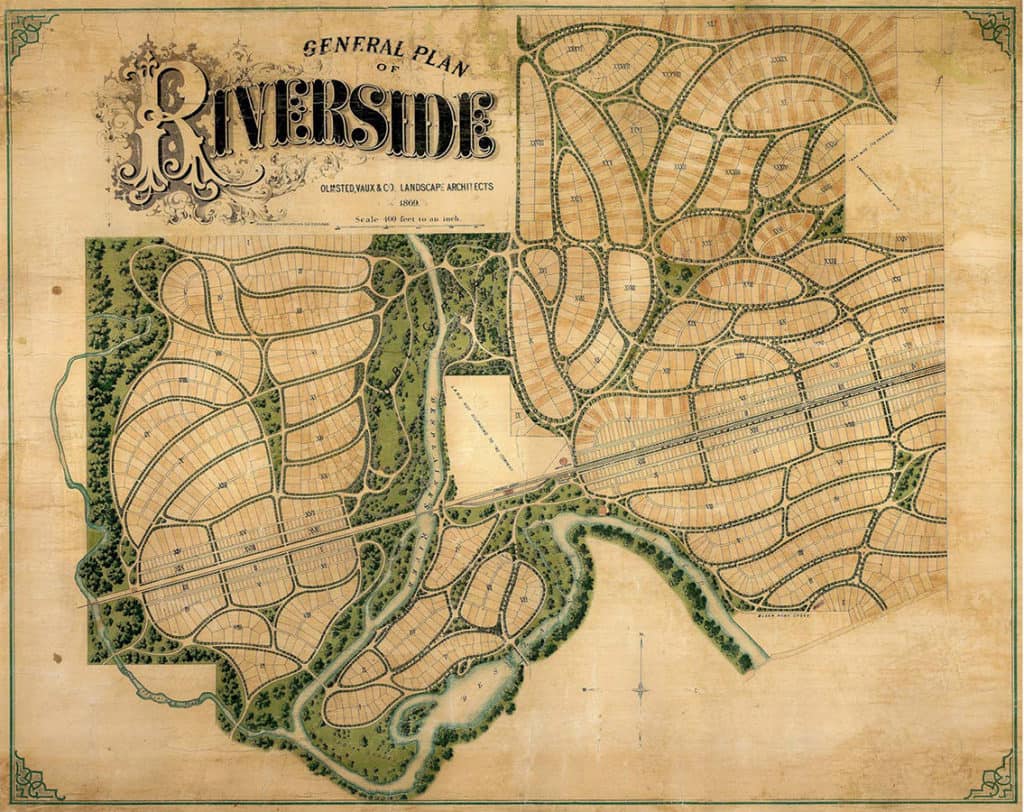
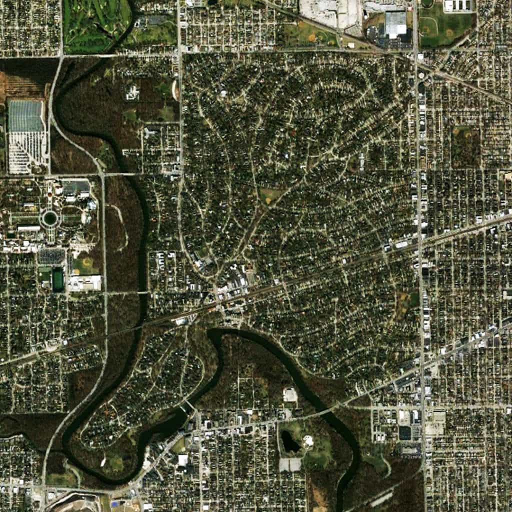
You would be hard-pressed to find a better model than Frederick Law Olmsted’s Riverside suburb in Chicago, Illinois. Riverside is one of the earliest (and still best) of the 19th century suburbs, which emerged from the City Beautiful movement. Olmsted designed Riverside in 1869, a full 60 years(!) before the landmark case, Village of Euclid, Ohio v. Ambler Realty Co., in which the US Supreme Court upheld zoning as a constitutional exercise of police power. The curvilinear street network of Olmsted’s plan discretely and explicitly separates in spatial terms the suburb from the large-scale regular grid logic in Chicago by making the most direct paths for movement around – rather than through – the residential area. Streets were “laid out as to afford moderately direct routes of communications between different parts of the neighborhood (but) they would be inconvenient to be followed for any purpose of business beyond the mere supplying of the wants of the neighborhood itself. That is to say, it would be easier for any man wishing to convey merchandise from any point a short distance on one side of the neighborhood to a point a short distance on the other side to go around it rather than through it” (Olmsted quoted in Reps, 1979 about an earlier but similar plan in Berkeley, California).

This is a similar design method deployed in Middle Eastern cities to isolated residential areas by complicating routes through those areas. However, like the Middle Eastern model, Olmsted’s Riverside suburb still maintains a multitude of street connections (17 in total) to the surrounding urban context at its periphery streets. This provides a stark contrast to even many New Urbanist developments; for example, Celebration in Orlando, FL and Amelia Park in Fernandina Beach, FL, which both only have three street connections to the surrounding urban context. The real genius of Olmsted’s Riverside plan achieves discrete separation from the surrounding urban context in spatial terms without relying upon interruptus in extremis (using the absolute minimum of external street connections, which is mathematically one), which lies at the core of the suburban sprawl model associated with Euclidean zoning and roadway classifications of modern transportation planning (and later, admittedly, the cost-savings aims of developers and home builders). So, we are not against suburbs. All we are saying is. if we are going to build suburbs – and we have to, it’s a fact – make sure they are damn good ones.
(Updated: April 13, 2017)
Urban Patterns is a series of posts from The Outlaw Urbanist presenting interesting examples of terrestrial patterns shaped by human intervention in the urban landscape over time.

