Tag Archives: The Outlaw Urbanist

On Space | The Structural City

On Space | The Structural City
by Dr. Mark David Major, AICP, CNU-A

The spatial experience of the city is a child’s playground of structures, of a faraway multitude and its near-invariants, a beingness trivial and noble, earthy in its dimensions but astral in meaning. The foreground is composed as the background is configured, imposed by the actions of local actors but emerging on a global stage of meaning and consequence. We are its actors and the playwright, telling the story and bringing it to life for an audience that is ourselves, as if performance could thrive across a mirror of timeless depth and perception, an infinite recursion writ large and whispered softly. The city is a presentation – and representation – of our best and worst selves, of our past and our future, denoting significance in the moment of the present, the here and now of our lives, of the everyday errands of individual importance but (seemingly) societal inconsequentiality. We think, therefore we are but also we move, here we were and will be. These abstract and material constructions of the city reach for the horizon and to the sky, never attaining either but embedding the object with a purpose, with a meaning, and with a question that simultaneously transcends and surrenders to the entities populating the streets, spaces, and buildings of the city. It is transcendence and capitulation to the physical and the spatial, to the kinetic energy of movement and the static inertia of place, to the functioning of the urban object, that at once determines and allows its formation and articulation.

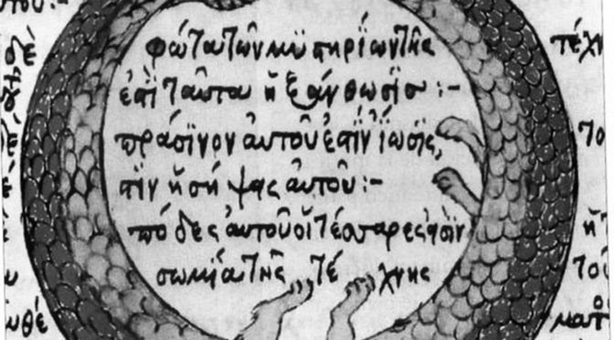
It is an entity that births and devours itself, this Urban Ouroboros, forming protective walls against unseen intruders and unknown dangers. We are the beginning of our story, its past prologue. We are at the center of our story, its extant climax. We are the edge of our story, its future denouement. But it is not the genesis, neither the center nor even the edge that carries the value of our actions. It is the path lying in-between, from where to here to there, from the mere act of marking a path in the landscape to the volatile core of our beingness in the city, and further to the tranquil border that defines the state of being within or without. The grid is the thing. The grid is its genesis, it generates and swathes, offering a translucent skin, which reveals the heart and muscle, pulse and rhythm of the city. Its skin is spelled out in the superordination of geometries both great and small, widths of mysteriously known paths, lengths of promising unspoken journeys, and rigid alignments of mass and light. Hierarchies are simply defined, and structures are mystically revealed in the body of the city; a city of collective memory, of shared purpose, and of forgotten desires that we carry along with us on the path. It is achieved with frightening efficiency, which we consciously retreat from, to our own detriment, yet cannot deny, to our own blessing. The dynamics of the city rise and fall with our intentions, with our mistakes, and with our unending beauty in the body of the collective. Its effects are systematic across and embedded within body and mind, perpetuating the rapid spread of malignancies and their antidote. A city is an object of cosmic imagination grounded in a foundation of our earthly desires and guttural sins. It all these things, and more… much more.

On Space is a regular series of philosophical posts from The Outlaw Urbanist. These short articles (usually about 500 words) are in draft form so ideas, suggestions, thoughts and constructive criticism are welcome.

Share the knowledge!
Share

A Compressed City of Time in Light | The City in Art

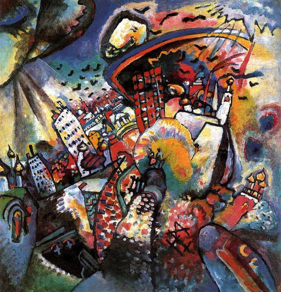
Wassily Kandinsky’s Moscow I (1916), oil on canvas, 49.5 x 51.5 cm, The State Tretyakov Gallery, Moscow, Russia.

A Compressed City of Time in Light | The City in Art
by Dr. Mark David Major, AICP, CNU-A

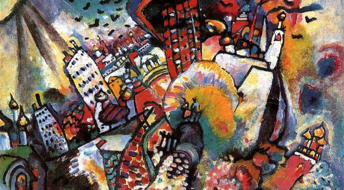
Wassily Kandinsky painted Moscow I in 1916 after he was forced to return to Russia in 1914 because of Germany’s declaration of war against Russia during World War I. The year 1915 was a period of profound depression and self-doubt during which he tried to build a new life at age 50 after living almost two decades in Munich, Germany. He did not paint a single picture. In 1916, Kandinsky painted Moscow I. He wrote, “I would love to paint a large landscape of Moscow taking elements from everywhere and combining them into a single picture weak and strong parts, mixing everything together in the same way as the world is mixed of different elements. It must be like an orchestra” (Becks-Malorny, Wassily Kandinsky, 1866–1944, 115). Moscow I contains some of the same romantic fairy-tale qualities of his earlier paintings, fused with dramatic forms and colors. “The sun dissolves the whole of Moscow into a single spot, which, like a wild tuba, sets all one’s soul vibrating” (Kandinsky, “Reminiscences,” 360).
At first glance, Kandinsky’s Moscow I appears to be a simple collage of landmarks, freed of the constraints of gravity and space, represented in a highly abstract manner by the artist. However, upon closer examination, there appears to be a logic to the almost spherical layout of objects composing the Moscow built environment (for example, the Kremlin is clearly represented towards the lower right). Using Kandisky’s own words about this painting as a guide (see above), we can hypothesize Kandisky placed these objects within the frame of the painting in relation to the time of day when each achieves its apex in terms of natural light and vibrant color, hence the almost spherical layout and luxurious richness of the hues. The spherical layout seems to mirror the path of the sun across the sky, or perhaps the daylight hours on the face of a clock. In this sense, Kandinsky’s Moscow I is a notional ‘clock of the city’, representing for us the optimal passage of time to see the collected objects of the city as shown in the painting. If true, then it is a clever means to elevate the painting beyond mere collage, above the mere randomness of collected objects that are compressed and freed of space. It also embeds his representation of Moscow with a kinetic energy that metaphorically accounts for the activity of urban life itself, the city as more than a mere collection of things but as a thing that, in itself, is alive.

About Wassily Kandinsky
Wassily Kandinsky (born December 16, 1866, died December 13, 1944) was a Russian painter and art theorist. He is credited with painting the first purely abstract works. With the possible exception of Marc Chagall (who was born/educated in Russia but adopted France as his home in adulthood to the point of being considered a “Russian-French” artist), Kandinsky is probably the most influential Russian artist in human history. Born in Moscow, Kandinsky spent his childhood in Odessa but later enrolled at the University of Moscow to study law and economics. Successful in his profession, he was offered a professorship (Chair of Roman Law) at the University of Dorpat where he began painting studies (life-drawing, sketching, and anatomy) at the age of 30. In 1896 Kandinsky settled in Munich, studying first at Anton Ažbe’s private school and then at the Academy of Fine Arts. He returned to Moscow in 1914 after the outbreak of World War I. Kandinsky was unsympathetic to the official theories on art in Communist Moscow and returned to Germany in 1921. There, he taught at the Bauhaus school of art and architecture from 1922 until the Nazis closed it in 1933. Like Chagall, he then moved to France where he lived for the rest of his life, becoming a French citizen in 1939, and producing some of his most prominent pieces of art. He died at Neuilly-sur-Seine in 1944. Unlike Chagall, Kandinsky never attained the status of being (in part) a French artist but has always been considered a definitive Russian one (Source: Wikipedia).

The City in Art is a series by The Outlaw Urbanist. The purpose is to present and discuss artistic depictions of the city that can help us, as professionals, learn to better see the city in ways that are invisible to others. Before the 20th century, most artistic representations of the city broadly fell into, more or less, three categories: literalism, pastoral romanticism, and impressionism, or some variation thereof. Generally, these artistic representations of the city lack a certain amount of substantive interest for the modern world. The City in Art series places particular emphasis on art and photography from the dawn of the 20th century to the present day.

Share the knowledge!
Share

Urban Patterns | Nuuk, Greenland

“Look around, leaves are brown
And the sky is a hazy shade of winter.”
— Hazy Shade of Winter, Simon & Garfunkel
Admit it: most of us prefer the 1987 version by The Bangles.

Urban Patterns | Nuuk, Greenland
by Dr. Mark David Major, AICP, CNU-A

NOTE: Urban Patterns is focusing on more obscure and/or extreme locations in a number of posts over the next few weeks.

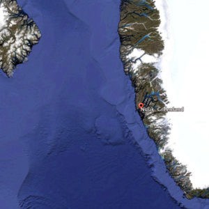
Satellite view of Nuuk on the southwest coast of Greenland from 800 km (Image: US Geological Survey, Landsat and IBCAO, Data SIO, NOAA, U.S. Navy, NGA, GEBCO, courtesy of Google Earth, 2013). The north coast of Baffin Island, Canada is to the extreme left of this image.

Nuuk, Greenland is the capital city of Greenland. It is located at the end of the Nuup Kangerlua fjord on the eastern shore of the Labrador Sea. The area around Nuuk has a long history of habitation dating as far back to 2,200 BC including the ancient pre-Inuit, Vikings/Norse, Norwegian, and Danish people. The colony founded in 1728 by the Dano-Norwegian Crown consisted of mutinous soldiers, convicts, and prostitutes; most of whom died within the first year of scurvy and other ailments. Today, it has a population of approximately 16,500 people and over a third of Greenland’s total population lives in the Nuuk Greater Metropolitan area. The town has steadily grown over the last two decades with the population increasing by over a third relative to the 1990 levels, and by over 22% relative to the 2000 levels. Nuuk has developed trade, business, shipping, and other industries. It began as a small fishing settlement with a harbor but, as the economy developed rapidly during the 1970s and 1980s, the fishing industry declined. However, seafood including fish, seal, and so forth is still sold in abundance in Nuuk and the capital contains a number of fish markets. Minerals such as zinc, gold, and so forth have significantly contributed to the development of Nuuk’s economy. The city, like much of Greenland, is heavily dependent upon Danish funding and investment (Source: Wikipedia).

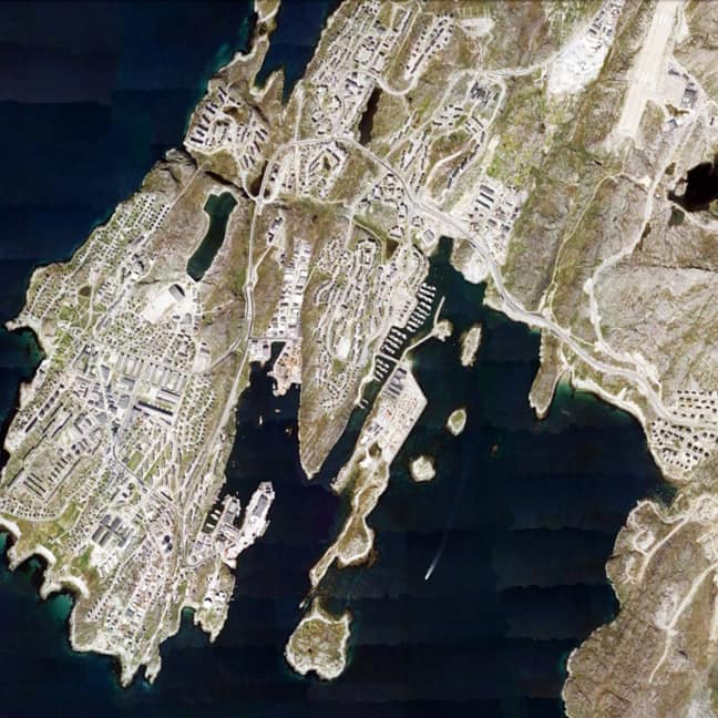
Satellite view from 10km of Nuuk, Greenland in 2013 (Source: Google Earth).

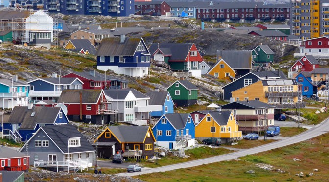
The urban grid of Nuuk is somewhat unexpected. Given the extreme polar climate, one might expect a more compact layout to promote energy and heat efficiency in the settlement. However, the town has more of a dispersed deformed grid layout, perhaps somewhat more characteristic of Inuit settlements in the horizontal dimension whilst much of the architecture reflects a Danish/European influence in the vertical dimension (see the header image). The dispersed nature of the urban grid might also be reflective of the rapid growth occurring in the town over the previous three decades. Some areas of the urban grid are laid out in a manner consistent with American suburban sprawl patterns, especially to the east and north of the town. The somewhat hilly terrain of the town probably plays a role in this settlement form as well. Given its location in Greenland, several things about Nuuk might, at first glance, strike some people as odd: for example, Nuuk has its own golf club and course,  which is adjacent to the University of Greenland campus (yes, there is a university but only 150 students); there is the Greenland National Museum, a National Library, and a Greenland National Bank; and, even two stadia located in the town, a futbol stadium with a seating capacity of 2,000 people and a handball stadium that can hold 1,000 people. Nuuk, Greenland is so unexpected in many ways, which it is utterly fascinating.

(Updated: July 4, 2017)

Urban Patterns is a series of posts from The Outlaw Urbanist presenting interesting examples of terrestrial patterns shaped by human intervention in the urban landscape over time.

Share the knowledge!
Share

Urban Patterns | The Center of Our Terrestrial Universe

“Thoughts meander like a restless wind, Inside a letter box,
They stumble blindly, as they make their way, Across the universe.”
Across the Universe, The Beatles

Urban Patterns | The Center of Our Terrestrial Universe | Chanute, Kansas USA
by Dr. Mark David Major, AICP, CNU-A

NOTE: Urban Patterns will focus on more obscure and/or extreme locations in a number of posts over the next few weeks.

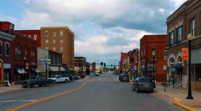
According to the Mac version of Google Earth, the center of our terrestrial universe can be found in the City of Chanute of Neosho County, Kansas. When you open Google Earth on a Mac, allow the globe to stop spinning, then only zoom in on the Earth and you’ll eventually find yourself in Chanute, Kansas. Dan Webb, a software engineer for the Mac OS X version of Google Earth, programed the software this way; he explains his charmingly flippant reasons here. Incidentally, if you do the same on the Windows version of Google Earth (you know, fifteen minutes after the PC has started up and Windows has downloaded all of its updates), you’ll actually end up in Lawrence, Kansas. However, since Apple is infinitely superior to Windows, then the Mac version of Google Earth must be correct about our ‘terrestrial center’.

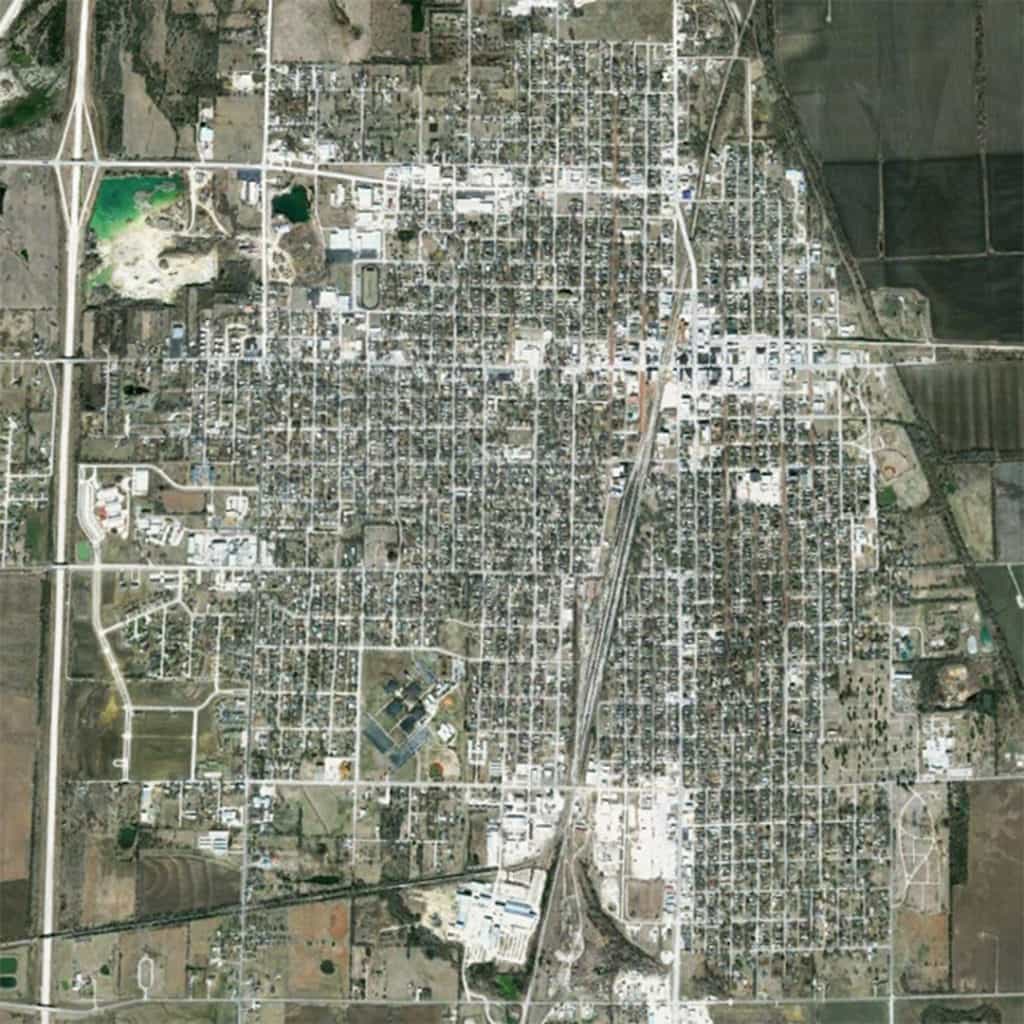
Satellite view from 5 km of Chanute, Kansas USA (Source: Google Earth).

“Neosho” is a Native American word generally accepted to be of Osage derivation. It is translated variously as “water that has been made muddy”, “clear cold water” or “clear water”, the last being the most accepted. Chanute was formally founded in 1873. When the Leavenworth, Lawrence & Galveston Rail Road crossed the Missouri, Kansas and Texas state limits within Neosho County, four rival towns initially sprang up in the vicinity of the junction: New Chicago, Chicago Junction, Alliance, and Tioga. The four towns were consolidated in 1872 and the new town was named Chanute in honor of Octave Chanute, a railroad civil engineer. Chanute has a population of approximately 9,100 people (Source: Wikipedia). The urban pattern of Chanute is characterized by several typical – but still interesting – components of the American landscape. First, there is a predominant regular grid aligned to the cardinal directions, consistent with the method of land division established by the 1785 Land Ordinance in the United States; Second, this regular grid marginally shifts from perfect orthogonality. For example, West Main Street (the primary east-west route toward the top of the above image) marginally shifts northward along some distance before shifting southward again into alignment with East Main Street on the other side of the railroad tracks. Third, this regular grid has evolved over time around the railroad line passing through the center of Chanute in a southwest to northeast direction (from Tulsa, Oklahoma to Kansas City, Missouri). This generates a significant interruption to the orthogonal grid in the town, introducing differentiation from east-to-west by privileging those routes crossing the tracks to link both sides of town. Indeed, the interruptions (e.g. the railroad tracks, the large block to the south defining the Neosho Community College campus, and 215th Road/E. Elm Street angling into the regular grid from the east at the upper middle right of the above image) to the regular grid of Chanute characterize the town as much as the regular grid itself. Finally, the western edge of Chanute is defined by State Highway 169, which mirrors the Tulsa-to-Kansas City alignment of the railroad. However, this is not an interstate highway. Chanute is almost exactly at the center of a ring of interstates, more than a hundred miles in any direction to 35/335 to the north and west, 498 to the east, and 44 to the south. Because of this, and the fact that its population has remained relatively stable over the last 100 years (only variation of +/- 1,000), Chanute has maintained its small-town persona as an American farming community.

(Updated: July 3, 2017)

Urban Patterns is a series of posts from The Outlaw Urbanist presenting interesting examples of terrestrial patterns shaped by human intervention in the urban landscape over time.

Share the knowledge!
Share

Urbanists Branded as Outlaws for Bluntly Speaking Truth | Urbanism Speakeasy

Urbanists Branded as Outlaws for Bluntly Speaking Truth | Urbanism Speakeasy

Mark David Major recently made an appearance on the podcast, Urbanism Speakeasy.

Excerpt:

“We are outlaws. So says a passionate group of bloggers who have been challenging status quo infrastructure planners and designers. Mark David Major joins the Urbanism Speakeasy this week. He is the principal blogger and co-founder of The Outlaw Urbanist.”

Download the Podcast for FREE in the iTunes Store or listen online here:  Urbanists branded as outlaws for bluntly speaking truth | Urbanism Speakeasy.

Share the knowledge!
Share