Tag Archives: The Urban Pattern

REVIEW | Paradigm lost, Industrial and Post-industrial Detroit | UDi

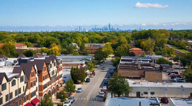
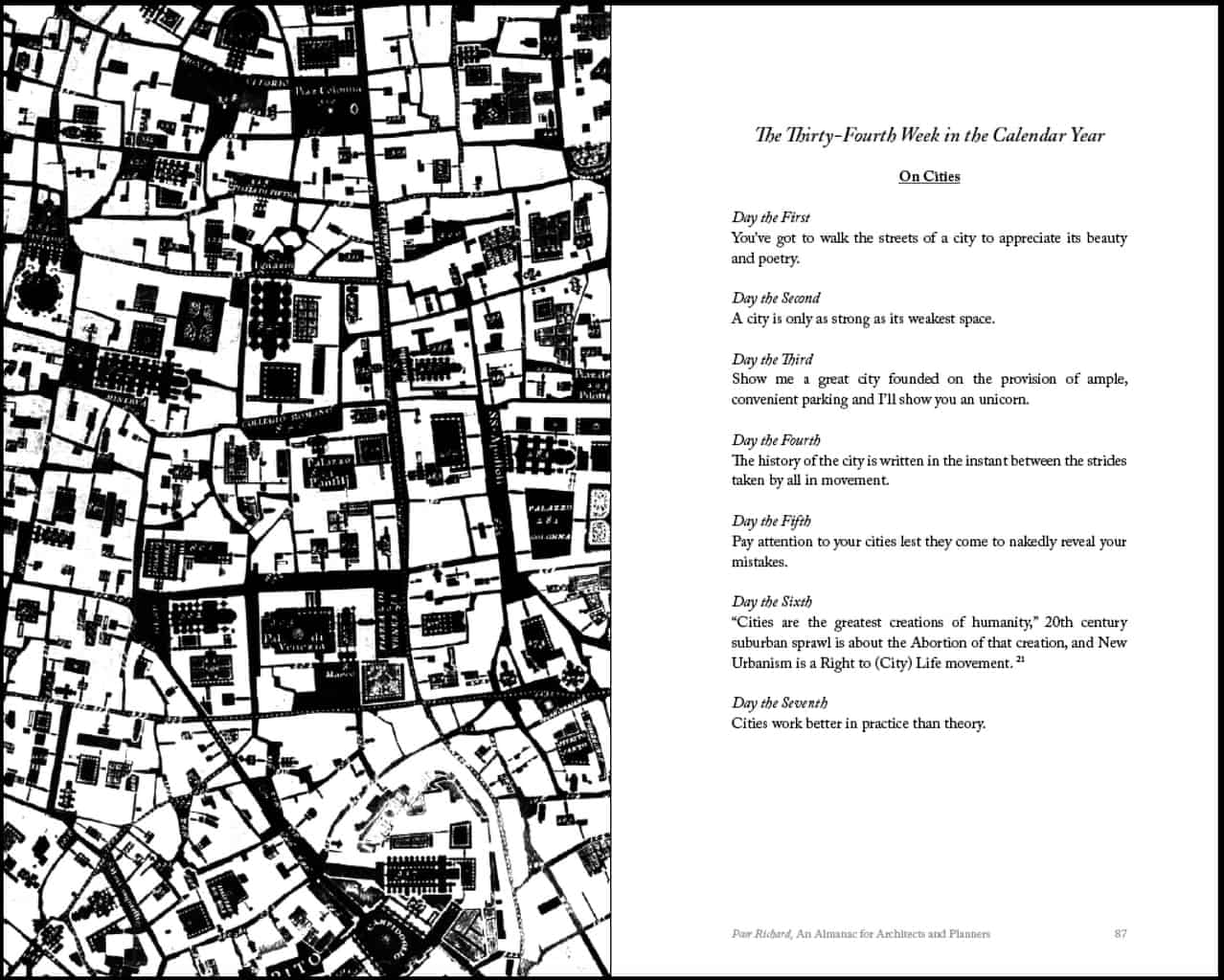
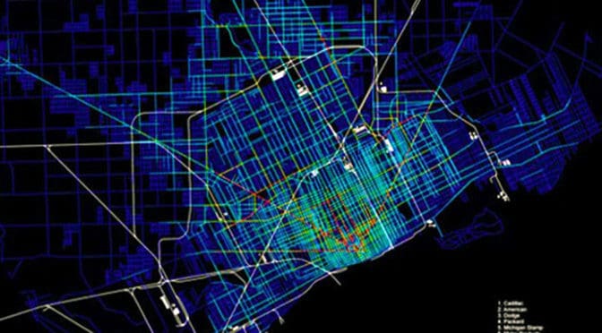
Featured Image: Choice network analysis at radius 10,000 meters of Detroit in 1952 with industry superimposed from Paradigm lost, Industrial and post-industrial Detroit (Psarra et al, 2013).

REVIEW: Paradigm lost, Industrial and post-industrial Detroit by Sophia Psarra, Conrad Kickert, and Amanda Pluviano, Urban Design International, Advanced Online Publication, March 27, 2013
by Mark David Major, The Outlaw Urbanist contributor

There is a simple question at the heart of the Psarra et al paper, “Paradigm lost: Industrial and post-industrial Detroit – An analysis of the street network and its social and economic dimensions from 1796 to the present,” available as an advanced online publication from Urban Design International. This question is: can spatial pattern be implicated in the remarkable urban decline of Detroit over the last half-century? It is an important question precisely because so many architecture, urban design and planning professionals – as well as politicians and policy makers  – never bother to ask it, especially in the United States. The answer provided by Psarra et al is an academically careful and qualified ‘yes’.

Their basic argument is the locating of large-scale industrial uses at the northern periphery of the urban grid (along and near to Davison St./Grand Ave.) beginning around 1900-1910 – in combination with interstate highway system construction and decline of the streetcar system a few decades later – served to disrupt the integrated functioning of the urban street network, commercial, industrial and residential land uses, and the transportation infrastructure serving them (railroads, streetcars) in the city. This facilitated radical decentralization of Detroit to the suburbs, where developers and industry could find ever larger and cheaper land parcels. Their argument is a little more nuanced than this but that is the gist. In doing so, they conclude (though don’t say so bluntly) the automobile both made and destroyed Detroit.

They acknowledge more complex factors were, no doubt, at work in the decline of Detroit but argue understanding the pattern of urban space and how it relates to land uses and transportation infrastructure is crucial for diagnosing the problem. In its diagnosis, the paper excels though it is very light on offering solutions (beyond a vague call for “radical solutions”). For example, they generally discuss what they describe as “Landscape Urbanism” without much detail. They are far too kind to reveal what, I suspect, is probably an outright disdain for this approach to serious urban problems. Landscape Urbanism only exists because it is politically expedient and offers policy makers/politicians the appearance of doing something (and feeds the financial coffers of consultants) when, in fact, it is usually a useless solution that avoids the real problem all together. What is really interesting about their historical analysis is where industrial land uses were not located; namely, along the riverfront at the edge of the Woodward plan. This suggests the seeds of Detroit’s urban decline might be traced back to the early 19th century. Large-scale industrial land uses may not have been allowed to develop along the riverfront of the Woodward plan. If the industrial land uses along Davison/Grand had come to be located along the riverfront instead of the northern periphery, Detroit may have been better positioned to manage its transition from an industrial to a post-industrial city, as other cities have accomplished to varying degrees of success.

By necessity, academic articles cannot cover all of the bases. For example, I would have liked to have seen spatial analysis of contemporary Detroit with its interstate highway system ‘peeled off’ to better reveal its disruptive effect on the underlying street grid pattern. I’m not even sure if current space syntax software allows for this kind of ‘alternative’ analysis. I would have also liked to have seen a spatial model of Detroit embedded within its larger urban context to the south in Canada (Windsor/LaSalle), where the railroad lines do terminate along the riverfront of the Detroit River. There is also the political factor. Detroit has been subject to one-party rule (Democratic) for the last half-century and it’s hard to believe this is only coincidental with its decline as an urban center. To excuse the Democratic Party from Detroit’s decline, one almost has to concede that all government policies are essentially useless (a very Libertarian position). However, there is only so much anyone can cover in an article. “Paradigm lost, Industrial and post-industrial Detroit” is well worth the read. At the very least, it will get you questioning the “conventional wisdom” in the field about Detroit and other cities experiencing similar problems.

You read the full article online or download a PDF via the link below:

URBAN DESIGN International | Paradigm lost: Industrial and post-industrial Detroit – An analysis of the street network and its social and economic dimensions from 1796 to the present.

Share the knowledge!
Share

Urban Patterns | Olmsted’s Riverside Suburb in Chicago

“Take me to the river, drop me in the water,
Take me to the river, dip me in the water,
Washing me down, washing me down.”
Take Me to the River, Talking Heads

Urban Patterns | Olmsted’s Riverside Suburb in Chicago
by Dr. Mark David Major, AICP, CNU-A

We are not anti-suburbia. In fact, quite the opposite. By definition, cities grow at their edges and suburbs have played a vitally important role in the growth of cities over thousands of years even if the modern use of the term ‘suburb’ only first emerged during the 19th century. We are against badly designed suburbs. We are against the proliferation of cheap, badly designed suburbs that have spread across the American landscape like an infection since 1926 but, especially, during the post-war period, i.e. suburban sprawl. By cheap, we really mean flimsy vertical (usually baloon-frame) constructions instead of merely low-cost in gross terms, though this is also often an aspect of the suburban sprawl model. So, what does a well-designed suburb look like?

Frederick Law Olmsted’s general plan for the Riverside neighborhood of Chicago, Illinois.

You would be hard-pressed to find a better model than Frederick Law Olmsted’s Riverside suburb in Chicago, Illinois. Riverside is one of the earliest (and still best) of the 19th century suburbs, which emerged from the City Beautiful movement. Olmsted designed Riverside in 1869, a full 60 years(!) before the landmark case, Village of Euclid, Ohio v. Ambler Realty Co., in which the US Supreme Court upheld zoning as a constitutional exercise of police power. The curvilinear street network of Olmsted’s plan discretely and explicitly separates in spatial terms the suburb from the large-scale regular grid logic in Chicago by making the most direct paths for movement around – rather than through – the residential area. Streets were “laid out as to afford moderately direct routes of communications between different parts of the neighborhood (but) they would be inconvenient to be followed for any purpose of business beyond the mere supplying of the wants of the neighborhood itself. That is to say, it would be easier for any man wishing to convey merchandise from any point a short distance on one side of the neighborhood to a point a short distance on the other side to go around it rather than through it” (Olmsted quoted in Reps, 1979 about an earlier but similar plan in Berkeley, California).

Satellite view from 5 km of Riverside in Chicago, Illinois (Source: Google Earth).

This is a similar design method deployed in Middle Eastern cities to isolated residential areas by complicating routes through those areas. However, like the Middle Eastern model, Olmsted’s Riverside suburb still maintains a multitude of street connections (17 in total) to the surrounding urban context at its periphery streets. This provides a stark contrast to even many New Urbanist developments; for example, Celebration in Orlando, FL and Amelia Park in Fernandina Beach, FL, which both only have three street connections to the surrounding urban context. The real genius of Olmsted’s Riverside plan achieves discrete separation from the surrounding urban context in spatial terms without relying upon interruptus in extremis (using the absolute minimum of external street connections, which is mathematically one), which lies at the core of the suburban sprawl model associated with Euclidean zoning and roadway classifications of modern transportation planning (and later, admittedly, the cost-savings aims of developers and home builders). So, we are not against suburbs. All we are saying is. if we are going to build suburbs – and we have to, it’s a fact – make sure they are damn good ones.

(Updated: April 13, 2017)

Urban Patterns is a series of posts from The Outlaw Urbanist presenting interesting examples of terrestrial patterns shaped by human intervention in the urban landscape over time.

Share the knowledge!
Share

Urban Patterns | Ragusa, Sicily in Italy

“Can we move to Italy?
Meet me by the church up high on the hill.”
Italy, Julia Fordham

Urban Patterns | Ragusa, Sicily, Italy
by Dr. Mark David Major, AICP, CNU-A

To many people, Ragusa, Sicily in Italy represents the prototypical Italian hilltop village lying below the Hyblaean Mountains. It is listed on the UNESCO World Heritage Sites. The origins of the oldest part of the town on a 300-meter (980 feet) high hilltop (upper town to the right, below) lying between two valleys can be traced to the 2nd Millennium BC, i.e. more than 3,000 years ago. The ancient city came into contact with nearby Greek colonies and grew due to the nearby port of Camerina. Following a short period of Carthaginian rule, it fell into the hands of the ancient Romans and the Byzantines, who fortified the city and built a large castle. Ragusa was occupied by the Arabs in 848 AD, remaining under their rule until the 11th century, when the Normans conquered it. Thereafter Ragusa’s history followed the events of the Kingdom of Sicily, created in the first half of the twelfth century (Source: Wikipedia).

Satellite view from 2 km of Ragusa, Sicily in Italy (Source: Google Earth).

Upper town has a deformed grid layout where the street pattern conforms to the topography of the hill. This tends to make movement longer in terms of time and distance through upper town but changes in elevation are more gradual. This offers an excellent contrast to an urban pattern such as that found in San Francisco, where the regular grid layout enables movement through the layout to be shorter in terms of time and distance but changes in elevation tend to be much steeper. Together, Ragusa and San Francisco provide two models of how to incorporate acute topographical conditions within a settlement. The vertical construction of dwellings adapts to the topographical conditions of a local site in particular ways. In the case of San Francisco, this occurs by steeply adapting finished floors so they step up or down in section with the topography, which serves to maintain the conceptual logic of the regular grid imposed on the land. In Ragusa, the logic of the deformed grid in the town emerges from an apparently local process of aggregating dwelling units. During this aggregation process, finished floors are adapted to the contours of the topography so changes in finished floor elevation tend to be gradual instead of steep. In this way, the layout literally incorporates the acute topographical conditions into its functional pattern. This is why Moholy-Nagy (1968) describes such layouts as geomorphic. The street pattern of the newer areas adjacent to lower town (to the left, above) at the foot of the hill in the valley is a regular grid since the topography is less acute (e.g. more flat) at this location. The lower town also utilizes larger block sizes in its regular grid layout.

(Updated: April 11, 2017)

Urban Patterns is a series of posts from The Outlaw Urbanist presenting interesting examples of terrestrial patterns shaped by human intervention in the urban landscape over time.

Share the knowledge!
Share

Preview | Poor Richard | An Almanac for Architects and Planners

COMING IN APRIL 2013! POOR RICHARD, AN ALMANAC FOR ARCHITECTS AND PLANNERS BY MARK DAVID MAJOR, AICP

A high-resolution preview of the front cover is below.

The witticisms and sayings of Poor Richard are organized by calendar weeks, one generic theme per week, and a single saying for each day of the week – plus one for “years in the state of leaping” – adding up to a full calendar year. Each week of the calendar week is accompanied by a high contrast, black and white illustration designed or selected to get people thinking differently about cities. A high-resolution preview of “On Cities” for pages 86-87 with an accompanying illustration (inverted detail of the Nolli map of Rome presenting civic space in black and blocks in white) is below.

“On Cities” for the 34th Week in the Calendar Year on pages 86-86. Click on the image to see a high resolution version.


Poor Richard, An Almanac for Architects and Planners also includes a foreword by Julia Starr Sanford, a preface from the author, an Introduction incorporating the “Declaration of Planning Independence” previously published on The Outlaw Urbanist, bibliography and illustration credits, and an Afterword featuring The Outlaw Urbanist manifesto.

Poor Richard, An Almanac for Architects and Planners by Mark David Major, AICP, Foreword by Julia Starr Sanford, Forum Books, an Imprint of Carousel Productions, 136 pages, 5.0″ x 8″, $9.99 (in print); also available in eBook, format and price TBD.

Share the knowledge!
Share

Urban Patterns | Old Town Fernandina | Spanish Laws of the Indies

“Old Town, the girl’s a fool, she broke the rule…”
Old Town, Thin Lizzy

Urban Patterns | Old Town Fernandina | Spanish Laws of the Indies
by Dr. Mark David Major, AICP, CNU-A

Old Town Fernandina is located on the northern end of Amelia Island in Florida, immediately south of the border with the State of Georgia, and about 40 miles north of Downtown Jacksonville. Old Town Fernandina was the last Spanish settlement founded in North America based on the Laws of the Indies and, as such, is listed on the National Register of Historic Places. Old Town is located on an inlet to the St. Mary’s River and Amelia River from the Atlantic Ocean, which offered (and still does) a generous deep-water port on the Atlantic coast for fishing and trade. Fernandina Beach grew southward with the construction of the David Yulee cross-state railroad from Cedar Key-to-Fernandina Beach in 1861 so the center of retail/commercial activity in Fernandina Beach shifted to what is now called “Downtown Fernandina.” Downtown Fernandina is also listed on the National Register of Historic Places. Because of this, Old Town Fernandina is probably the ‘purest’ example of a town founded based on the Spanish Laws of Indies remaining in North America. Fort San Carlos used to be located to the west of Plaza San Carlos (open space on the left of Old Town) but two-thirds of the grounds on which the fort formerly sat has been lost due to soil erosion.

Satellite view of Old Town Fernandina in Fernandina Beach, Florida USA (Source: Google Earth).
1811 Plat of Old Town Fernandina, Florida.

The earliest plat for the town (north is to the left in the above image) shows a regular grid layout ‘fitted’ to the shape of the topography of this peninsula in 4 x 4 block layout (5 x 5 street layout). The topography interrupts this geometric logic at the southeast (above, upper right-hand corner) and the northwest (above, lower left-hand corner) though the plat clearly shows the intention to in-fill to the northwest at the water’s edge in order to generate rectangular lots. Instead of a central plaza, the plaza in Fernandina was shifted to the what would become the water’s edge after the ‘disappearance’ of San Carlos into the river at the western edge of the plan (above, bottom edge of the drawing). The layout of lots within each block is also interesting with larger lots ‘internalized’ within the blocks and smaller lots ‘externalized’ along the eastern and western edges of the blocks. The exception is lots on the northern and southern edges of the blocks (identified as #1 and #2 in this plan) immediately adjacent to the plaza.

(Updated: April 7, 2017)

Urban Patterns is a series of posts from The Outlaw Urbanist presenting interesting examples of terrestrial patterns shaped by human intervention in the urban landscape over time.

Share the knowledge!
Share