“Islands in the stream, that is what we are, no one in between…”
— Islands in the Stream, Bee Gees
Urban Patterns | Hashima, Japan
by Dr. Mark David Major, AICP, CNU-A
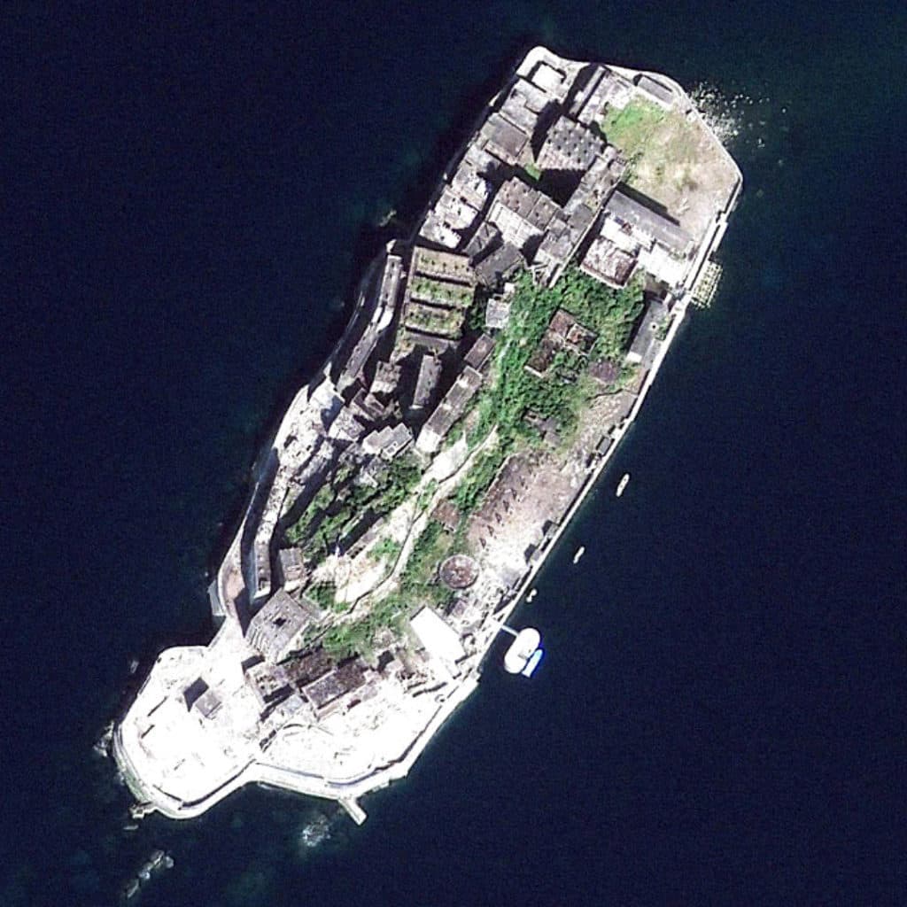
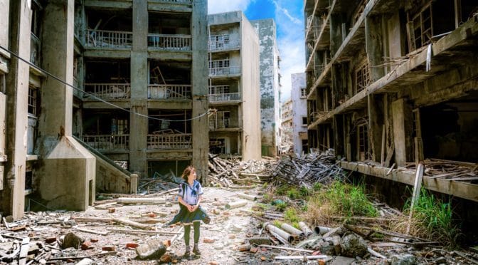
Many people will be familiar with popular and fantastic ‘dystopian’ photographs of the abandoned urbanscape and buildings on Hashima (or Gunkanjima, meaning “battleship island”), Japan. Otherwise, people have probably seen the latest James Bond film (Skyfall, 2012) where several scenes were filmed on the island as the ‘secret lair” of villain Silva (played with relish by Javier Bardem). An excellent review of the island’s history, “Hashima: The Ghost Island”, by Brian Burke-Gaffney is available online from Cabinet Magazine here. However, satellite images of the island are rarely provided. A Google image search in April 2013 only produced one aerial photograph taken from a few hundred feet.

In 1959, Hashima was the most densely populated city on Earth, with 5,259 inhabitants on the small, rocky outcropping, or 216,264 people per square mile (Source: Wikipedia). The layout and terrain of the island represents something of a microcosm of urban form processes condensed into an extremely very small area. Based on historical photographs, Hashima was enlarged using embankments to ‘regularize’ the shape of the island. The original shoreline appears, more or less, reflected in the irregular shape of the central strip of green colors viewable from above on the island. There is a small-scale deformed grid in the south-central portion of the island whereas there is a regular grid layout in its north-westerly portion. The layout offsets to these plan elements in order to oriented buildings along the western shoreline: on a larger scale, in the central west area using deformation; and, in two linear building strips immediately adjacent to the western shoreline. There are two large open spaces: one along the eastern shoreline, used as the ‘marshaling’ ground for embarking on and departing from the island; and, a second at the northern tip of the island, which was primarily used for recreational space. There is also an enclosed square in the north central area of the island. Hashima is fascinating not only for a dystopian nature arising from its abandonment since 1974 but also because its layout contains an urban ‘universe’ of formal articulation on only 16 acres.
(Updated: April 18, 2017)
Urban Patterns is a series of posts from The Outlaw Urbanist presenting interesting examples of terrestrial patterns shaped by human intervention in the urban landscape over time.

