Tag Archives: Missouri

Urban Patterns | Kansas City, Missouri-Kansas USA

“We’ll be standin’ on the corner of 12th in line
With our Kansas City baby and our bottle of Kansas City wine.”
Kansas City, Little Richard

Urban Patterns | Kansas City, Missouri-Kansas USA
by Dr. Mark David Major, AICP, CNU-A

Kansas City, Missouri is the largest city in the state and the sixth largest city in the American Midwest. According to the U.S. Census Bureau, the city had an estimated population of 481,420 in 2016, making it the 37th largest city by population in the United States. It is the anchor city of the Kansas City metropolitan area, which straddles the Kansas–Missouri border. Kansas City was founded in the 1830s as a Missouri River port at its confluence with the Kansas River. On June 1, 1850, the town of Kansas was incorporated; shortly after came the establishment of the Kansas Territory. Confusion between the two ensued and the name Kansas City was assigned to distinguish them soon thereafter. Kansas City, Kansas is the third-largest city in that state and the third-largest city (after Kansas City, Missouri and Overland Park, Kansas) of the Kansas City metropolitan area. The Kansas City metropolitan area is a 15-county metropolitan area that straddles the border between Missouri and Kansas. With a population of about 2,340,000, it ranks as the second largest metropolitan area in Missouri (after Greater St. Louis). Kansas City, Kansas is abbreviated as KCK to differentiate it from Kansas City, Missouri. As of the 2010 census, Kansas City, Kansas had a population of 145,786 residents. (Source: Wikipedia).
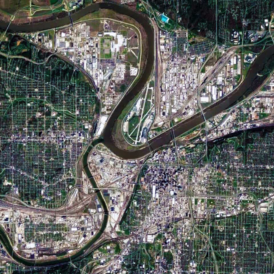
Satellite view, 15 km, Kansas City,Missouri-Kansas USA, Google Earth
Satellite view from 15 km of Kansas City Missouri-Kansas USA (Source: Google Earth).

There are two distinctive characteristics to the urban pattern of Kansas City at different scales of the city. The first is the series of large building footprints and urban blocks composing a series of small-scale (in relative terms) offset grids adjacent to the Missouri and Kansas Rivers. This is most apparent in the close-up satellite view from 15 km of Kansas City (see above). This is a direct result of its historical origins in water transportation, which remains important to this day for the city; namely, the laying out of street networks to ensure a rectangular shape to the plots on the most valuable land immediately adjacent to the rivers.
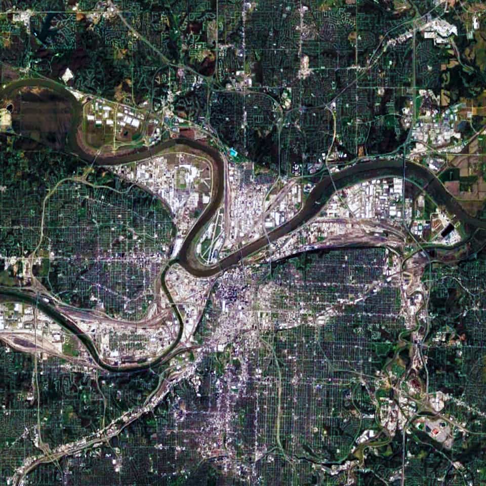
Satellite view, 30 km, Kansas City,Missouri-Kansas USA, Google Earth
Satellite view from 30 km of Kansas City Missouri-Kansas USA (Source: Google Earth).

When examining the Kansas City urban pattern at the large-scale (see satellite view from 30 km above), the second distinctive characteristic becomes much more apparent; namely, a strong north-south and east-west structure in the street network of Kansas City. Initially, some people might think this occurred due to the stereotypical view about the ‘flatness’ of the American prairie. However, the topography in and around Kansas City is composed of gentle, rolling hills and river bluffs. Instead, this is evidence of the emergent pattern of the Jeffersonian grid in the 1785 Land Ordinance.

Urban Patterns is a series of posts from The Outlaw Urbanist presenting interesting examples of terrestrial patterns shaped by human intervention in the urban landscape over time.

Share the knowledge!
Share

Urban Patterns | St Louis, Missouri USA

“I will be your tootsie wootsie,
If you will meet in St. Louis, Louis,
Meet me at the fair.”
— Meet Me in St. Louis, Judy Garland

Urban Patterns | St. Louis, Missouri USA
by Dr. Mark David Major, AICP, CNU-A

St. Louis is an independent city (meaning it is not part of St. Louis County) and major American port in the state of Missouri, built along the western bank of the Mississippi River, on the border with Illinois. The city had an estimated population of 311,404 in 2016. It is the cultural and economic center of the Greater St. Louis area (metropolitan population of 2.9 million people), making it the largest metropolitan area in Missouri and the 19th-largest in the United States (Source: Wikipedia).

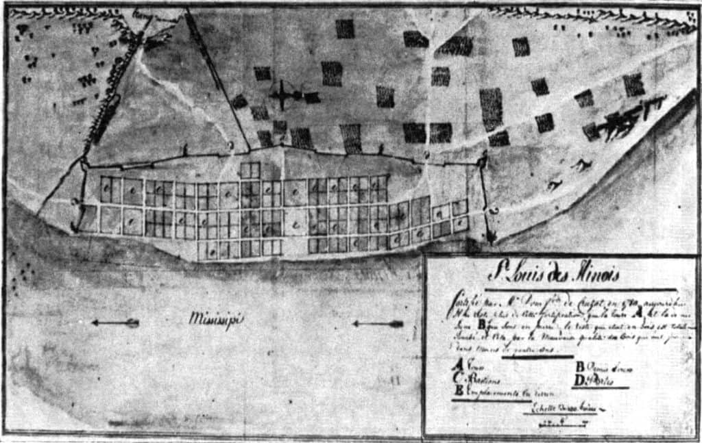
map, St. Louis, 1780, archives, Wikipedia
A map of St. Louis in 1780. From the archives in Seville, Spain (Source: Wikipedia).

Prior to European settlement, the area was a major regional center of Native American Mississippian culture. The city of St. Louis was founded in 1764 by French fur traders Pierre Laclède and Auguste Chouteau, and named after Louis IX of France. In 1764, following France’s defeat in the Seven Years’ War, the area was ceded to Spain and retroceded back to France in 1800. Nominally, the city operated as an independent city after 1764 until 1803, when the United States acquired the territory as part of the Louisiana Purchase. During the 19th century, St. Louis developed as a major port on the Mississippi River. In the 1870 Census, St. Louis was ranked as the 4th-largest city in the United States. It separated from St. Louis County in 1877, becoming an independent city and thus, limiting its own political boundaries. In 1904, it hosted the World’s Fair/Louisiana Purchase Exposition and the Summer Olympics (Source: Wikipedia).

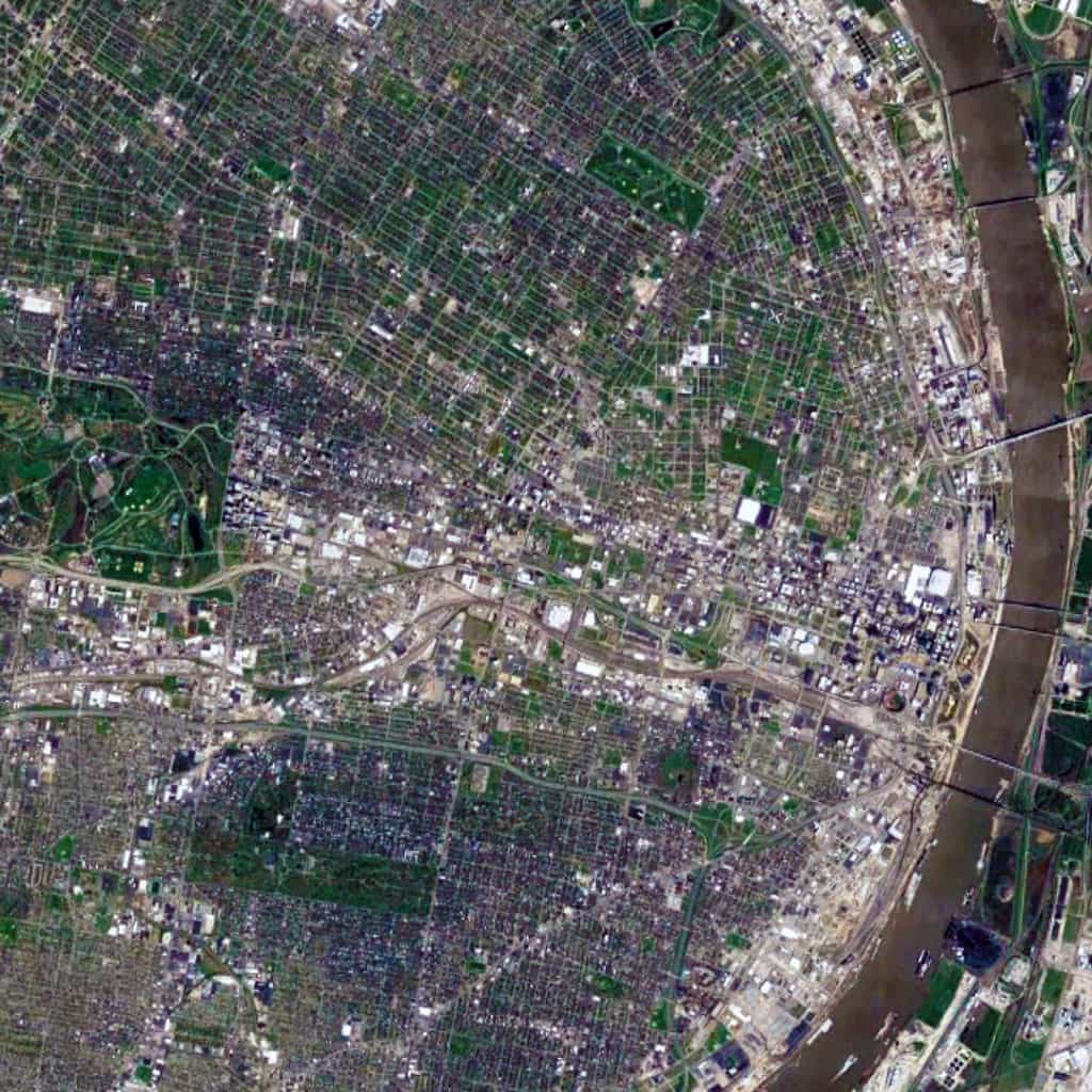
Satellite view, 15 km, St. Louis, Missouri, USA, Google Earth
Satellite view from 15 km of St. Louis, Missouri in the USA (Source: Google Earth).

The St. Louis urban pattern is composed of a series of small-scale regular grids of varying size, which are offset in relation to each other. This originally occurred due to adapting the regular grid layout to the topography of the Mississippi River adjacent to the riverfront at this location to ensure that most valuable lots were rectangular in shape for the purposes of buildability. Like other cities in the world composed of offset, regular grids (such as Athens, Greece and New Orleans, Louisiana), this – in combination with the distribution of land from afar by the French/Spanish crowns during the Colonial period – had a ‘cascade effect’ in shaping the layout and orientation of future parcels of small-scale regular grids in the city. Later, railroad lines running east-west introduced a very strong north-south divide in the city, which persists to this day. Oddly, this divide (historically reflecting a post-war racial divide in the city, e.g. whites in south St. Louis and blacks in north St. Louis) has been reinforced by Federal, state, and city planning efforts such as the Jefferson National Expansion Memorial (i.e. Gateway Arch) grounds on the riverfront in downtown St. Louis.

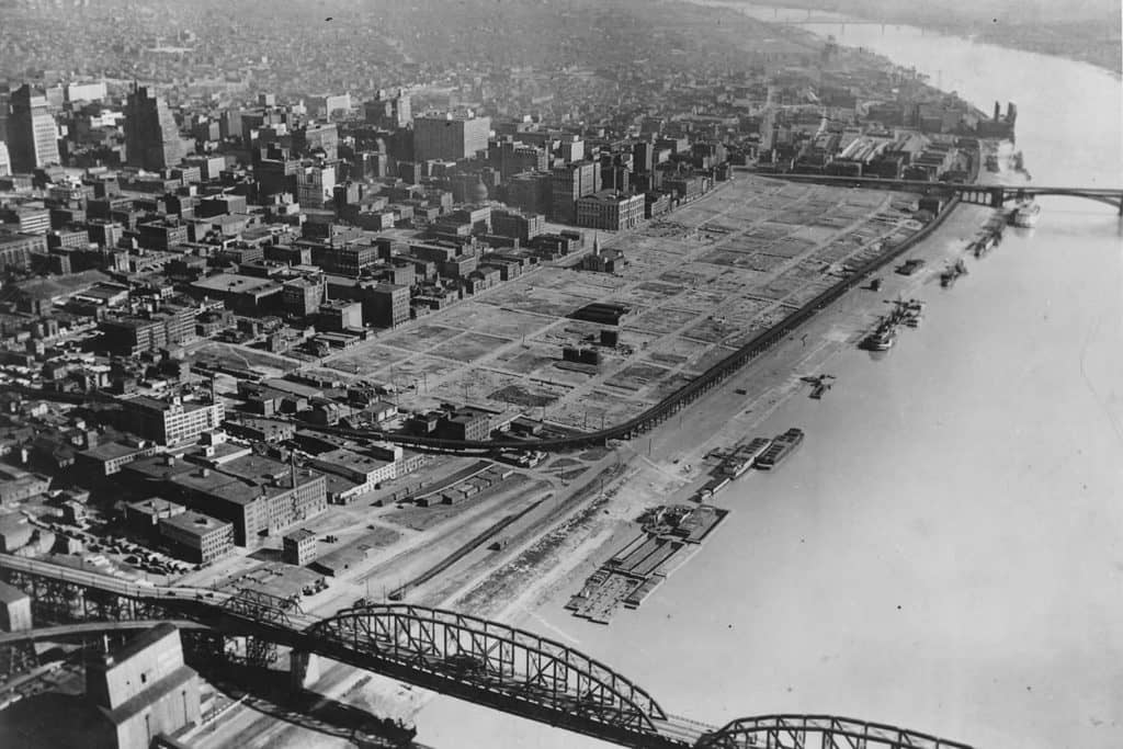
St Louis, Warehouse District, New Orleans, French Quarter, 1930s, Gateway Arch
St. Louis’ Warehouse District – same size as two New Orleans’ French Quarters – demolished during the 1930s to (eventually) make way for the Jefferson National Expansion Memorial grounds and Gateway Arch though this riverfront land remained vacant for over two decades.

Urban Patterns is a series of posts from The Outlaw Urbanist presenting interesting examples of terrestrial patterns shaped by human intervention in the urban landscape over time.
Share the knowledge!
Share

PHOTO ESSAY | Country Club Plaza | Kansas City MO

PHOTO ESSAY | Country Club Plaza | Kansas City MO
Photographs by Dr. Mark David Major, AICP, CNU-A

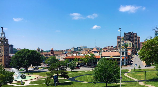
Opened in 1923, Country Club Plaza is a privately owned American shopping center in the Country Club District of Kansas City, Missouri. The center consists of 18 separate buildings representing 804,000 square feet of retail space and 468,000 square feet of office space. The standalone buildings are built in a distinctive Seville Spain theme and are on different blocks mostly west of Main Street and north of Brush Creek, which blends into the Country Club neighborhood around it. The area as a whole is often simply called the “The Plaza” (Source: Wikipedia).

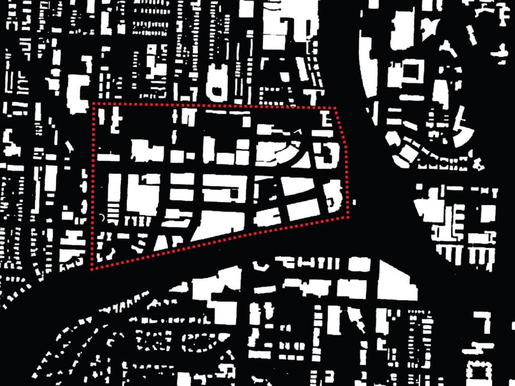
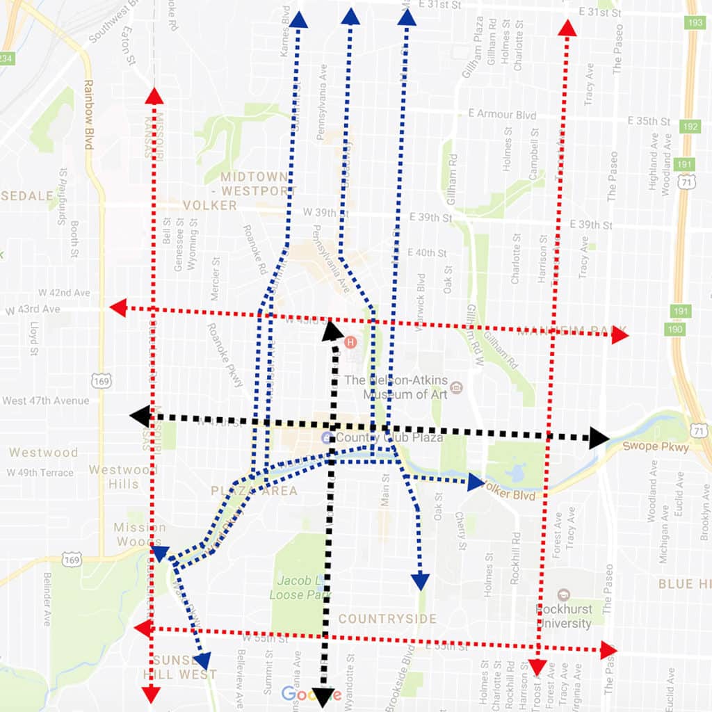
It is all-too-easy to examine the figure ground of building footprints (top, above) and conclude that Country Club Plaza is defined by ‘strong edges,’ especially to the south (Brush Creek) and east (Mill Creek Park). However, this is misleading and less important than the relationship of ‘edge streets’ to the larger context of Kansas City in all directions. In fact, the spatial logic of the Plaza area (and Country Club Plaza, in particular) is simple, yet quite sophisticated. A central cross-axis (cardo and decumanus) defines the local catchment area (in black, see below).

Central cross-axis defining the local area relationship and the layered ‘edge streets’ defining the larger contextual relationship to Kansas City in all directions.

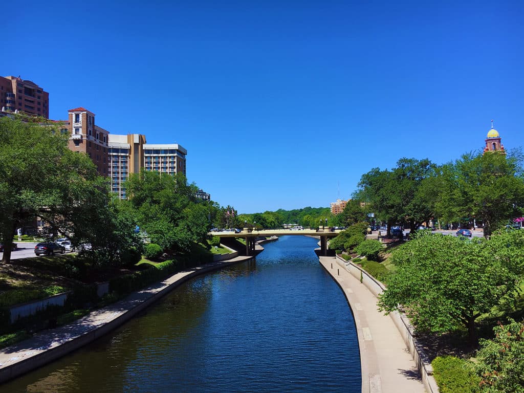
A series of sequential ‘edge streets’ defined the relationship to the larger Kansas City context with the one closest to Country Club Plaza tending to split along the southern, eastern and western edges (in blue) for the purposes of traffic management. This includes Ward Parkway running parallel along both sides of Brush Creek (see below).

View along Brush Creek looking westward (Photograph: Mark David Major).

A series of major streets (in red, see above) farther afield – West 43rd Street to the north, State Line Road to the west, Gillman Road to the west, and West 55th Street to the south – define another edge to the Plaza area. It is this second edge that is the more important one for Country Club Plaza to access a regional catchment area since the cross-axis of the local catchment area reaches to each of these edge streets, helping to structure of the relationship of Country Club Plaza within a much larger area. The Plaza neighborhood itself then uses a series of streets of low/moderate length and connectivity within the interstitial areas formed by this classical morphology to generate its distinctiveness at different scales of movement (automobile, walking/biking) within Kansas City.

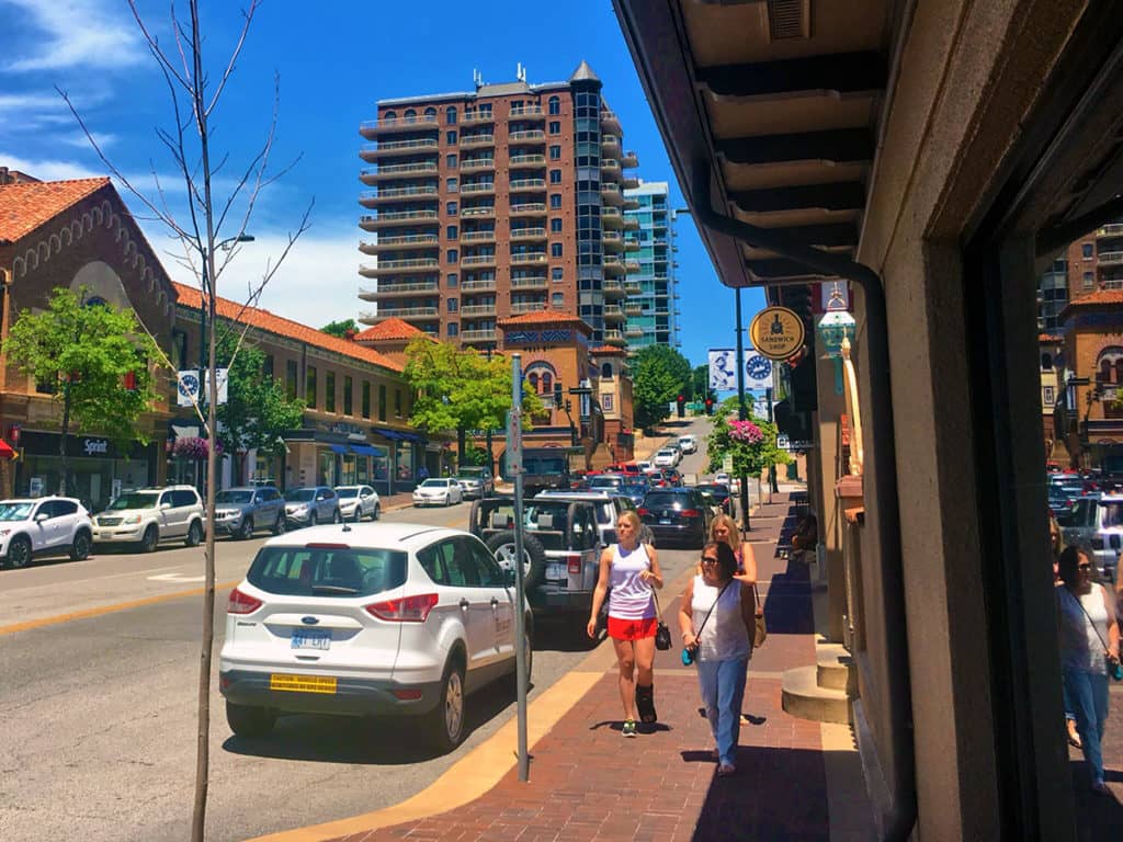
Looking north along Broadway at the corner of Nichols Road (Photograph: Mark David Major).

Plentiful on-street, short-term parking (2 hours or less) helps to slow down the traffic on the streets within Country Club Plaza itself though some road section improvements (central landscape medians instead of continuous left turn lanes) might prove more beneficial for the area over the long term.

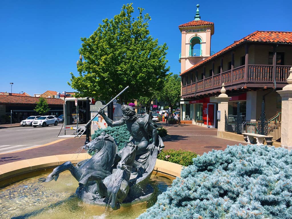
Looking west along 47th Street at the corner of Wornall Road in the small public space associated with the Neptune Fountain (Photograph: Mark David Major).
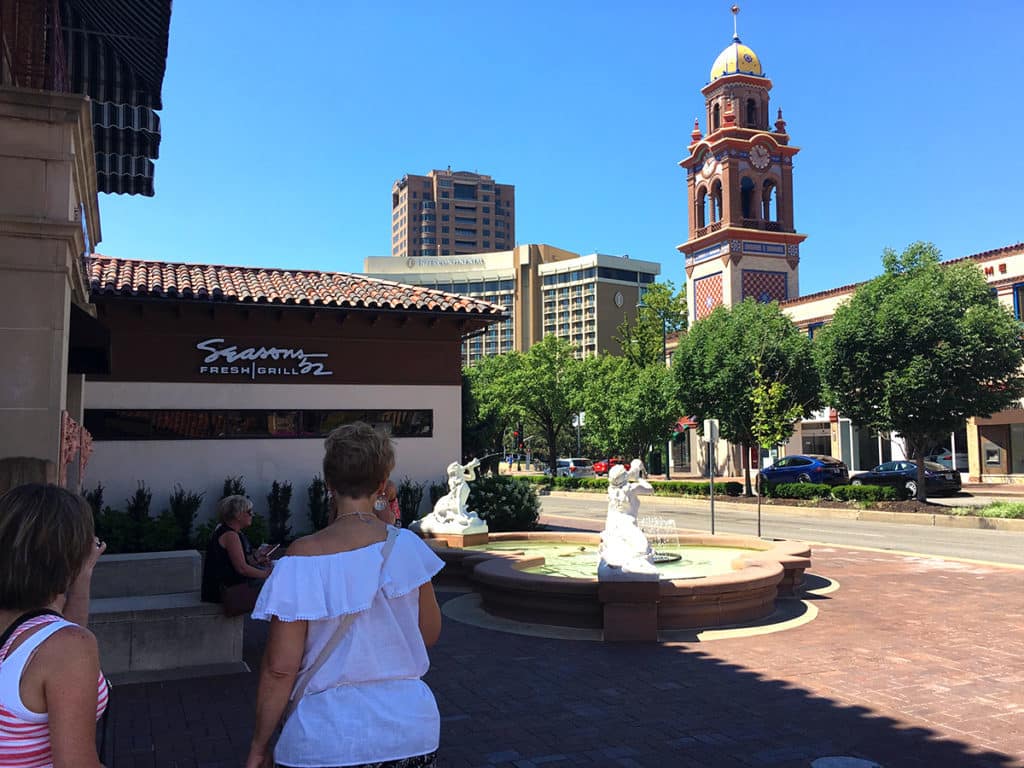
Looking southwest along Broadway towards Brush Creek from the small square associated with what is called the Mermaid Fountain (technically, the fountain depicts sirens, as indicated by the ancient megaphones they are holding) (Photograph: Mark David Major).
Looking west through the small public square at the southwest corner of Pennslyvania Avenue and Nichols Road. I call this “Penguin Square” because of the three bronze statues of penguins at its center (Photograph: Mark David Major).
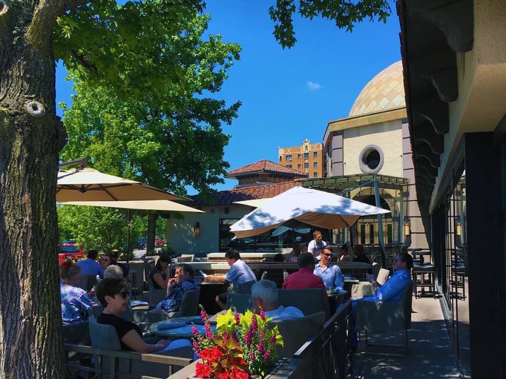
Looking west across the outdoor patio for the Gram & Dunn restaurant at the corner of Pennsylvania Avenue and Ward Parkway across the street from Brush Creek (Photograph: Mark David Major).
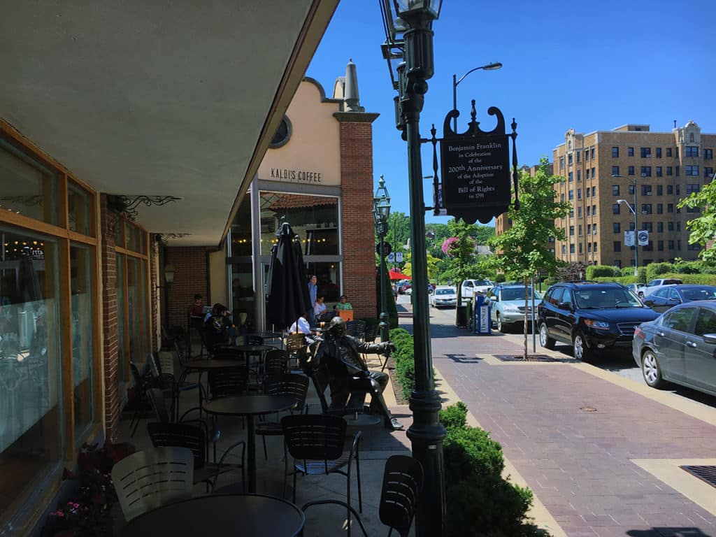
Looking south down Jefferson Street through the outdoor eating plaza of Kaldi’s Coffee at the corner with Nichols Road (Photograph: Mark David Major).

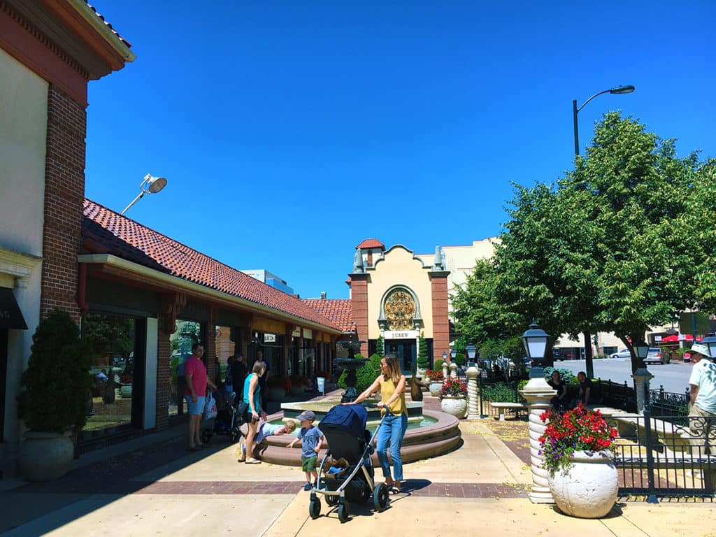
Country Club Plaza makes very clever use of public squares and plazas (often in conjunction with fountains, for which the area is renowned) by turning over some of its most valuable parcels (street corners or “100% location”, according to William Whyte) for public uses. Some of these street corner spaces also operate as outdoor patio seating for restaurants and coffee shops. Most are quite successful, which emphasizes the greater importance of ‘people watching’ than the enclosure of space for a successful public square.

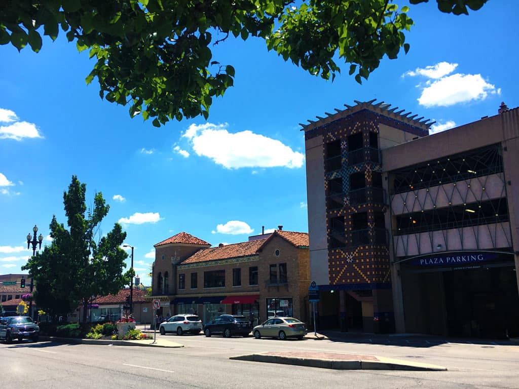
Streetside entry to interior parking building on Nichols Road near the corner of Broadway (Photograph: Mark David Major).

As pointed out by numerous New Urbanists over the years, Country Club Plaza provides for a generous allocation of off-street parking by ‘burying’ parking structures within the center of urban blocks. This is necessary due to the lack of an extensive rail transit system in Kansas City. The KC Streetcar, opened in 2016, has a limited route in downtown Kansas City. However, once that rail transit system expands, then Country Club Plaza would be an ideal candidate for a station; preferably in the central block, which is mostly composed of off-street parking and smallish, single-story retail space along the street frontage at this time (right of the photo below).

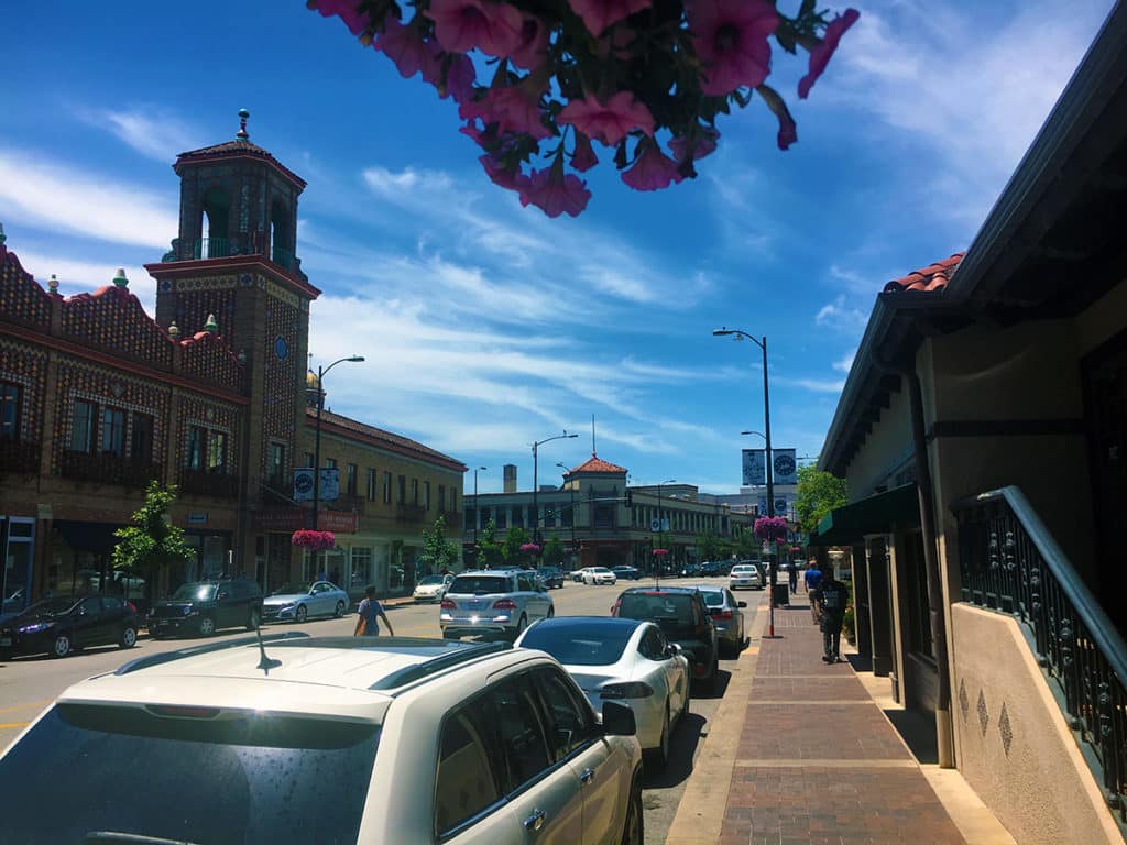
Looking west along Nichols Road at the corner of Central Street outside of Starbuck’s Coffee (Photograph: Mark David Major).
Share the knowledge!
Share

NOW AVAILABLE | A Failure of Modernism | ‘Excavating’ Pruitt-Igoe

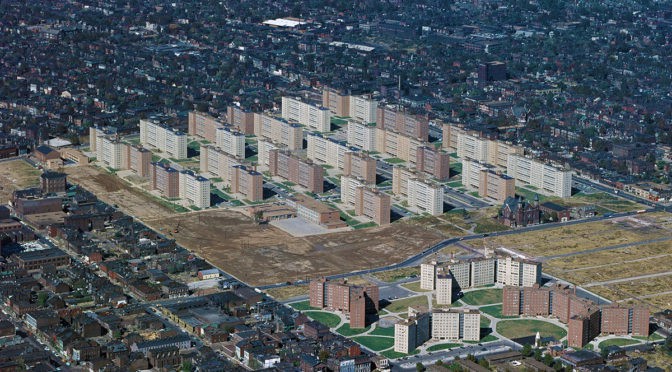
A Failure of Modernism: ‘Excavating’ Pruitt-Igoe investigates the Pruitt-Igoe Public Housing Complex in St. Louis, Missouri USA. A large literature implicates several factors in Pruitt-Igoe’s decline, which public authorities famously demolished in 1972. Often, this literature cites design and planning as contributory factors without specifying how or why in precise terms. Building on archival records and previous research, we analyze the ‘spatial archaeology’ of Pruitt-Igoe using space syntax. Our purpose is to better understand how design and planning contributed to its social malaise. It concludes: 1) provision of space (i.e. quantity) became a liability as declining occupancy generated a ‘broken interface’ between adults and children; and, 2) the pilotis of the residential towers mediated formal access and spatial distribution in a layout characterized by ‘intelligible dysfunction,’ which facilitated opportunity and escape for criminal activities. Both fed the perception and reality of social malaise at Pruitt-Igoe (2.5 hour course). Click here to purchase this course ($17.49).

Key concepts:  design, Modernism, planning, public policy, and social housing.

Includes a two-hour video presentation and PDFs of the course supplementary material and slide handout.

Please note there may be a delay for a couple of hours before you are able to access the course because we have to confirm receipt of payment for each order before completing the purchase.

About the Instructor

mark_v3Dr. Mark David Major, AICP, CNU-A is an architect and planner with extensive experience in urban planning and design, business management and real estate development, and academia. He is a Professor of Urban Design at the Savannah College of Art and Design. Mark has been a visiting lecturer at the University of Florida, Georgia Tech, Architectural Association in London, the University of São Paulo in Brazil, and Politecnico di Milano in Italy.

Share the knowledge!
Share

PHOTO ESSAY | The Hill in Saint Louis

Large swathes of St. Louis are downright depressing from the point of view of vibrant urbanism. By now, most everyone has heard about the racial problems in Ferguson, one of the earliest examples of post-war, white flight suburban sprawl in the city now populated by economically vulnerable populations; most likely heralding the beginning of the ‘ghettoization period’ for sprawl’s reputation in the United States. However, Federal, State and local redevelopment, planning, and housing policy has relentlessly decimated once-vibrant North St. Louis and East St. Louis, Illinois since World War II to the point where one might mistakenly think these areas were long-ago victims of a Soviet nuclear strike (no, these are self-inflicted wounds). Unfortunately, the same scenario has been playing out for large areas of South St. Louis over the last twenty years as well.

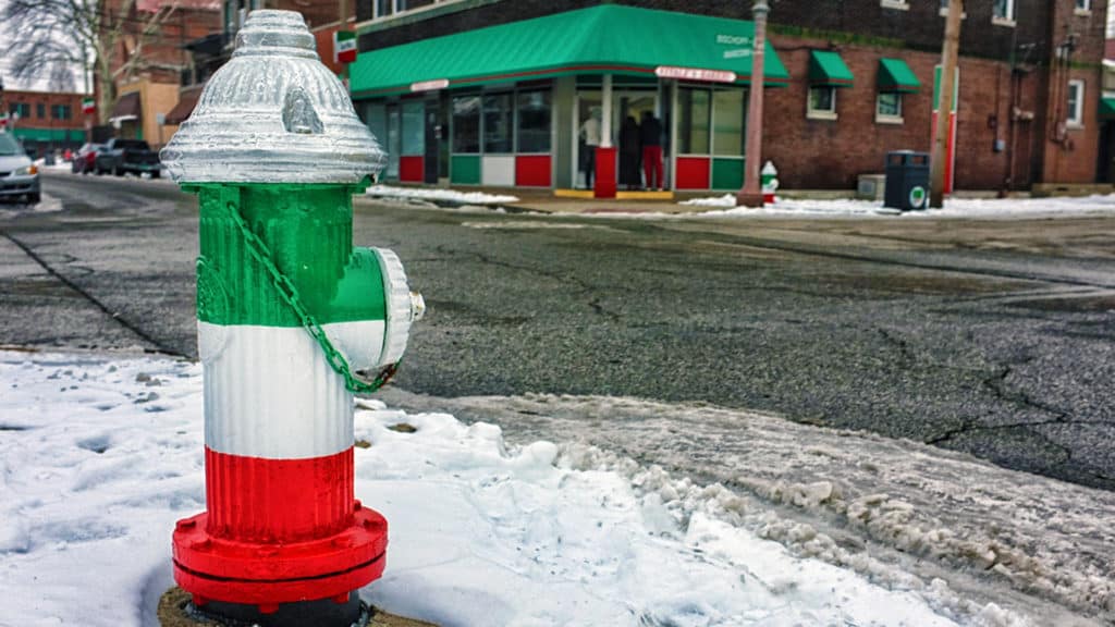
Fire hydrants flagged with the colors of the Italian flag on The Hill in St. Louis (Source: Wikipedia).

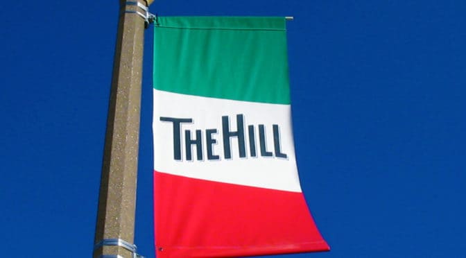
However, there are still some pockets of vibrant urbanism on display in St. Louis, which gives the city something to build upon if its leaders, professionals and citizens will only pause to look at those places as models for a sustainable future. One of these vibrant neighborhoods is The Hill located on the highest point in the city (formerly known as the St. Louis Hill) south of Forest Park. The official boundaries of The Hill are Manchester Avenue to the north, Columbia and Southwest Avenue to the South, South Kingshighway to the east, and Hampton Avenue to the west. For decades, the majority of residents on The Hill have been Italian Americans so the area is known for its many Italian businesses, restaurants (yes, the food is unbelievably good), and notable residents. This includes Yogi Berra, a Hall of Fame member of the New York Yankees during their 50s baseball dynasty known for his ‘Yogi-isms’ such as “It’s déjà vu all over again”, and Joe Garagiola, a Hall of Fame baseball broadcaster and rookie catcher for the  St. Louis Cardinals World Series championship team in 1946.

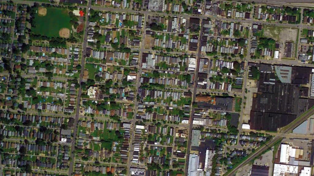
The Hill neighborhood, St. Louis satellite view from 1000m (Source: Google Earth).
Daggett Ave. and Macklind Ave. with Gioia’s Deli on the corner across from Berra Park (Photograph: Mark David Major).
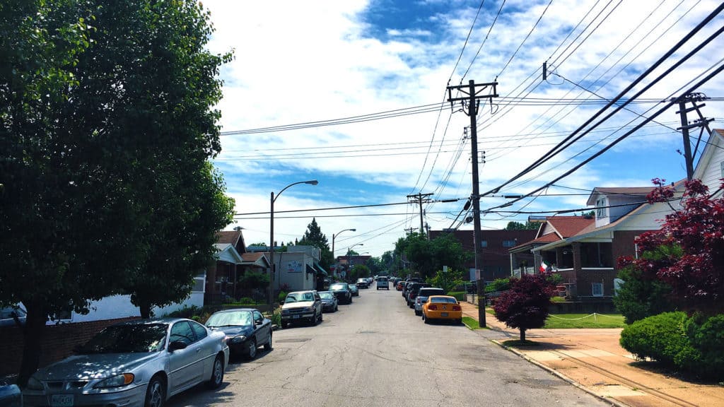
Looking up Edwards St. to the formerly named St. Louis Hill on The Hill in St. Louis (Photograph: Mark David Major).
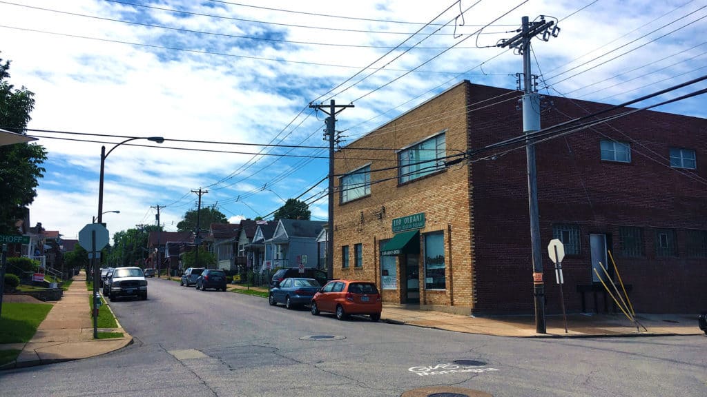
Eovaldi’s Deli (with historical sign for “Leo Oldani MFGRS Italian Salami” still on the facade) on the corner of Bischoff Ave. and Edwards St. across the street from Mama’s on the Hill Restaurant (Photograph: Mark David Major).
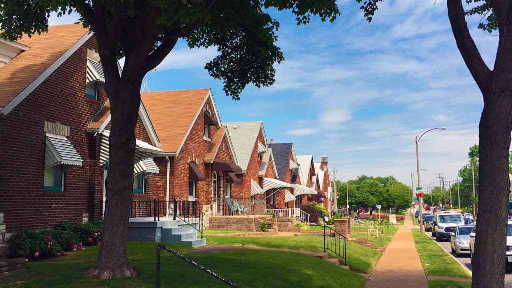
Rows of Midwestern brick vernacular homes on small lots along Wilson Ave. on The Hill in St. Louis (Photograph: Mark David Major).
Midwestern vernacular homes on small lots along Bischoff Ave. n The Hill in St. Louis (Photograph: Mark David Major).

Share the knowledge!
Share