Poor Richard, AN Almanac for Architects and Planners (2013) offered anew proverbs and witticisms about the architecture, urban design and planning of our cities. It was hailed as a “worthwhile”, “hilariously righteous epitome” for its “genius, extraordinary wit, passion for good design, and mastery of the history of planning” in “following both Benjamin Franklin and Ambrose Bierce” (Review by Harold Henderson, Planning Magazine, February 2014 and Foreword by Julia Starr Sanford to Poor Richard, AN Almanac for Architects and Planners).
The first volume of the Poor Richard series is now available for purchase in the Kindle Store for $1.99 (prices may vary in Europe, South America, and the Far East, check the Kindle Store in your country for prices).
For the best digital eBook experience, the author recommends purchasing the iBook version of the book (see below).
Poor Richard, Volume 1 is also available in print from Amazon, CreateSpace, and other online retailers as well as iBooks from the Apple iTunes Store.
Poor Richard, AN Almanac for Architects and Planners offered anew commentary, proverbs, and witticisms about the architecture, urban design and planning of our cities, which was hailed as a “worthwhile”, “hilariously righteous epitome” for its “genius, extraordinary wit, passion for good design, and mastery of the history of planning” in “following both Benjamin Franklin and Ambrose Bierce.”
In a similar vein, Poor Richard, ANOTHER Almanac for Architects and Planners brings together more common sense proverbs, astute observations, and general rules of thumb for anyone interested in the future of our cities. In doing so, author MARK DAVID MAJOR again draws from a dizzyingly array of sources for inspiration, including artistic movements of Modernism, obscure African, European and Oriental proverbs, and even the Torah and New Testament. These witticisms are often eloquent, sometimes biting, always insightful, and occasionally bizarre in the absence of deeper thought. They offer a valuable resource for the entire year, daily reminders for everyone involved in the building of our cities about their better angels and warning against the worse demons of human nature. The clear message of Poor Richard, ANOTHER Almanac for Architects and Planners, with foreword by STEVE MOUZON (author of The Original Green), is we can do better for our cities and we must do better for our cities.
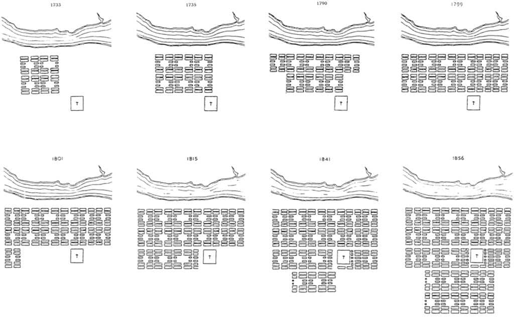
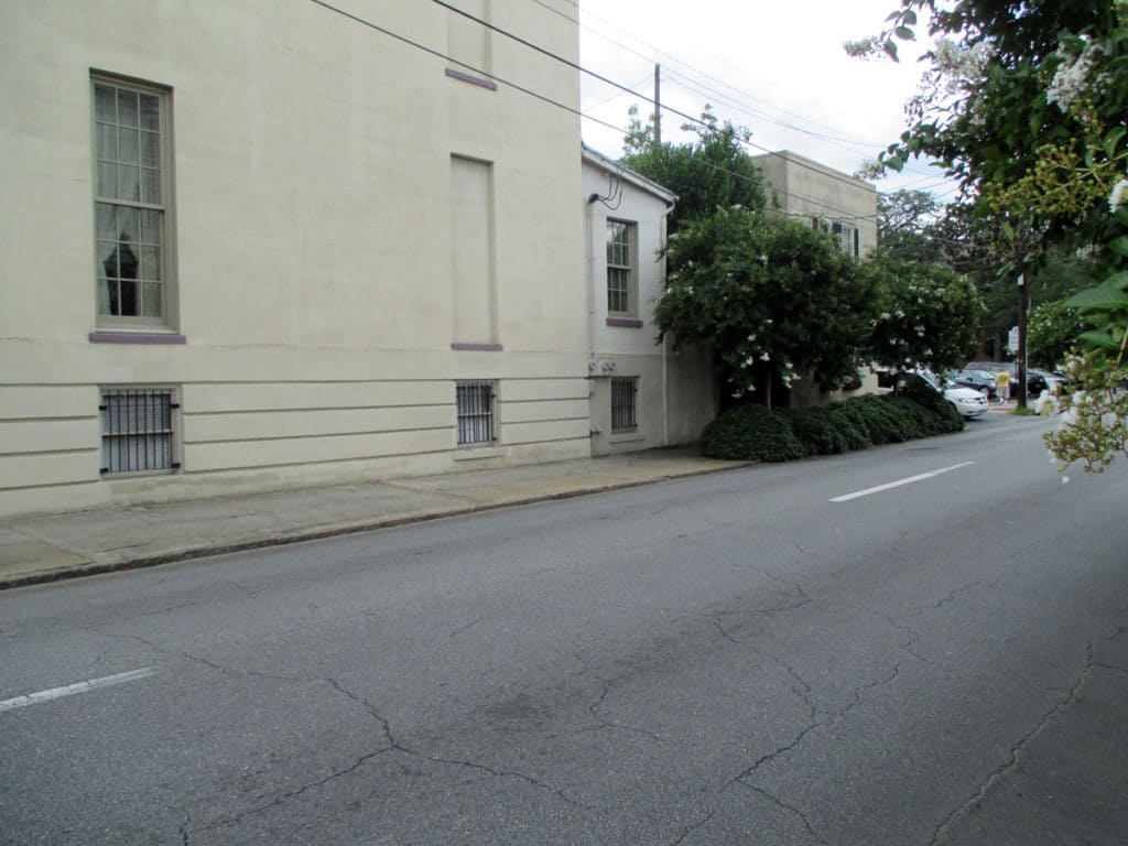
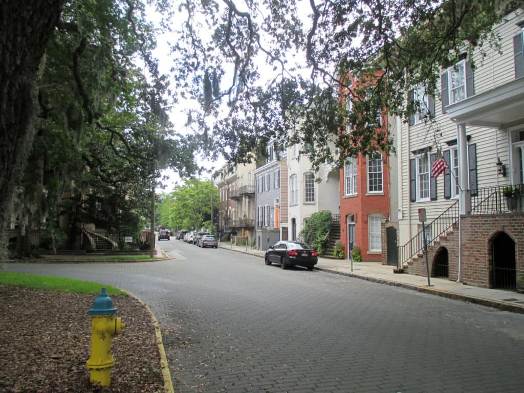
It has been said that ‘Savannah is all about its squares.’ This is inaccurate. The spatial logic of Savannah is all about the historical loading of front doors along east-west streets in the ward plan. This generates a spatial hierarchy in the plan between ‘outsiders’ (i.e. visitors) principally using north-south streets to enter the town (historically from the port, later via vehicular traffic) before assimilating along the east-west streets primarily used by ‘insiders’ (i.e. residents) (Anderson, 1986 and 1993; Kostof, 1991; Major, 2001 and 2014).
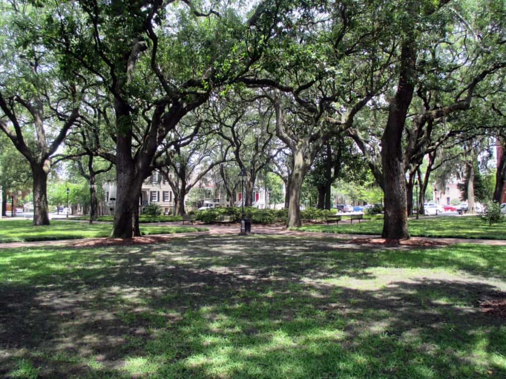
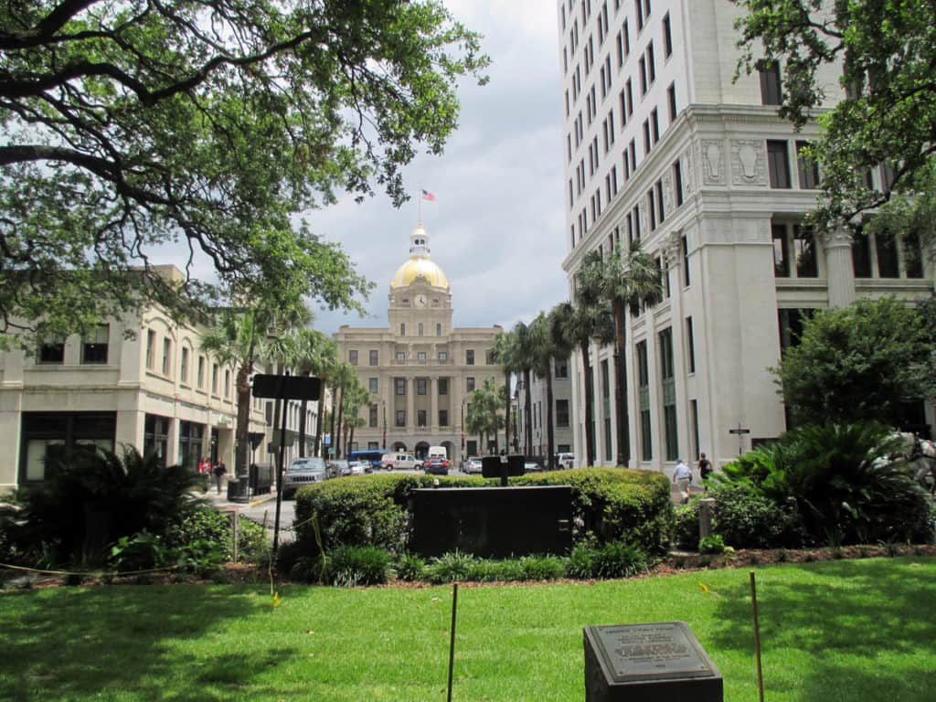
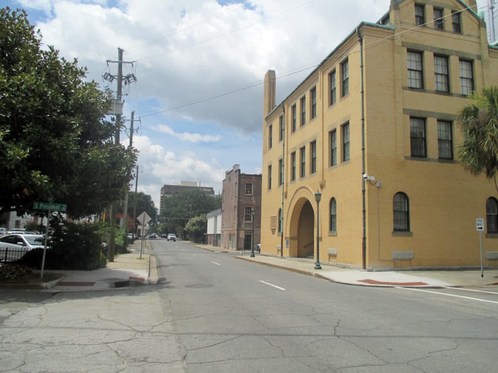
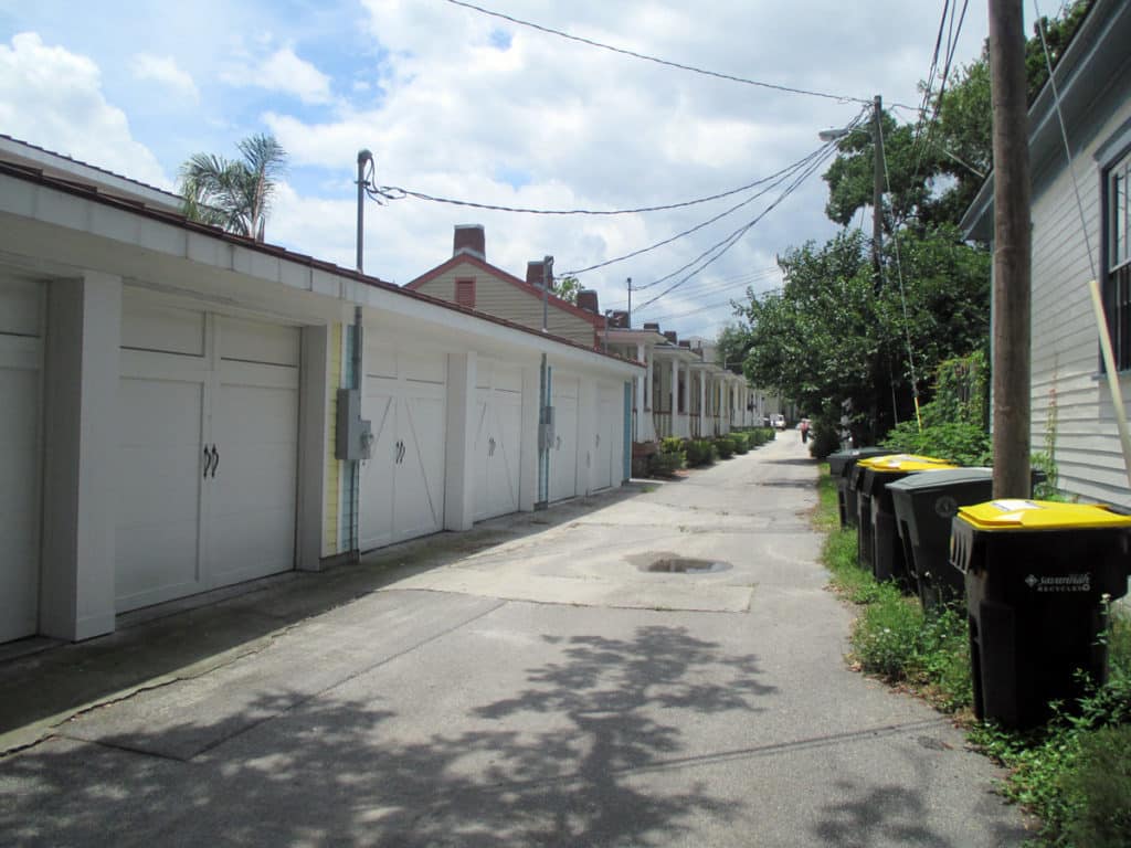
John Reps’ famous 1959 drawing of the historical growth of the Savannah, Georgia ward plan from 1733-1856 (Reps, 1965; 201).View southeast down West River Street: an east-west street in Savannah (Photograph: Mark David Major).View southwest from West River Street to Williamson Street showing the dramatic change in elevation from the bank of the Savannah River (Photograph: Mark David Major).View northwest across Oglethorpe Square (Photograph: Mark David Major).View northeast from Johnson Square down Bull Street to Savannah City Hall (Photograph: Mark David Major).North-south streets, mostly barren of trees or front doors, bear the weight of moving high-speed (in relative terms) traffic through Savannah’s ward plan (Photograph: Mark David Major).(Photograph: Mark David Major)
The spatial logic of the ward plan is imminently serviceable for managing moving traffic, treating most squares as enlarged roundabouts and filtering through traffic mostly along north-south streets such as this one. Over time, constitution (i.e. dwelling entrances) has emerged in a spotty fashion along these north-south streets but not enough (to date) to deteriorate the logic of loading front doors along east-west streets.
(Photograph: Mark David Major)
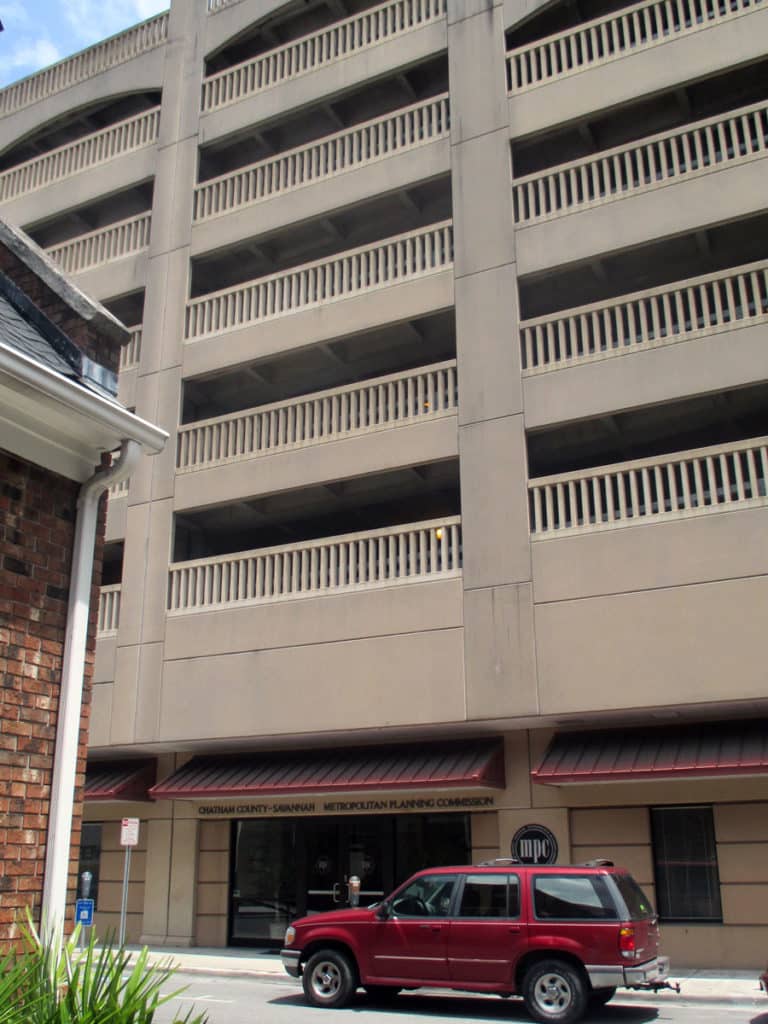
Despite this, Savannah’s ward plan is suffering under the weight of storing parked vehicles. There are parking garages located on at least four of the squares and two sides of Orleans Square is constituted by surface parking for the convention center. The wall constructed to ‘hide’ this surface parking does nothing to support the functioning of the ward plan or Orleans Square itself. This photo shows the Chatham County-Savannah Metropolitan Planning Commission offices occupying a ground level retail space (not a bad idea but poorly designed frontage) on Oglethorpe Square at the base of a seven-story parking garage (metaphorically-speaking, being crushed under the weight of parked vehicles).
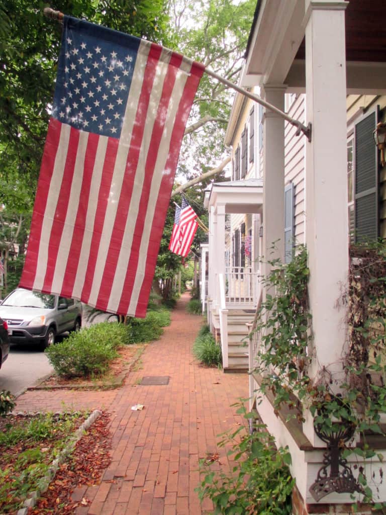
Loading of front doors along an east-west street in Savannah’s ward plan (Photograph: Mark David Major).Loading of front doors (including double-loading at ground level and second-floor entries) on an east-west street defining the northern edge of Oglethorpe Square in Savannah (Photograph: Mark David Major).(Photograph: Mark David Major)
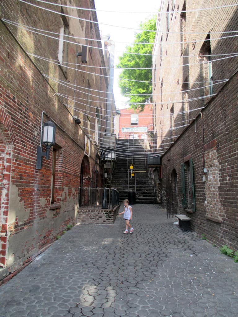
Some modern in-fill development adheres to the nuances of how Savannah’s ward plan was historically designed to function (front doors loaded on this east-west street in the development in the background) whereas some actively retards that functioning (garages loaded on east-west street in the development in the foreground, turning this portion of the space into an alleyway with trash cans).
References
Anderson, Stanford. 1993. “Savannah and the Issue of Precedent: City Plan as Resource”, Settlements in the Americas: Cross-Cultural Perspectives (Ed. Ralph Bennett). Newark: University of Delaware Press.
Anderson Stanford. 1986. “Studies towards an Ecological Model of Urban Environment”, On Streets (Ed. Stanford Anderson). Cambridge, Massachusetts: MIT Press.
Kostof, Spiro. 1991. The City Shaped: Urban Patterns and Meaning Through History. London: Thames and Hudson, Ltd.
Major, Mark David. 2015. Relentless Magnificence: The American Urban Grid. Ph.D. Thesis. Copies available from University College London.
Major, Mark David. 2001. “When is a door more than a door? The role of constitution in strongly geometric configurations”, Third International Space Syntax Symposium Proceedings (Eds. J. Peponis, J. Wineman, S. Bafna), 37.1-37.14.
Reps, John W. 1965. The Making of Urban America: A History of City Planning in the United States. Princeton, NJ: Princeton University Press.
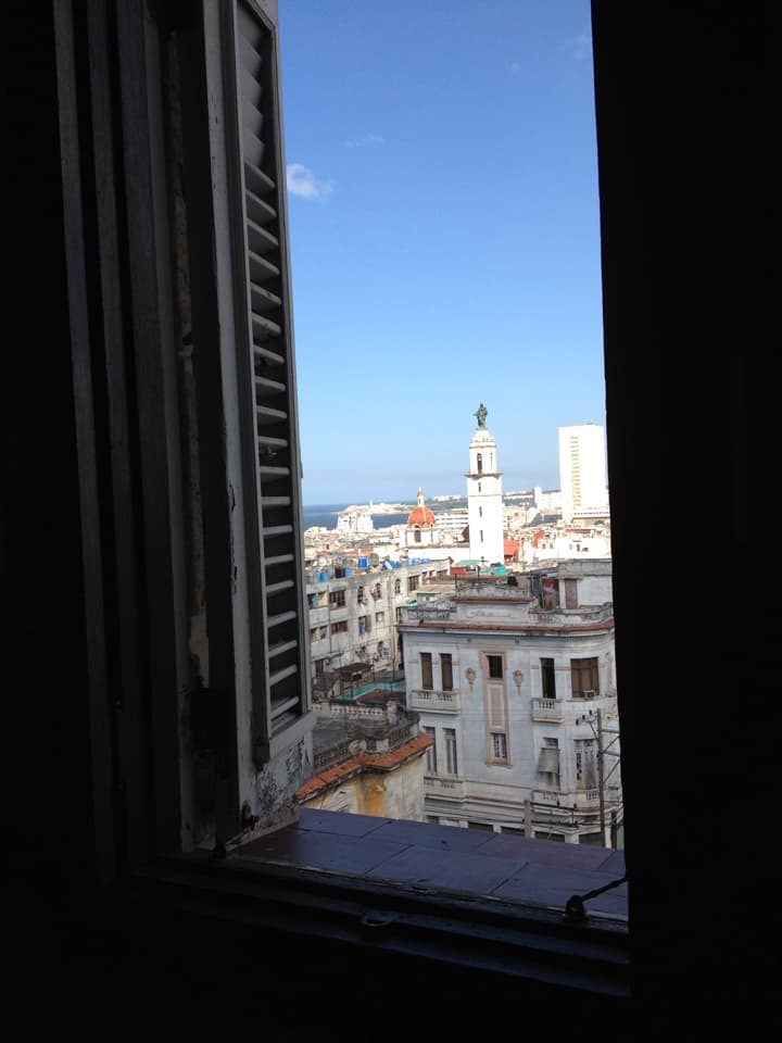
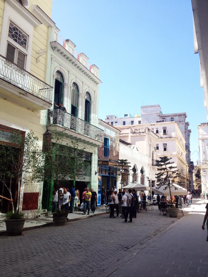
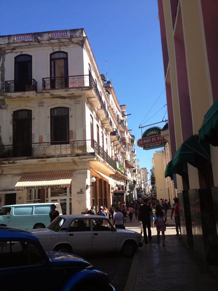
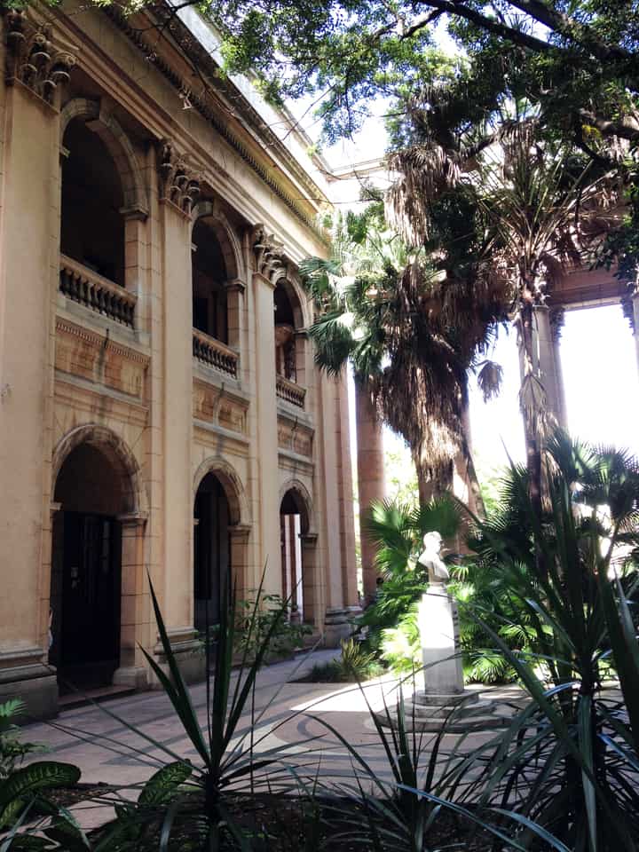
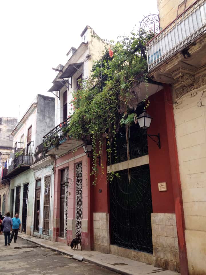
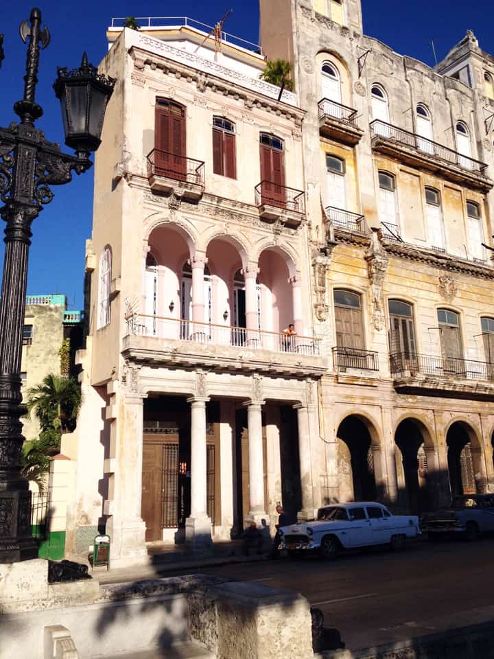
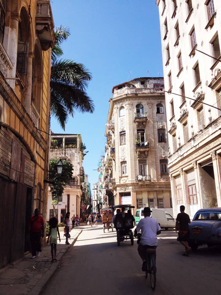
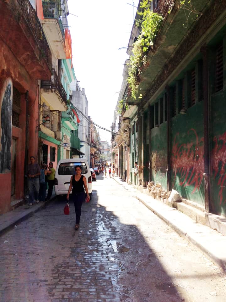
PHOTO ESSAY | Havana, Cuba | Part 2 Photographs by Concrete Blonde
Part 2 of a brief photographic essay of architecture and urban space in Havana, Cuba courtesy of Concrete Blonde. Again, the urban vocabulary of Havana is remarkably consistent: the street life of urban balconies, the use of balcony gardens in softening the urban streetscape, rooftop terraces, abundant use of urban sidewalk arcades, and the use of color.
Looking over a Havana neighborhood through an open window with the harbor in the distance.Havana street life above and below, courtesy of a ground-level retail shop and second floor balconies.A narrow shopping street in Havana, Cuba.A lavishly-vegetated garden in the courtyard of a public building in Havana, Cuba.Vegetation hanging from a second floor balcony soften the hard edges of the urban streetscape in Havana, Cuba.Upper-level balconies introduce additional street constitution and casual surveillance of the street in the urban environment of Havana, Cuba.Balconies and sidewalk arcades defining the street vocabulary of Havana, Cuba.A street space well-used by pedestrians in Havana, Cuba.A narrow street width in Havana, Cuba.Finally, a light well made of empty bottles at a local restaurant in Havana, Cuba; included here only because it’s so ingeniously cool.
Gorgeous aerial photograph of the fascinating dual spatial network in a sub-Sahara African settlement in Libya where the ground-level street network tends to be reserved for men and roof terrace network tends to be reserved for women. Thanks to Dana Bixby for posting this National Geographic photograph on the Space Syntax in Architecture and Urban Design Facebook page.
Photograph: National Geographic, January 13, 2013 issue.
Share the knowledge!
Blogging about architecture, urbanism, and culture…

 Poor Richard, AN Almanac for Architects and Planners (2013) offered anew proverbs and witticisms about the architecture, urban design and planning of our cities. It was hailed as a “worthwhile”, “hilariously righteous epitome” for its “genius, extraordinary wit, passion for good design, and mastery of the history of planning” in “following both Benjamin Franklin and Ambrose Bierce” (Review by Harold Henderson, Planning Magazine, February 2014 and Foreword by Julia Starr Sanford to Poor Richard, AN Almanac for Architects and Planners).
 AVAILABLE BEFORE THE HOLIDAYS!!!