The City’s Essential DNA
by Mark David Major, AICP, BA, BA, MSc
Founder, The Outlaw Urbanist
Email: [email protected]
Web: www.outlaw-urbanist.com
Twitter: @OutlawUrbanist
NOTE: This is a shorter, punchier, reference-free version of “The City’s Essential DNA: Formal design and spatial processes in the urban patterns”, which appears in Volume 4, Issue 1 of The Journal of Space Syntax, 2013, pp 160-164, ISSN: 2044-7507. It was prepared at the request of a Planning Department for their academic publication but they decided to pass on the article because it was “too technical”.
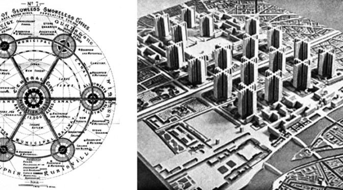
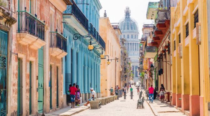
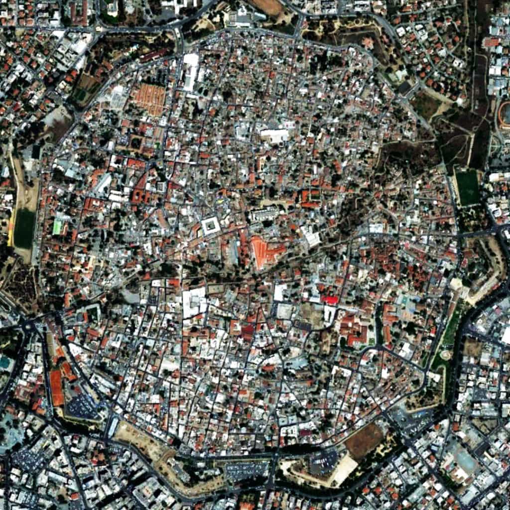
Our descriptions of cities are often based on their physical form. In urban theory, the description of ‘organic’ and ‘regular’ cities is one of the most persistent and useful. The first stresses process over time in terms of unplanned growth whereas the second on conscious design. This ‘shorthand’ provides a basic understanding of cities across different times, cultures, and geographical regions, which is useful precisely because they are theory-loaded terms. They seemingly convey a lot of information in an easy-to-grasp manner. Regular explicitly describes physical form and the design process that gave rise to it. Organic explicitly describes process over time in terms of urban growth, tacitly understood such cities tend to be characterized by deformed grids. The explicit and implicit description of urban form and process is the basis of their descriptive value since most cities are easily classified as having common or different attributes when characterized as organic or regular. There have been frequent attempts to develop better terminology. Utilitarian, deformed, surface order, neutral, offset, gridiron, radial, uniform, homogeneous, undifferentiated matrix, sprawl, geomorphic… the amount of jargon is enough to give anyone a headache. However, describing urban form as deformed or regular is also theory-loaded since cities are characterized in geometrical terms.  The key is the incidence or deficiency of a readily apparent geometry in the physical composition of streets and blocks in plan. American cities tend to possess such geometries so they are regular grids. European or Middle Eastern ‘organic’ cities appear to lack such geometries so they are deformed grids. Others have defined this as the difference between composition and configuration to better distinguish between how we view the city (static form) and how it works (dynamic process). Composition is an easy-to-grasp, understand-all-at-once description and configuration is a more complex view of relations amongst elements that potentially affect urban functions. This distinction is often confused or misunderstood, inevitably leading us to a theoretical dead-end.
At a detailed scale, the Urban Transect specifies this distinction between form and process in the design of the street itself for those transitioning from Euclidean zoning to form-based codes. Several formal elements (street width, road sections, building footprints, landscaping) are tied to functional uses (density and intensity). If cities are interfaces between scales of movement, as suggested by John Peponis at Georgia Tech, then the Urban Transect creates an idealized model of this essential urban dynamic of form and process for the design of streets to better classify it for application in form-based zoning regulations and streetscape design. Duany and Talen’s explanatory diagram of transect planning specifies a geometric logic (all urban streets connect at right angles) but the applicability of transect planning for types of cities seems readily apparent. What varies from one city to another is geometry and scale as realized in the layout. The true brilliance of transect planning is, the more it is applied in real world conditions, then the less tenable becomes the roadway classifications of modern transportation planning. Those beholden to the dominant 20th century planning paradigm should beware of New Urbanists bearing gifts.
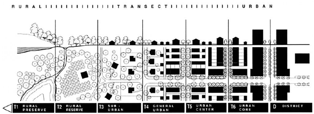
Transect planning is largely silent about generating an urban pattern above the level of the street, leaving this to the design sensibilities of the professionals. This appears to leave a gulf of understanding between the urban whole and the street itself. However, this is precisely where the essential dynamics of form and process as it impacts on urban functions are realized in cities. Hiller and Hanson argue in The Social Logic of Space the physical arrangement of space “has a direct relation – rather than a merely symbolic one – to social life, since it provides the material preconditions for patterns of movement, encounter and avoidance which are the material realization – sometimes the generator – of social relations.” New Urbanists have been basically arguing the same for thirty years. In everyday practice, this becomes complicated because we tend to view and design space in discrete terms, independent of a larger geographical, topographical, and/or urban context. In doing so, the importance of design in establishing the material preconditions for our everyday use of urban space is often minimized, misunderstood, or even ignored.
Our design decisions in generating the urban pattern are important. For example, it is in this realm that an important (and little discussed) distinction arises between intra-connectivity (street connections within the bounds of a site) and inter-connectivity (street connections between bounds of different sites). Historically, intra-connectivity has been strongly realized in New Urbanism developments but inter-connectivity weakly so. We cannot simply leave design of the urban pattern to the (varied) abilities of professionals and hope for the best. We must identify and understand it so we can intervene better and smarter.  If we focus on the static and dynamic relationship between form and process, composition and configuration, in the design of the urban grid, a basic set of design decisions having formal and process implications for urban space can be identified.
We could describe this as the essential DNA for all types of cities. There is grid expansion and deformation, whereby the urban pattern expands in a consistent manner or else deforms in relation to some external factor, usually topography or land ownership patterns. In regular cities, deformation usually occurs whilst still adhering in some manner to the basic conceptual order of the existing urban pattern but in different cardinal directions. In organic cities, deformation tends to occur during up-scaling of the urban pattern to relation to its ever-growing edges by introducing more geometrical order in the layout. There is street extension, whereby an existing street is extended in one of both directions. In regular cities, this tends to occur as a straight-on continuation in adherence to the conceptual order of the regular grid. In organic cities, this tends to occur as an open-angled continuation, which generates its distinctive deformed grid pattern. Street extension is also the primary tool for strip development in the growth of linear and crossroad settlements, especially during the early stages of community growth, of which Las Vegas is probably the most famous example. The most easily recognizable form of the essential urban dynamic is block size manipulation.

The dynamic nature of block size manipulation in our cities can be easily seen in a side-by-side figure ground representation (blocks in white, space in black) of Philadelphia yesterday and today. There are two remarkable yet seemingly contradictory things about this comparison. First, is the degree to which the original block scheme of Penn’s plan has changed, principally through a process of block subdivision and, second, is the degree to which the integrity of Penn’s original plan concept has endured despite hundreds, perhaps thousands, of small- and large-scale interventions over 330 years. Finally, there is discrete separation by linear segregation of streets. Street connections are either broken (as in American suburban sprawl through interruptus in extremis) or complicated (as in Middle Eastern cities by narrowing street widths to generate labyrinthine-like but still well-connected layouts) to isolate (usually residential) areas in the urban pattern.
These design methods can be found in the urban pattern of all cities. The spatial processes associated with formal design tend to converge on the ortho-radial grid model. This is a prime example of what Carvalho and Penn mean, saying “the impact of local controls on growth… is, at most, spatially localized… at a macro level, cities display a surprising degree of universality.” In fact, the essential variation across different types of cities appears the scale of street lengths and connections tied to their degree of geometrical articulation; longer, more connected and expansive in regular cities primarily using right angles whereas shorter, less connected, and more compact in organic cities using open and right angles. In the end, cities are not so complicated; rather, it is our theories that tend to complicate our understanding of them.

Based on excerpts from forthcoming The Syntax of City Space: American Urban Grids by Mark David Major.

