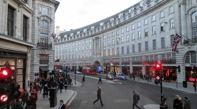
Regent Street is a major shopping street in the West End of London. It is named after George, the Prince Regent (later George IV) and was built under the direction of the architect John Nash. The street runs from Waterloo Place in St James’s at the southern end, through Piccadilly Circus and Oxford Circus, to All Souls Church. From there Langham Place and Portland Place continue the route to Regent’s Park. The street was completed in 1825 and was an early example of town planning in England, replacing a number of earlier roads including Swallow Street. Nash’s street layout has survived, although all the original buildings except All Souls Church have been replaced following reconstruction in the late 19th century. The street is known for its flagship retail stores, including Liberty, Hamleys, Jaeger and the Apple Store. The Royal Polytechnic Institution, now the University of Westminster, has been based on Regent Street since 1838 (Source: Wikipedia).
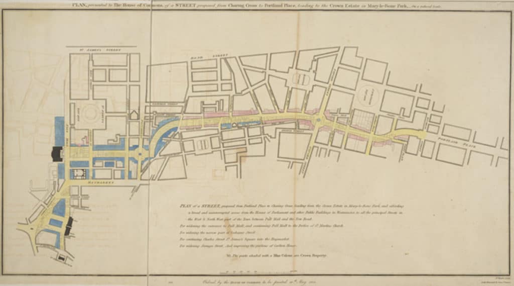
Regent Street proposal, published 1813, titled “PLAN, presented to the House of Commons, of a STREET proposed from CHARING CROSS to PORTLAND PLACE, leading to the Crown Estate in Marylebone Park” (Source: Wikipedia).
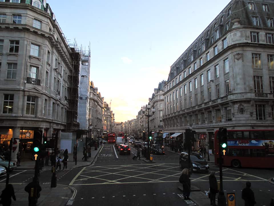
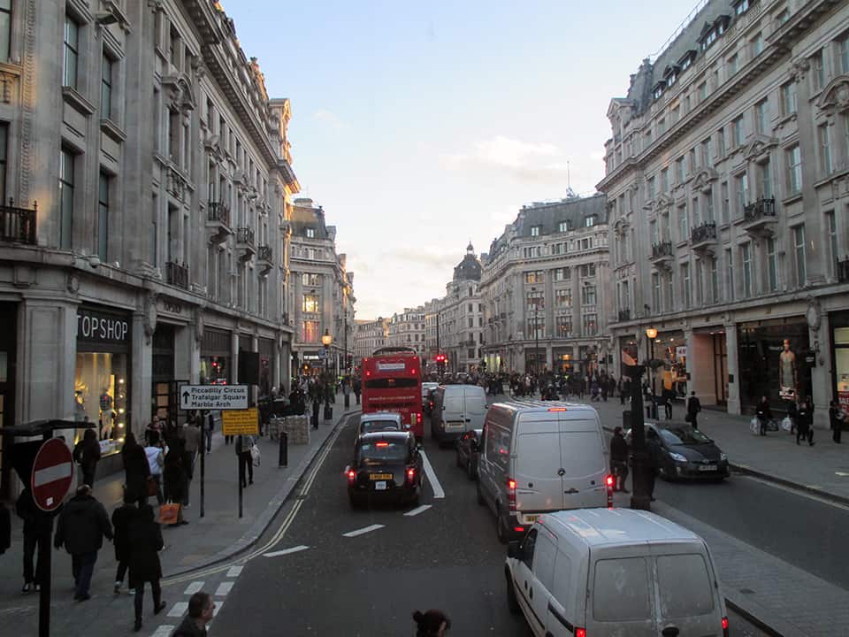
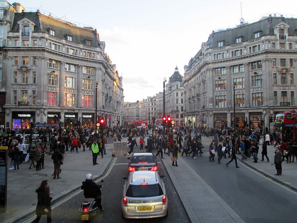
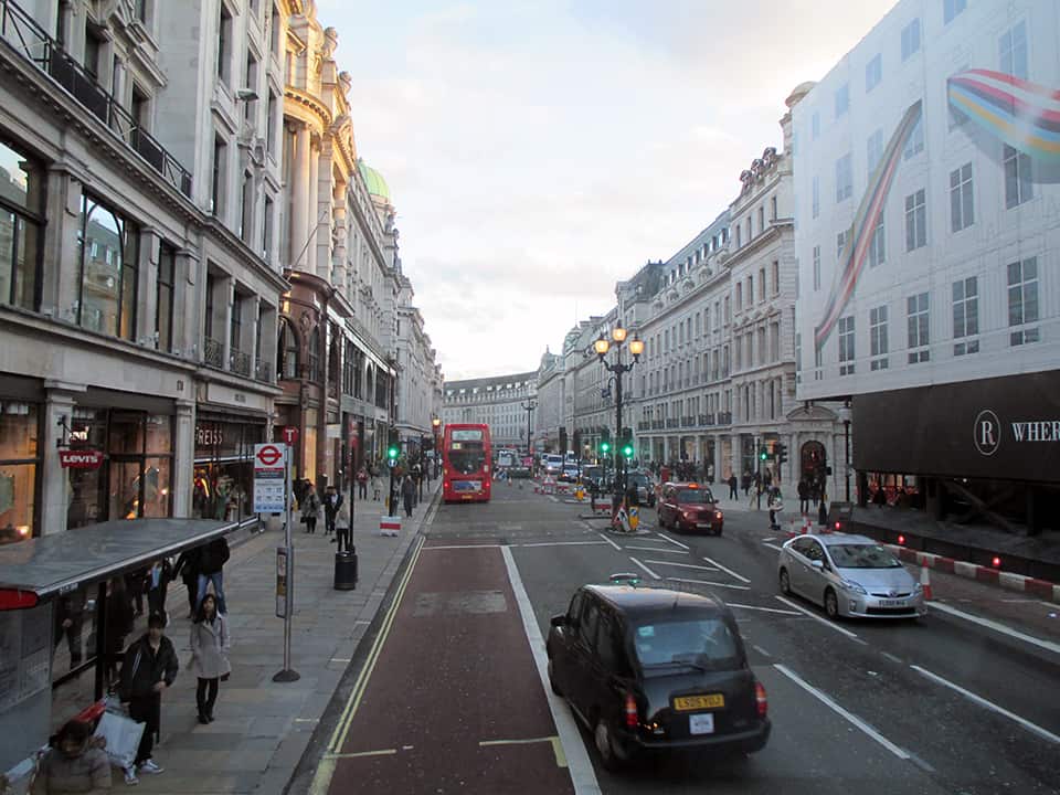
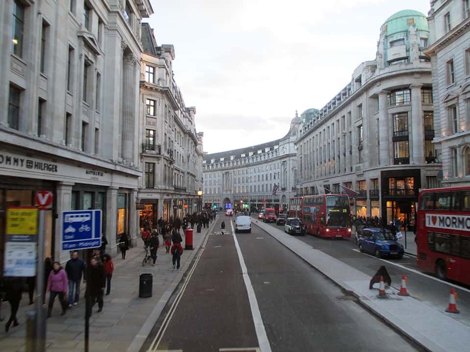
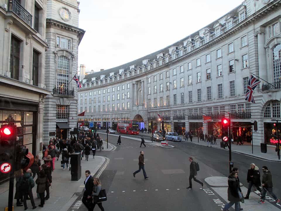
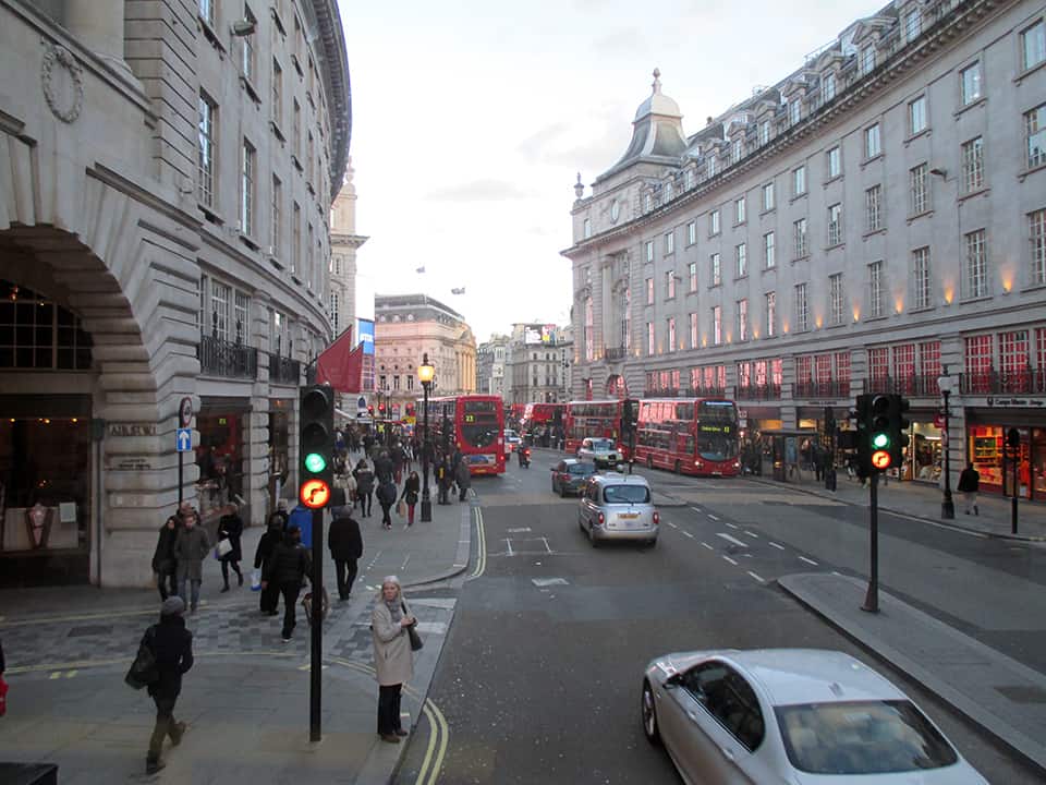
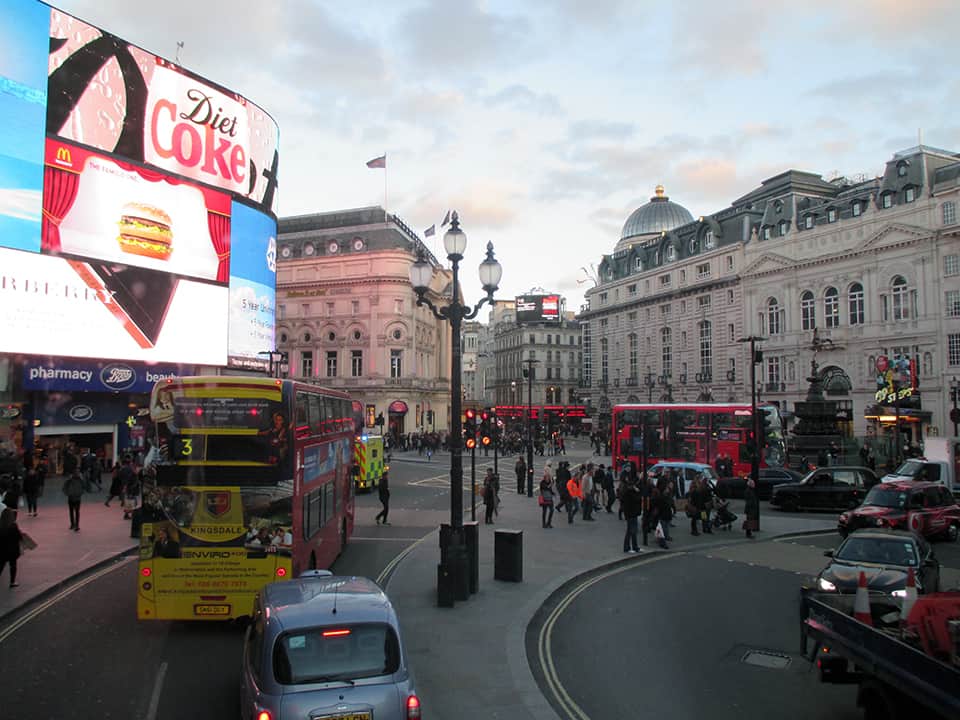
Upper Regent Street, London (Image: Mark David Major).Upper Regent Street, London (Image: Mark David Major).Oxford Circus, intersection of Oxford Street and Regent Street, London (Image: Mark David Major).Lower Regent Street, London. Carnaby Street is located two blocks to the east (left) of this intersection (Image: Mark David Major).Lower Regent Street, London (Image: Mark David Major).Lower Regent Street, London (Image: Mark David Major).Lower Regent Street looking toward Piccadilly Circus (right around the bend), London (Image: Mark David Major).Piccadilly Circus, London (Image: Mark David Major).
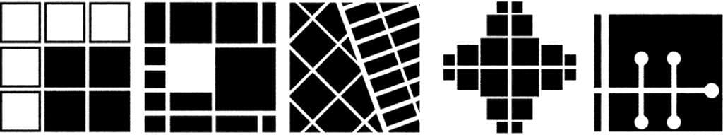
Form and process in the urban pattern: (left to right) grid expansion, block size manipulation, deformation, street extension, and discrete separation.
The City’s Essential DNA
by Mark David Major, AICP, BA, BA, MSc
Founder, The Outlaw Urbanist
NOTE: This is a shorter, punchier, reference-free version of “The City’s Essential DNA: Formal design and spatial processes in the urban patterns”, which appears in Volume 4, Issue 1 of The Journal of Space Syntax, 2013, pp 160-164, ISSN: 2044-7507. It was prepared at the request of a Planning Department for their academic publication but they decided to pass on the article because it was “too technical”.
Our descriptions of cities are often based on their physical form. In urban theory, the description of ‘organic’ and ‘regular’ cities is one of the most persistent and useful. The first stresses process over time in terms of unplanned growth whereas the second on conscious design. This ‘shorthand’ provides a basic understanding of cities across different times, cultures, and geographical regions, which is useful precisely because they are theory-loaded terms. They seemingly convey a lot of information in an easy-to-grasp manner. Regular explicitly describes physical form and the design process that gave rise to it. Organic explicitly describes process over time in terms of urban growth, tacitly understood such cities tend to be characterized by deformed grids. The explicit and implicit description of urban form and process is the basis of their descriptive value since most cities are easily classified as having common or different attributes when characterized as organic or regular. There have been frequent attempts to develop better terminology. Utilitarian, deformed, surface order, neutral, offset, gridiron, radial, uniform, homogeneous, undifferentiated matrix, sprawl, geomorphic… the amount of jargon is enough to give anyone a headache. However, describing urban form as deformed or regular is also theory-loaded since cities are characterized in geometrical terms. The key is the incidence or deficiency of a readily apparent geometry in the physical composition of streets and blocks in plan. American cities tend to possess such geometries so they are regular grids. European or Middle Eastern ‘organic’ cities appear to lack such geometries so they are deformed grids. Others have defined this as the difference between composition and configuration to better distinguish between how we view the city (static form) and how it works (dynamic process). Composition is an easy-to-grasp, understand-all-at-once description and configuration is a more complex view of relations amongst elements that potentially affect urban functions. This distinction is often confused or misunderstood, inevitably leading us to a theoretical dead-end.
At a detailed scale, the Urban Transect specifies this distinction between form and process in the design of the street itself for those transitioning from Euclidean zoning to form-based codes. Several formal elements (street width, road sections, building footprints, landscaping) are tied to functional uses (density and intensity). If cities are interfaces between scales of movement, as suggested by John Peponis at Georgia Tech, then the Urban Transect creates an idealized model of this essential urban dynamic of form and process for the design of streets to better classify it for application in form-based zoning regulations and streetscape design. Duany and Talen’s explanatory diagram of transect planning specifies a geometric logic (all urban streets connect at right angles) but the applicability of transect planning for types of cities seems readily apparent. What varies from one city to another is geometry and scale as realized in the layout. The true brilliance of transect planning is, the more it is applied in real world conditions, then the less tenable becomes the roadway classifications of modern transportation planning. Those beholden to the dominant 20th century planning paradigm should beware of New Urbanists bearing gifts.
Andres Duany and Emily Talen’s The Urban Transect
Transect planning is largely silent about generating an urban pattern above the level of the street, leaving this to the design sensibilities of the professionals. This appears to leave a gulf of understanding between the urban whole and the street itself. However, this is precisely where the essential dynamics of form and process as it impacts on urban functions are realized in cities. Hiller and Hanson argue in The Social Logic of Space the physical arrangement of space “has a direct relation – rather than a merely symbolic one – to social life, since it provides the material preconditions for patterns of movement, encounter and avoidance which are the material realization – sometimes the generator – of social relations.” New Urbanists have been basically arguing the same for thirty years. In everyday practice, this becomes complicated because we tend to view and design space in discrete terms, independent of a larger geographical, topographical, and/or urban context. In doing so, the importance of design in establishing the material preconditions for our everyday use of urban space is often minimized, misunderstood, or even ignored.
Our design decisions in generating the urban pattern are important. For example, it is in this realm that an important (and little discussed) distinction arises between intra-connectivity (street connections within the bounds of a site) and inter-connectivity (street connections between bounds of different sites). Historically, intra-connectivity has been strongly realized in New Urbanism developments but inter-connectivity weakly so. We cannot simply leave design of the urban pattern to the (varied) abilities of professionals and hope for the best. We must identify and understand it so we can intervene better and smarter. If we focus on the static and dynamic relationship between form and process, composition and configuration, in the design of the urban grid, a basic set of design decisions having formal and process implications for urban space can be identified.
We could describe this as the essential DNA for all types of cities. There is grid expansion and deformation, whereby the urban pattern expands in a consistent manner or else deforms in relation to some external factor, usually topography or land ownership patterns. In regular cities, deformation usually occurs whilst still adhering in some manner to the basic conceptual order of the existing urban pattern but in different cardinal directions. In organic cities, deformation tends to occur during up-scaling of the urban pattern to relation to its ever-growing edges by introducing more geometrical order in the layout. There is street extension, whereby an existing street is extended in one of both directions. In regular cities, this tends to occur as a straight-on continuation in adherence to the conceptual order of the regular grid. In organic cities, this tends to occur as an open-angled continuation, which generates its distinctive deformed grid pattern. Street extension is also the primary tool for strip development in the growth of linear and crossroad settlements, especially during the early stages of community growth, of which Las Vegas is probably the most famous example. The most easily recognizable form of the essential urban dynamic is block size manipulation.
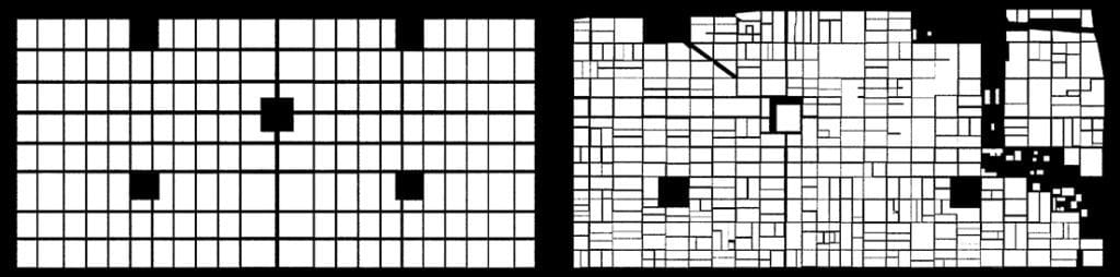
Philadelphia, Yesterday and Today: Philadelphia urban pattern in 1682 (left) and today (right) within bounds of William Penn’s original 1682 plan.
The dynamic nature of block size manipulation in our cities can be easily seen in a side-by-side figure ground representation (blocks in white, space in black) of Philadelphia yesterday and today. There are two remarkable yet seemingly contradictory things about this comparison. First, is the degree to which the original block scheme of Penn’s plan has changed, principally through a process of block subdivision and, second, is the degree to which the integrity of Penn’s original plan concept has endured despite hundreds, perhaps thousands, of small- and large-scale interventions over 330 years. Finally, there is discrete separation by linear segregation of streets. Street connections are either broken (as in American suburban sprawl through interruptus in extremis) or complicated (as in Middle Eastern cities by narrowing street widths to generate labyrinthine-like but still well-connected layouts) to isolate (usually residential) areas in the urban pattern.
These design methods can be found in the urban pattern of all cities. The spatial processes associated with formal design tend to converge on the ortho-radial grid model. This is a prime example of what Carvalho and Penn mean, saying “the impact of local controls on growth… is, at most, spatially localized… at a macro level, cities display a surprising degree of universality.” In fact, the essential variation across different types of cities appears the scale of street lengths and connections tied to their degree of geometrical articulation; longer, more connected and expansive in regular cities primarily using right angles whereas shorter, less connected, and more compact in organic cities using open and right angles. In the end, cities are not so complicated; rather, it is our theories that tend to complicate our understanding of them.
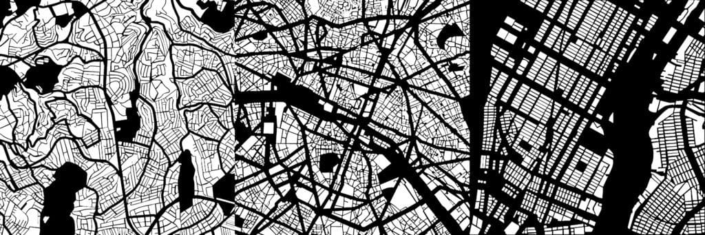
The Urban Pattern: Istanbul, Turkey (left), Paris, France (center), and New York in the United States (right) (Note: not to scale)
Based on excerpts from forthcoming The Syntax of City Space: American Urban Grids by Mark David Major.
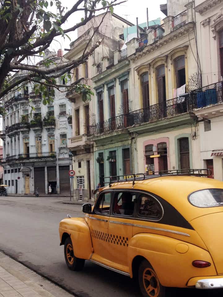
PHOTO ESSAY | Havana, Cuba | Part 2 Photographs by Concrete Blonde
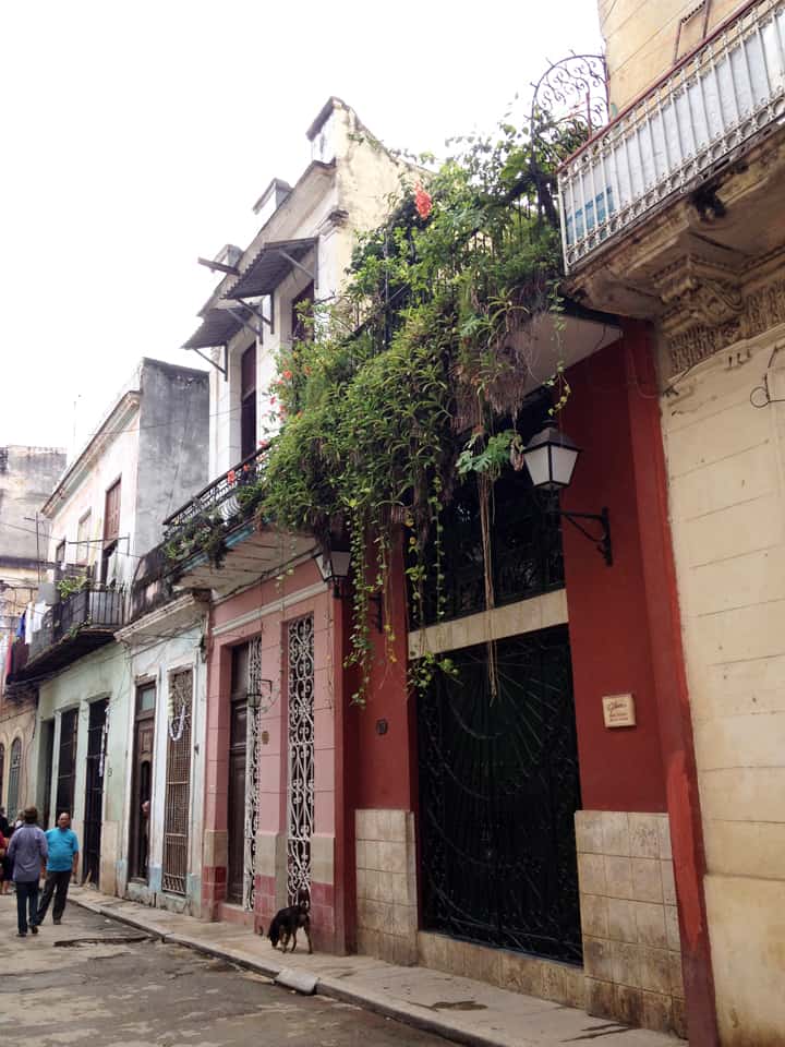
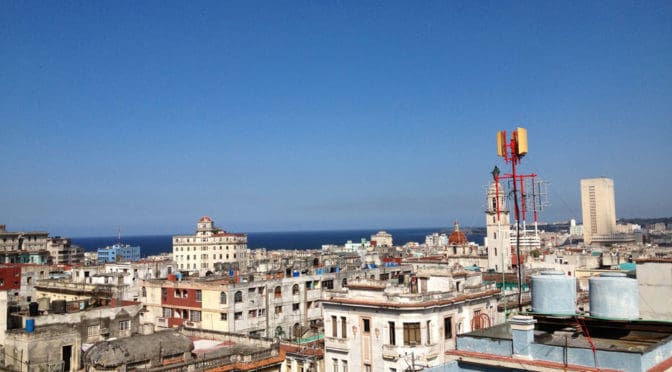
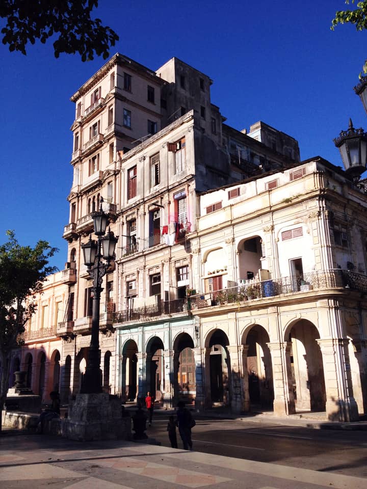
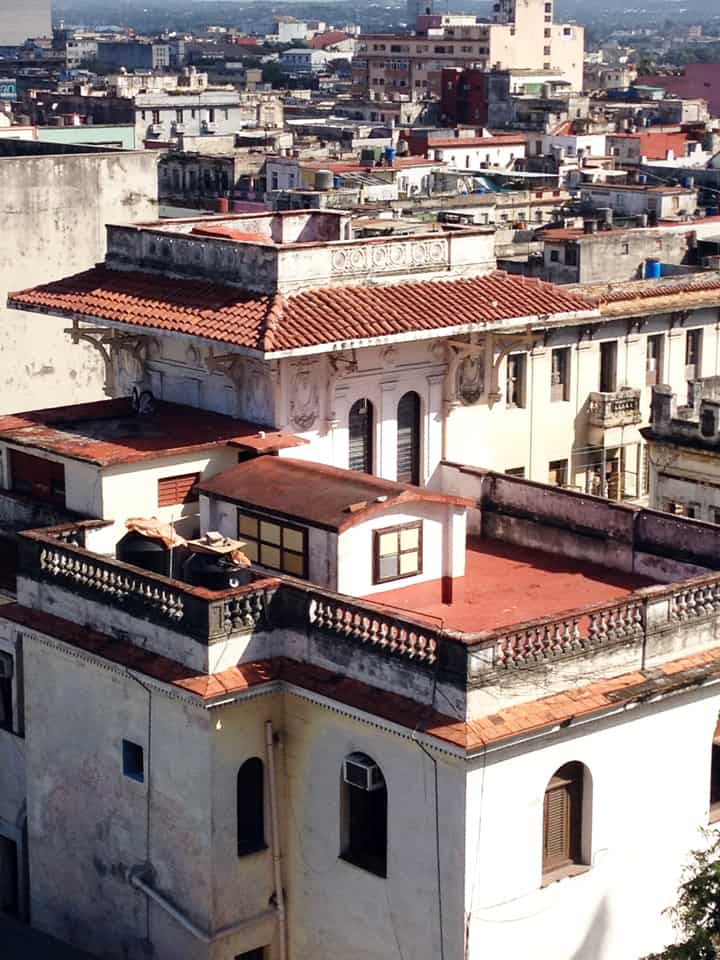
Part 2 of a brief photographic essay of architecture and urban space in Havana, Cuba courtesy of Concrete Blonde. Again, the urban vocabulary of Havana is remarkably consistent: the street life of urban balconies, the use of balcony gardens in softening the urban streetscape, rooftop terraces, abundant use of urban sidewalk arcades, and the use of color.
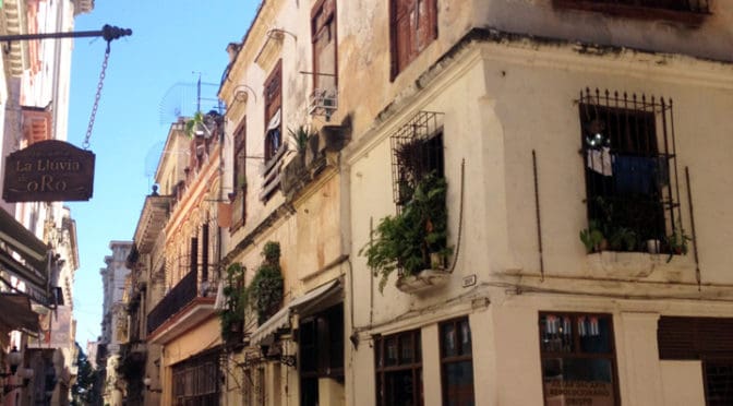
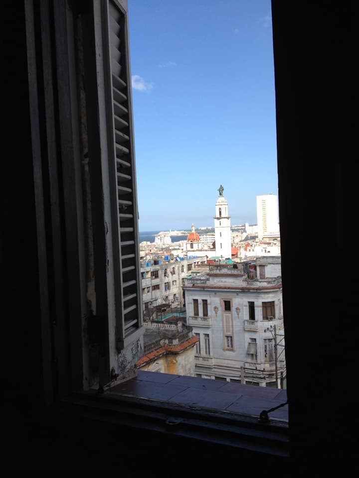
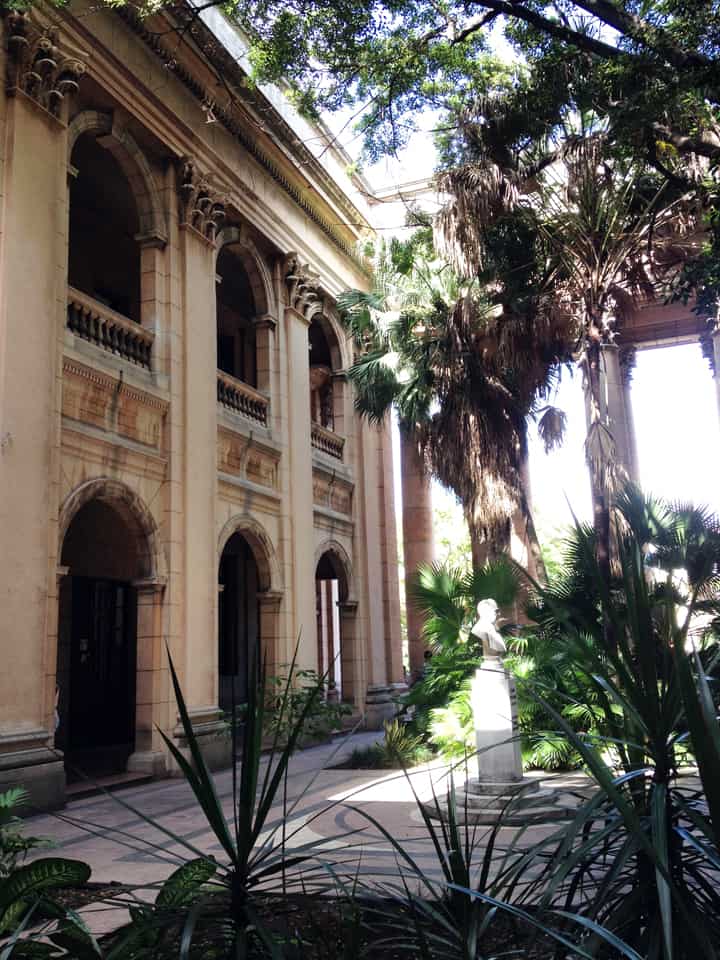
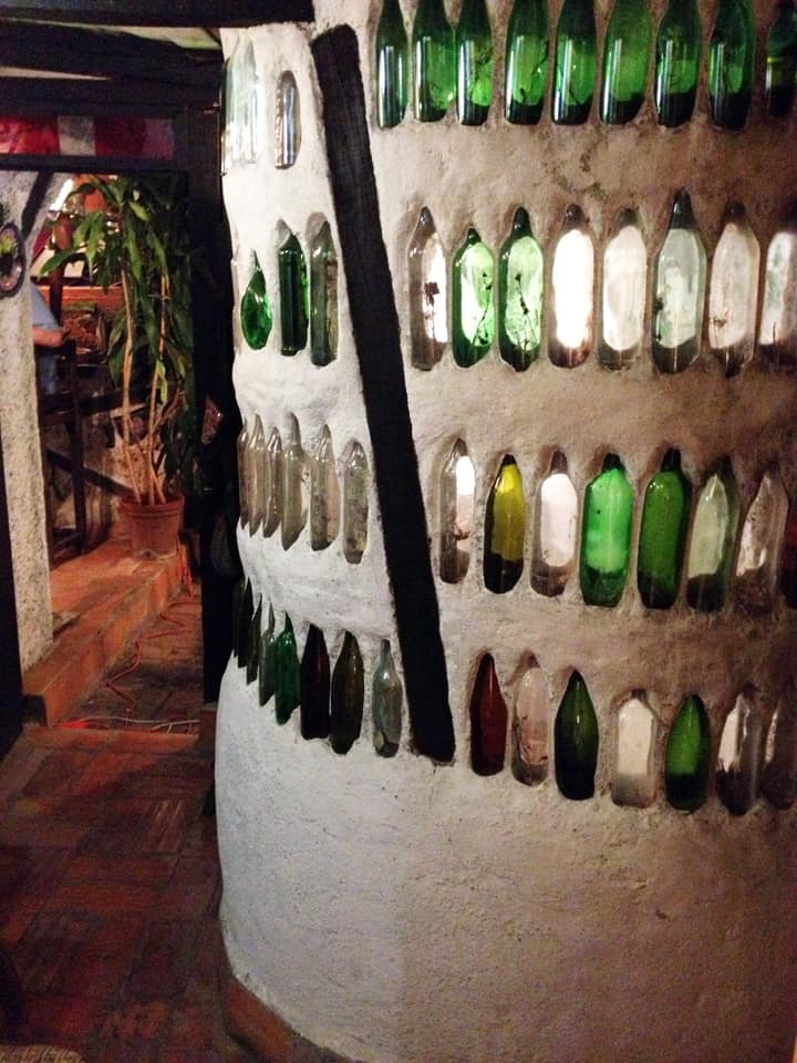
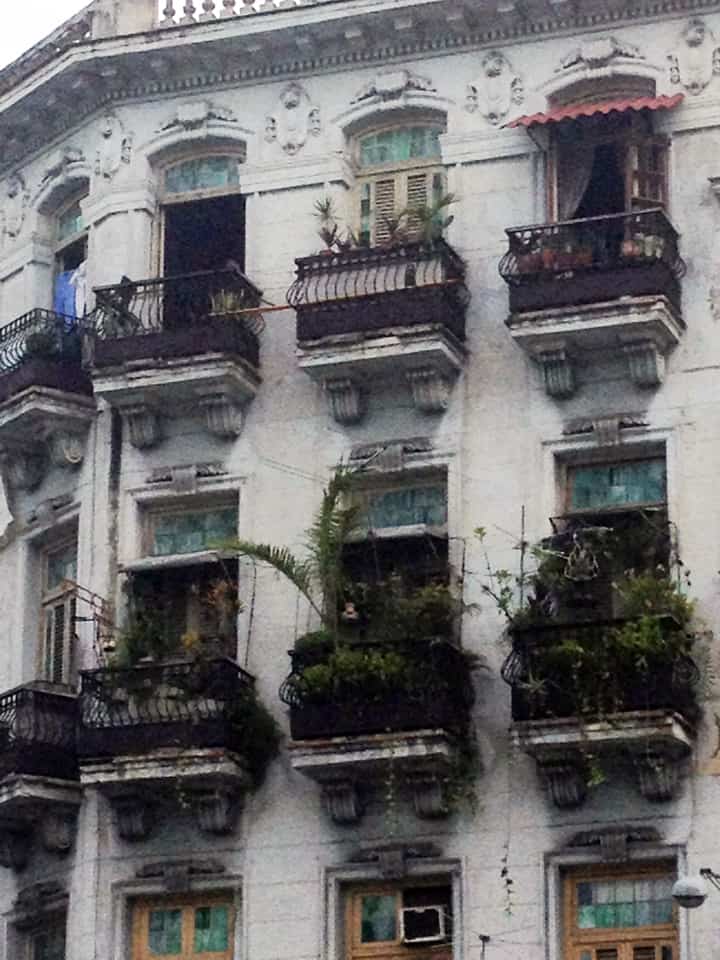
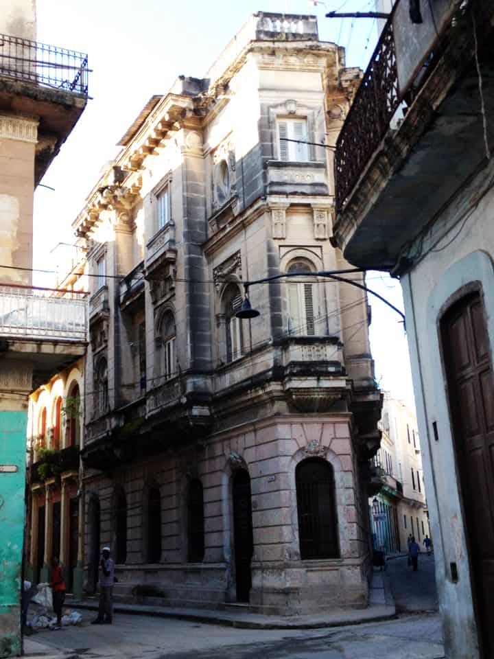
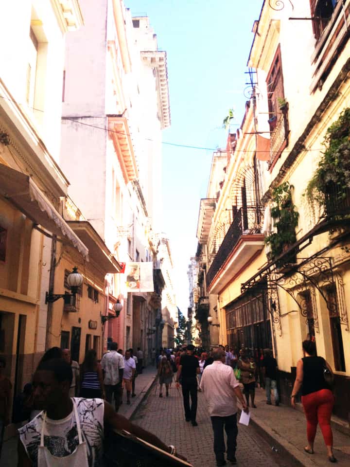
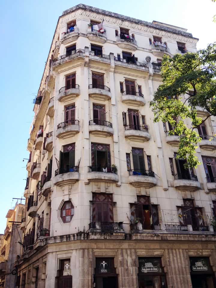
Looking over a Havana neighborhood through an open window with the harbor in the distance.Havana street life above and below, courtesy of a ground-level retail shop and second floor balconies.A narrow shopping street in Havana, Cuba.A lavishly-vegetated garden in the courtyard of a public building in Havana, Cuba.Vegetation hanging from a second floor balcony soften the hard edges of the urban streetscape in Havana, Cuba.Upper-level balconies introduce additional street constitution and casual surveillance of the street in the urban environment of Havana, Cuba.Balconies and sidewalk arcades defining the street vocabulary of Havana, Cuba.A street space well-used by pedestrians in Havana, Cuba.A narrow street width in Havana, Cuba.Finally, a light well made of empty bottles at a local restaurant in Havana, Cuba; included here only because it’s so ingeniously cool.
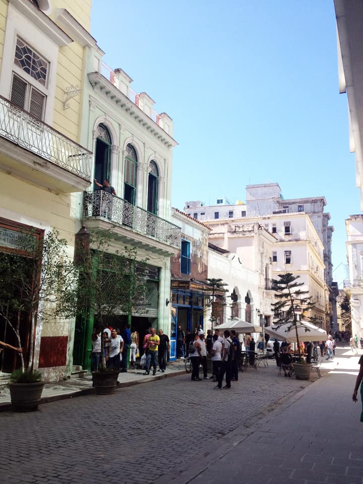
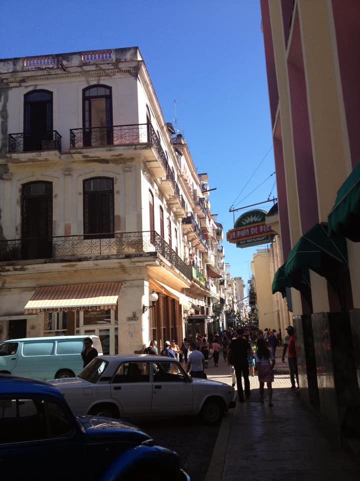
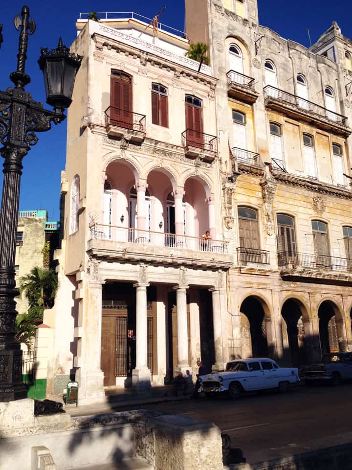
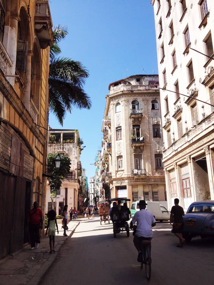
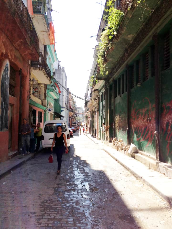
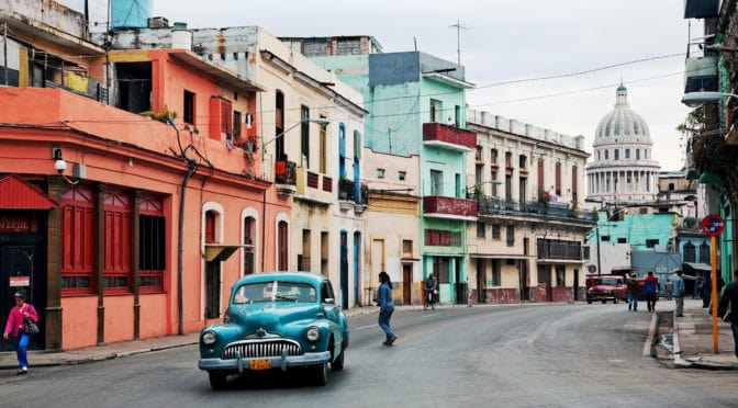
PHOTO ESSAY | Havana, Cuba | Part 1 Photographs by Concrete Blonde
Part 1 of a brief photographic essay of architecture and urban space in Havana, Cuba courtesy of Concrete Blonde. In terms of urbanism, the most interesting aspects of these photographs are: the street life of urban balconies, the use of balcony gardens in softening the urban streetscape, rooftop terraces, abundant use of urban sidewalk arcades, and the use of color. In terms of political ideology, it seems symbolic that many of the cars (most likely of origin in Eastern Europe) and best architecture (at least, in terms of design if not actual age) predates the Communist Revolution lead by Fidel Castro in 1959; make of that what you will. However, the result is an urban treasure trove awaiting re-discovery and historic rehabilitation.
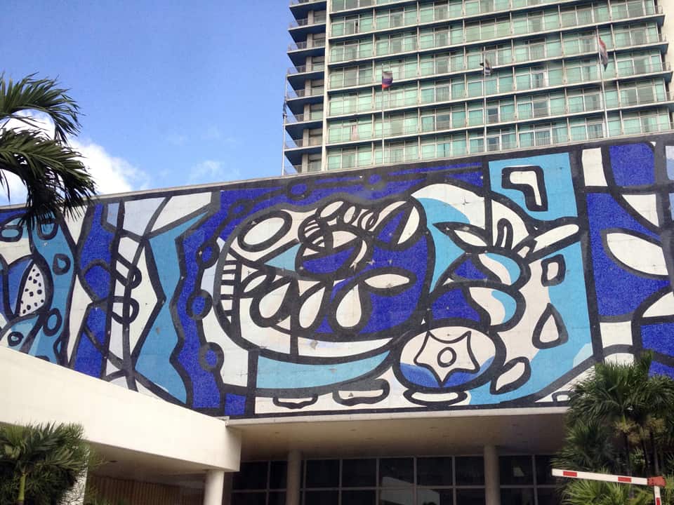
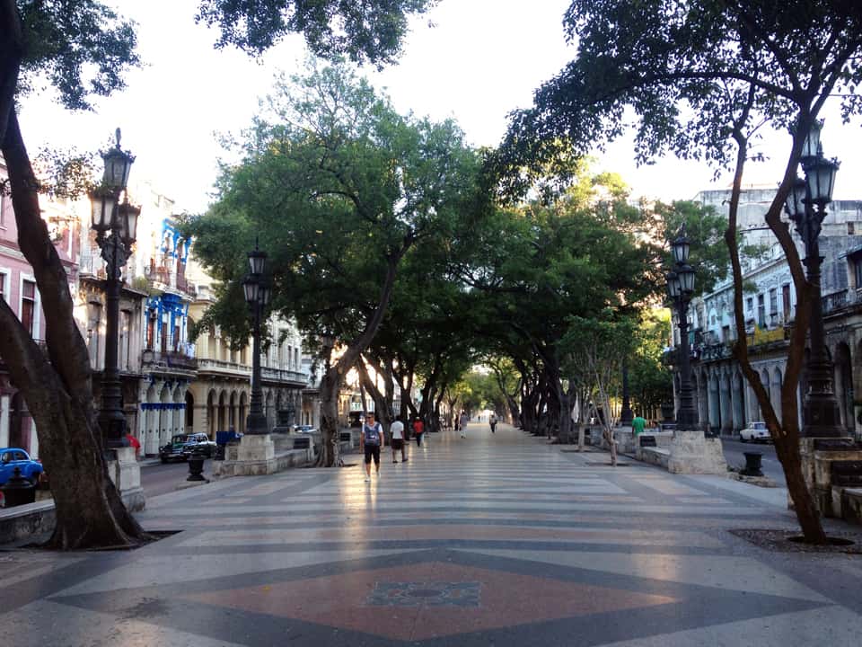
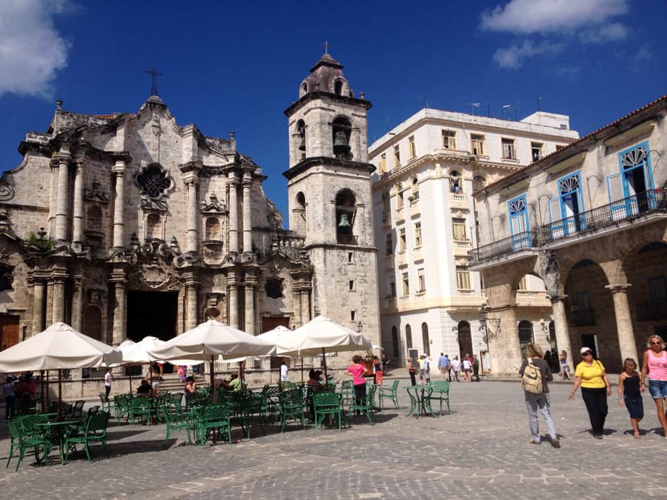
Havana streetscape showing sidewalk arcades and second-level balconies.Rooftop terraces in Havana, Cuba.Heavily-vegetated balconies in Havana, Cuba.From this perspective, notice how the line of sight sneaks pass the corner of buildings to continue along the space of the street. Architects and planners ignore such nuances of the urban pattern at their peril.Fantastic mural incorporated into the design of an otherwise mundane Modern building.Contemporary pedestrian plaza, probably a conversion of an old tram/rail line running down the middle of the street. Though beautifully done, notice how empty the plaza appears during the middle of the day due to the generous street width, especially in comparison to the following photo of a heavily-populated street in Havana with a narrower street width.A typical street scene in Havana, Cuba.Churchyard plaza in Havana, Cuba.Urban balconies defining the facade of an early twentieth century (1930s?) building in Havana, Cuba.Sidewalk arcades, balconies, and rooftop terraces on another street in Havana, Cuba.
Stay tuned for Part 2 of the Havana, Cuba Photographic Essay coming soon on The Outlaw Urbanist!
“Sent to spy on a Cuban talent show, First stop- Havana au go-go, I used to make a living, man, Pickin’ the banana, Hooray for Havana!” — Havana Affair, The Ramones
Urban Patterns | Havana, Cuba by Dr. Mark David Major, AICP, CNU-A
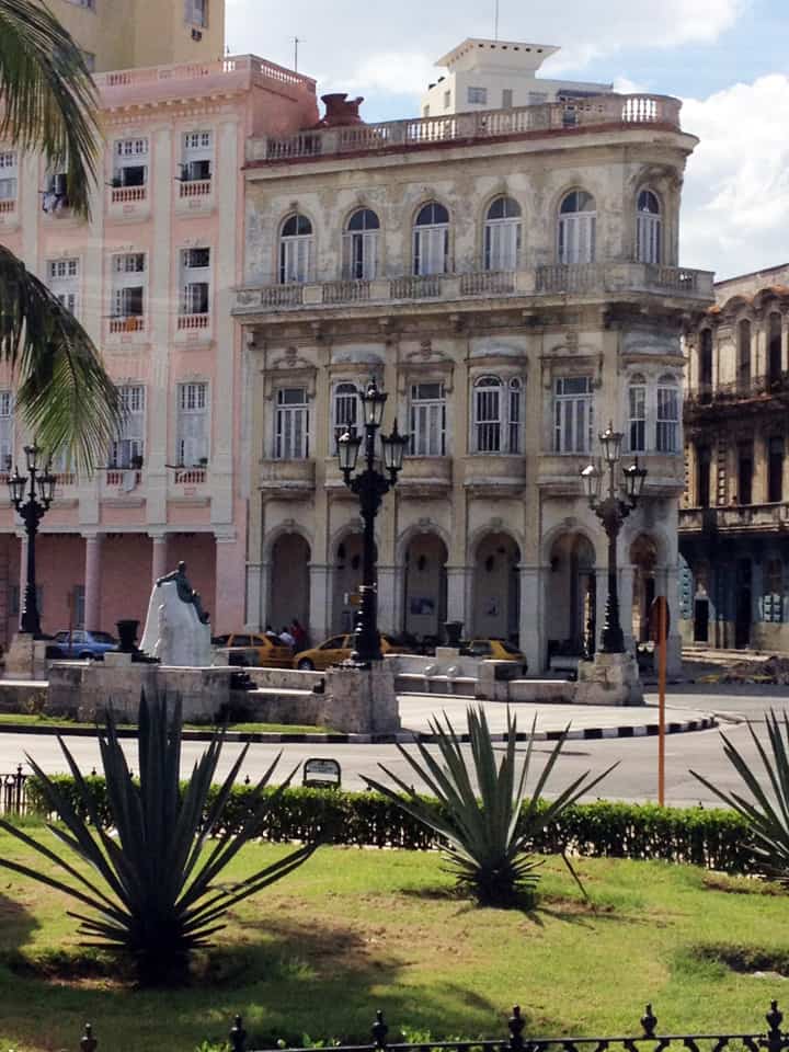
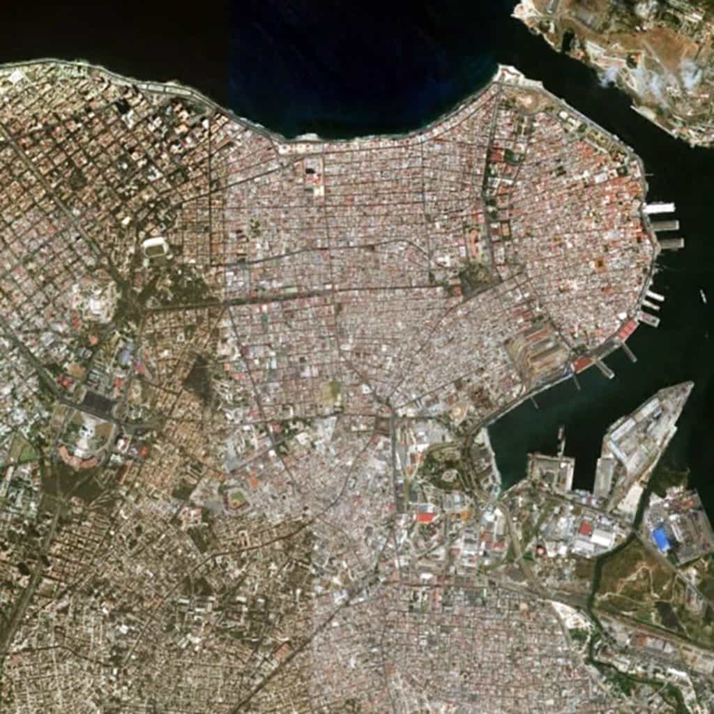
Havana is the capital city, major port, and leading commercial center of Cuba. The city proper has a population of 2.1 million inhabitants and it spans a total of 728 square kilometers (281 square miles), making it the largest city by area, most populous city, and third largest metropolitan area in the Caribbean region. Havana lies on the northern coast of Cuba, south of the Florida Keys, where the Gulf of Mexico joins the Caribbean. The city extends mostly westward and southward from the bay, which is entered through a narrow inlet and divides into three main harbors: Marimelena, Guanabacoa, and Atarés. Havana was founded by the Spanish in the 16th century and, due to its strategic location, served as a springboard for the Spanish conquest of South America, becoming a stopping point for treasure-laden Spanish Galleons on the crossing between the New World and Old World. King Philip II of Spain granted Havana the title of City in 1592. Walls and forts were built to protect the old city. Contemporary Havana can essentially be described as three cities in one: Old Havana, Vedado, and the newer suburban districts. Old Havana, with its narrow streets and overhanging balconies, is the traditional center of Havana’s commerce, industry, and entertainment as well as being a residential area. To the north and west a newer section – centered on the uptown area known as Vedado – has become the rival of Old Havana for commercial activity and nightlife. Centro Habana, sometimes described as part of Vedado, is mainly a shopping district that lies between Vedado and Old Havana. Chinatown and the Real Fabrica de Tabacos Partagás, one of Cuba’s oldest cigar factories, is located in the area. A third Havana is that of the more affluent residential and industrial districts that spread out mostly to the west. Among these is Marianao, one of the newer parts of the city, dating mainly from the 1920s (Source: Wikipedia).
The urban pattern of Havana, Cuba can be best described as a patchwork of regular and regular-like grids that vary in scale in terms of the length and width of streets and block sizes. Most streets in Havana can be fairly described as straight. Their lengths tend to vary based on the local grid pattern and whether any particular street is carried through and embedded within another adjacent grid or terminates at the edges of its own grid. In this sense, the urban pattern of Havana appears remarkably similar to that of Athens, Greece, which is also composed of a patchwork of small-scale (mostly) regular grids. There appears to be the pattern of scale in the urban grid related to the age of a local area, forming a somewhat radial pattern from the harbor to the southerly and (more so) westerly direction. For example, Old Havana has the smallest scale regular-like grid in the city (smaller blocks, shorter streets) though the overall geometric order of the urban grid in this area is less consistent than in younger areas of the city. For example, contrast this with the increase in scale of the regular grid in the Vedado area to the west of Old Havana or the generous scale of block sizes, street lengths and widths in the highly geometrical grid of Marianao area along a different cardinal alignment in relation to the shoreline of the coast to the extreme west (partially visible at the left edge of the above satellite image).
(Updated: July 12, 2017)
Urban Patterns is a series of posts from The Outlaw Urbanist presenting interesting examples of terrestrial patterns shaped by human intervention in the urban landscape over time.
Share the knowledge!
Blogging about architecture, urbanism, and culture…

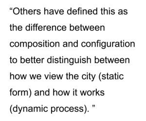 The key is the incidence or deficiency of a readily apparent geometry in the physical composition of streets and blocks in plan. American cities tend to possess such geometries so they are regular grids. European or Middle Eastern ‘organic’ cities appear to lack such geometries so they are deformed grids. Others have defined this as the difference between composition and configuration to better distinguish between how we view the city (static form) and how it works (dynamic process). Composition is an easy-to-grasp, understand-all-at-once description and configuration is a more complex view of relations amongst elements that potentially affect urban functions. This distinction is often confused or misunderstood, inevitably leading us to a theoretical dead-end.
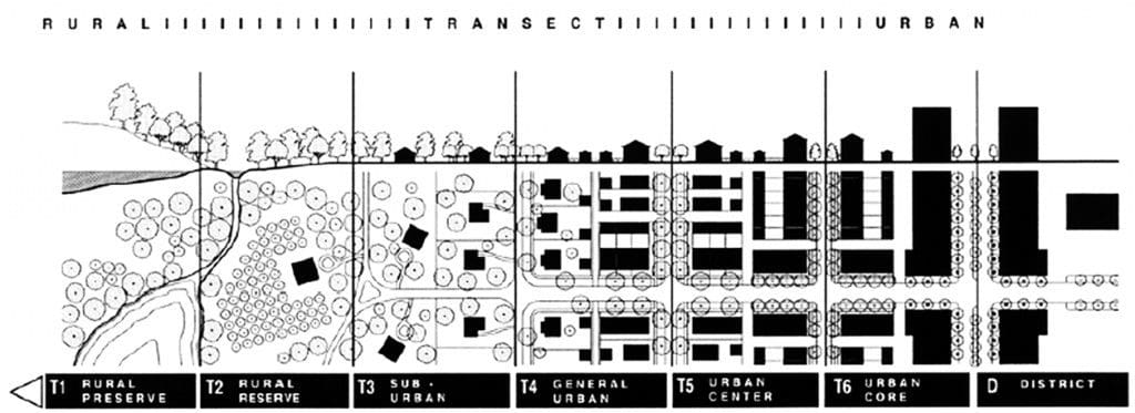
 If we focus on the static and dynamic relationship between form and process, composition and configuration, in the design of the urban grid, a basic set of design decisions having formal and process implications for urban space can be identified.