Tag Archives: Urban

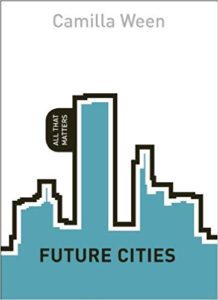
FROM THE VAULT | Future Cities by Camilla Ween

FROM THE VAULT | Future Cities by Camilla Ween
Review by Dr. Mark David Major, AICP, CNU-A, The Outlaw Urbanist contributor

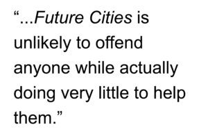
It is difficult to know what to make of Future Cities by Camilla Ween unless you are aware it is part of the All That Matters series of books published by Hodder & Stoughton under the “Teach Yourself” banner… and not at all related to the German soap opera of the same name (Alles was zählt) with more than 2,700 episodes and counting since 2006. I mention this because Future Cities is kind of like a soap opera in that it covers a weighty, substantial topic (e.g., the future of cities in the 21st century) in a superficial manner… and thinks it is doing a public service in the process. However, many people (whether well-informed or not) are likely to come away bewildered and confused after reading Ween’s book. As they say, it is a mile long and an inch deep… or 1.6 kilometers long and 2.54 cm deep for those on the metric system. It covers a wide range of topics – all nominally under some header of (insert descriptive adjective here) sustainability – without any serious attempt at critical appraisal of concepts and ideas discussed other than an subtle anti-status quo message (primarily directed at fossil fuels and capitalism) and a vague sense that we should all become vegetarian farmers by returning our cities to a pre-industrial state of agrarian existence. However, these leanings are extremely nuanced and subtle: most people will not even notice under than a noticeable lack of ‘how-to’ explained in the book. This means Future Cities does manage to accomplish something quite remarkable, which is an almost completely value-free overview about a topic of great value, e.g., cities. Quite frankly, I did not think that was possible. This means Future Cities is unlikely to offend anyone while actually doing very little to help them.
This perspective places Ween’s book squarely within the Landscape Urbanism school with a distinctive Old Labour leftward lean to the material, which is not surprising since she worked for more than a decade for former London Mayor Ken Livingstone. For example, Ween’s description of the London Transport bus system in the 1990s (i.e., before Ken Livingstone became Mayor of London and Ween worked for the Greater London Authority) is an outright mischaracterization as anyone who lived in London during the 1990s can attest. In this sense, Ween seems to be referring to customer satisfaction surveys (a ‘take a poll to solve the problem’ solution) and not public transport usage. Anyway, there is nothing wrong with Ween’s leanings as long as you bring substantive ideas to the table but she does not seem interested in deep ideas; only fashionable ‘Gizmo Green’ solutions about the bright technologically-based, zero-carbon, fusion-fuelled, socially-just future of our cities based on ad infinitum budgets. Cities are more dynamic, complex, problematic, and deeper than Ween’s book is willing to dive. However, that is the intention of Teach Yourself/All That Matter series: a Cliff’s Notes (a series of student study guides for people who cannot be bothered to read the source material in more detail) version on any fashionable topic. When it comes to cities, you should bother. In the end, it is the superficial nature of the series premise itself, which tends to undercuts any value in Ween’s Future Cities. It is like watching the movie without reading the book… and mistaking that you know everything about the book based on the movie. Future Cities might have some minimal value for second and third undergraduate architecture and planning students as a jumping-off point for more in-depth investigations and discussions about the urban issues raised by Ween but nothing more.

Future Cities by Camilla Ween
Series: All That Matters
English, Paperback, 160 pages
Publisher: Teach Yourself (2013)
ISBN-10: 1444196103
ISBN-13: 978-1444196108

You can purchase All That Matters: Future Cities by Camilla Ween on Amazon here.

From the Vault is a series from the Outlaw Urbanist in which we review art, architectural and urban design texts, with an emphasis on the obscure and forgotten, found in second-hand bookstores.

Share the knowledge!
Share

Planning Naked | Cessation of a Feature

Planning Naked | Cessation of a Feature
by Dr. Mark David Major, AICP, CNU-A

For two-and-a-half years now, The Outlaw Urbanist has brought you a semi-regular feature as regular as we can manage in the best interests of our mental health called “Planning Naked.” It has been your (hopefully hilarious) guide to most everything about the latest issue of APA’s Planning Magazine.

Due to changing circumstances, we are announcing a cessation of the “Planning Naked” feature. Somehow, we think the editors and reporters of Planning Magazine will be relieved to hear this news.

However, The Outlaw Urbanist is open to this cessation being of temporary nature, if there are any readers who would like to take up the mantle of fighting the status quo and helping to police the underlying  often hidden assumptions of the editors and reporters of APA’s Planning Magazine by volunteering to write new editions of “Planning Naked.”

If you are interested, email us at [email protected].

Planning Naked has been a semi-regular feature article with observations and comments about a recent issue of Planning: The Magazine of the American Planning Association.

Share the knowledge!
Share

Urban Patterns | St Louis, Missouri USA

“I will be your tootsie wootsie,
If you will meet in St. Louis, Louis,
Meet me at the fair.”
— Meet Me in St. Louis, Judy Garland

Urban Patterns | St. Louis, Missouri USA
by Dr. Mark David Major, AICP, CNU-A

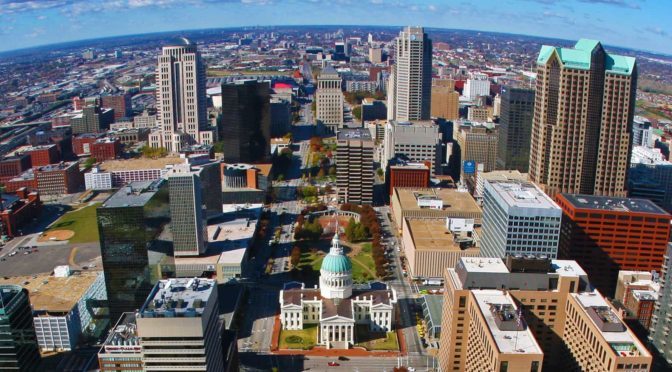
St. Louis is an independent city (meaning it is not part of St. Louis County) and major American port in the state of Missouri, built along the western bank of the Mississippi River, on the border with Illinois. The city had an estimated population of 311,404 in 2016. It is the cultural and economic center of the Greater St. Louis area (metropolitan population of 2.9 million people), making it the largest metropolitan area in Missouri and the 19th-largest in the United States (Source: Wikipedia).

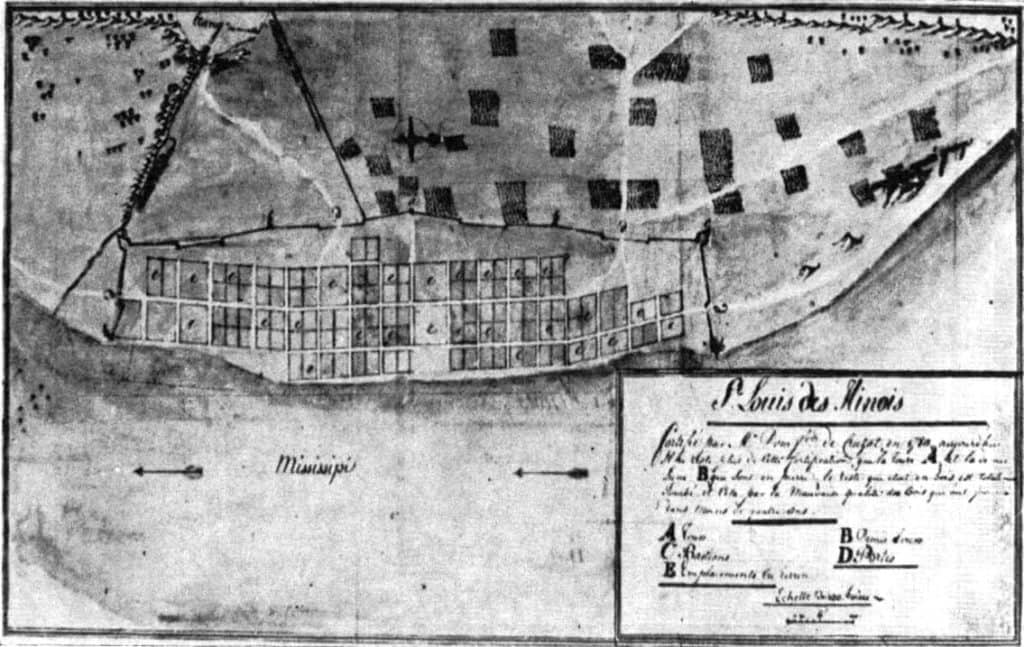
map, St. Louis, 1780, archives, Wikipedia
A map of St. Louis in 1780. From the archives in Seville, Spain (Source: Wikipedia).

Prior to European settlement, the area was a major regional center of Native American Mississippian culture. The city of St. Louis was founded in 1764 by French fur traders Pierre Laclède and Auguste Chouteau, and named after Louis IX of France. In 1764, following France’s defeat in the Seven Years’ War, the area was ceded to Spain and retroceded back to France in 1800. Nominally, the city operated as an independent city after 1764 until 1803, when the United States acquired the territory as part of the Louisiana Purchase. During the 19th century, St. Louis developed as a major port on the Mississippi River. In the 1870 Census, St. Louis was ranked as the 4th-largest city in the United States. It separated from St. Louis County in 1877, becoming an independent city and thus, limiting its own political boundaries. In 1904, it hosted the World’s Fair/Louisiana Purchase Exposition and the Summer Olympics (Source: Wikipedia).

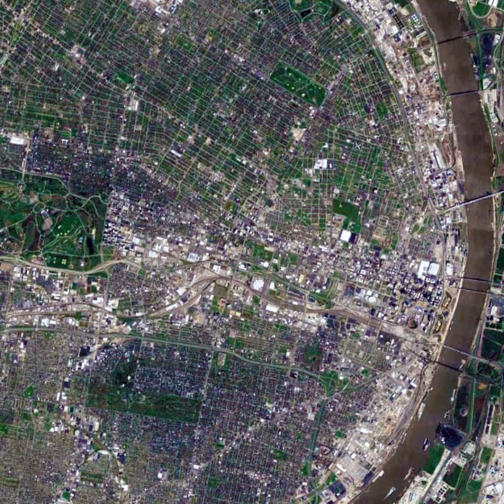
Satellite view, 15 km, St. Louis, Missouri, USA, Google Earth
Satellite view from 15 km of St. Louis, Missouri in the USA (Source: Google Earth).

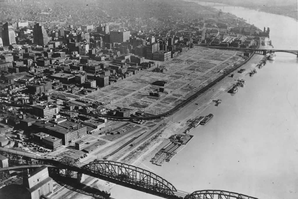
The St. Louis urban pattern is composed of a series of small-scale regular grids of varying size, which are offset in relation to each other. This originally occurred due to adapting the regular grid layout to the topography of the Mississippi River adjacent to the riverfront at this location to ensure that most valuable lots were rectangular in shape for the purposes of buildability. Like other cities in the world composed of offset, regular grids (such as Athens, Greece and New Orleans, Louisiana), this – in combination with the distribution of land from afar by the French/Spanish crowns during the Colonial period – had a ‘cascade effect’ in shaping the layout and orientation of future parcels of small-scale regular grids in the city. Later, railroad lines running east-west introduced a very strong north-south divide in the city, which persists to this day. Oddly, this divide (historically reflecting a post-war racial divide in the city, e.g. whites in south St. Louis and blacks in north St. Louis) has been reinforced by Federal, state, and city planning efforts such as the Jefferson National Expansion Memorial (i.e. Gateway Arch) grounds on the riverfront in downtown St. Louis.

St Louis, Warehouse District, New Orleans, French Quarter, 1930s, Gateway Arch
St. Louis’ Warehouse District – same size as two New Orleans’ French Quarters – demolished during the 1930s to (eventually) make way for the Jefferson National Expansion Memorial grounds and Gateway Arch though this riverfront land remained vacant for over two decades.

Urban Patterns is a series of posts from The Outlaw Urbanist presenting interesting examples of terrestrial patterns shaped by human intervention in the urban landscape over time.

Share the knowledge!
Share

MORESO | The Vitruvian Oath

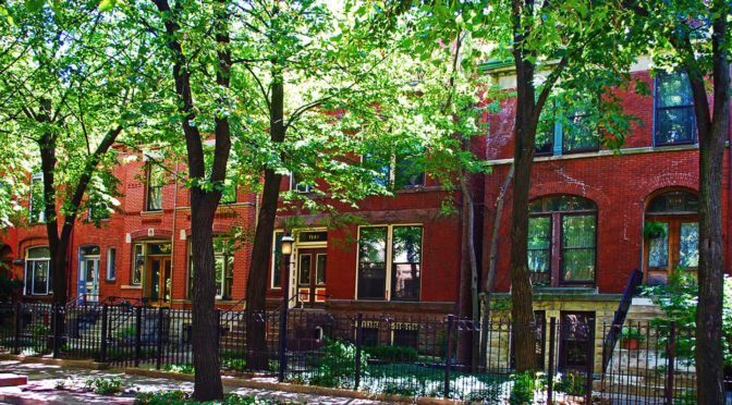
A ‘Hippocratic Oath‘ for architects, urban designers, town planners, developers, politicians, and anyone involved in the creation of our built environments.

The Vitruvian Oath

I swear by the Great Architect, my Creator or creators of the spirit and/or of the flesh.

I swear by our shared Humanity.

I swear by our most vibrant and livable Cities, Neighborhoods, and Buildings.

I swear by my Brothers and Sisters in the world, wherever they live, whenever they lived or will live, making them my witnesses of the past, the present, and the future.

I swear I will perform, according to my given talent, merited ability, and best judgment this solemn oath and duty to and for our built environments, from the most humble abode to the most magnificent metropolis.

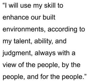
I will use my skill to enhance our built environments, according to my talent, my ability, and my judgment, always with a view of the people, by the people, and for the people.
I will keep pure and sacred life, body, and art in performing this duty.

In whatever lands I will enter, I will do so to help my fellow citizens, and I will abstain from intentional wrongdoing and harm to the form and function of our built environments, especially the abusing of my position for personal gain and vainglory.

And whatsoever I shall see or hear in the course of my profession in my intercourse with colleagues and clients, if it should not be publicized, I will never divulge, holding such things as sacred secrets, except for transparency in those things that advance human sciences and knowledge.

Now I shall carry out this oath and perform this duty and break it not, for myself and my fellow Man, may I gain forever a worthy reputation among humanity for my life, my body, and my art; but if I transgress against this oath and forswear myself, may the opposite destroy me.

Moreso is a new series of short ruminations or thoughts of the moment, usually of less than 500 words, from The Outlaw Urbanist.

Share the knowledge!
Share

Urban Patterns | Chicago, Illinois USA

“Come on, babe, Why don’t we paint the town? And all that jazz.
I’m gonna rouge my knees, And roll my stockings down,
And all that jazz.
Start the car, I know a whoopee spot, Where the gin is cold,
But the piano’s hot! It’s just a noisy hall, Where there’s a nightly brawl,
And all that jazz.”

— Bob Fosse’s Chicago: The Musical

Urban Patterns | Chicago, Illinois USA
by Dr. Mark David Major, AICP, CNU-A

Chicago is the third-most populous city in the United States with over 2.7 million residents. It is also the most populous city in both the state of Illinois and the Midwestern United States. It is the county seat of Cook County. The Chicago metropolitan area often referred to as “Chicagoland” has nearly 10 million people. It is the third-largest metropolis in the United States (after New York and Los Angeles). In terms of wealth and economy, Chicago is considered one of the most important business centers in the world. The town of Chicago was organized in 1833 with a population of about 200 people near a portage between the Great Lakes and the Mississippi River watershed. Within seven years it grew to more than 4,000 people. In mid-1835, the first public land sales began. The City of Chicago was incorporated in 1837. For several decades, Chicago was the fastest growing city in the world. Chicago was one of the five largest cities in the world by 1900. Before the growth of new Chinese cities during the early 21st century, the urban growth of Chicago during the 19th century was largely unprecedented in human history (Source: Wikipedia and The Syntax of City Space: American Urban Grids).

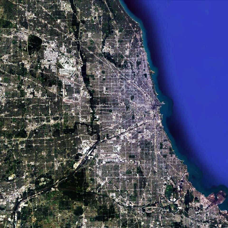
Satellite view, 90km, Metropolitan Chicago, Illinois, USA, Google Earth
Satellite view from 90km of Metropolitan Chicago, Illinois in the USA (Source: Google Earth).

Chicago has the most pervasively-realized regular grid in the world. In fact, the scale of the regular grid in Chicago is so massive that it is almost impossible to truly appreciate its scale. From one extreme to the other, it is probably the size of southeast England or twice the size of the European country of Luxembourg. However, it is only by examining the Chicago urban pattern at this scale that we can truly appreciate that there is a distinctive center-to-edge logic to the metropolitan region; most notably along the alignment of the Chicago River/Stevenson Expressway from the Loop in a southwest direction out of the area. This center-to-edge logic is replicated at the large-scale in the northern metropolitan region as well along the alignment of old Indian trails, which were incorporated into the urban fabric as paved roads; most notably a series of diagonal streets associated with the Northwest Highway out of town towards the state of Wisconsin.

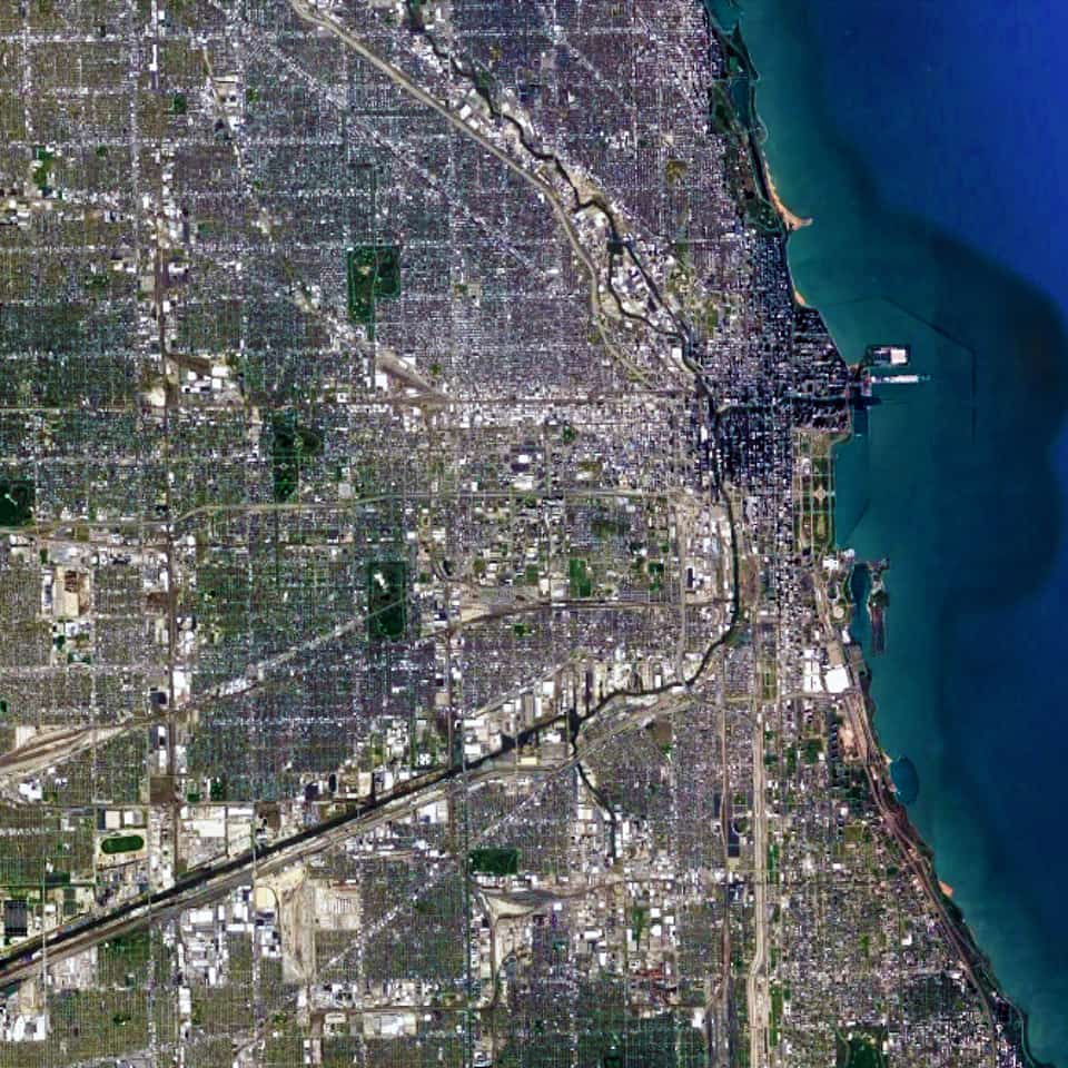
Satellite view, 25 km, Chicago, Illinois, USA, Google Earth
Satellite view from 25 km of Chicago, Illinois in the USA (Source: Google Earth).

When we zoom in on the Chicago urban pattern, the crucial role of the Chicago River as a water-based transportation artery in the city becomes much more obvious. So does the multitude of skyscrapers in the central business district of the Loop (north and west of Grant Park at the shoreline of Lake Michigan). We can also see the large building footprints of Industrial land uses gathered around the entire length of the Chicago River from the southeast into the center of the city and then northward. All of these topographical, geographical, and infrastructure components are woven together within the ‘relentless’ regular gridiron layout, which serves to privilege downtown Chicago (and, in particular, The Loop) within the larger urban pattern of metropolitan Chicago. This barely begins to scratch the surface of why the Chicago grid plays such a significant role in its magnificence as one of the world’s greatest urban patterns.

Urban Patterns is a series of posts from The Outlaw Urbanist presenting interesting examples of terrestrial patterns shaped by human intervention in the urban landscape over time.

Share the knowledge!
Share