

“Come on, babe, Why don’t we paint the town? And all that jazz.
I’m gonna rouge my knees, And roll my stockings down,
And all that jazz.
Start the car, I know a whoopee spot, Where the gin is cold,
But the piano’s hot! It’s just a noisy hall, Where there’s a nightly brawl,
And all that jazz.”
— Bob Fosse’s Chicago: The Musical
Urban Patterns | Chicago, Illinois USA
by Dr. Mark David Major, AICP, CNU-A
Chicago is the third-most populous city in the United States with over 2.7 million residents. It is also the most populous city in both the state of Illinois and the Midwestern United States. It is the county seat of Cook County. The Chicago metropolitan area — often referred to as “Chicagoland” — has nearly 10 million people. It is the third-largest metropolis in the United States (after New York and Los Angeles). In terms of wealth and economy, Chicago is considered one of the most important business centers in the world. The town of Chicago was organized in 1833 with a population of about 200 people near a portage between the Great Lakes and the Mississippi River watershed. Within seven years it grew to more than 4,000 people. In mid-1835, the first public land sales began. The City of Chicago was incorporated in 1837. For several decades, Chicago was the fastest growing city in the world. Chicago was one of the five largest cities in the world by 1900. Before the growth of new Chinese cities during the early 21st century, the urban growth of Chicago during the 19th century was largely unprecedented in human history (Source: Wikipedia and The Syntax of City Space: American Urban Grids).
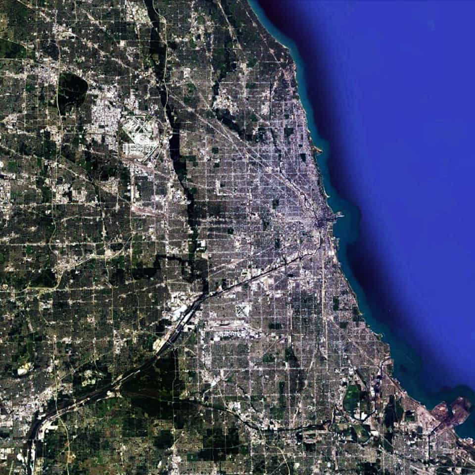
Chicago has the most pervasively-realized regular grid in the world. In fact, the scale of the regular grid in Chicago is so massive that it is almost impossible to truly appreciate its scale. From one extreme to the other, it is probably the size of southeast England or twice the size of the European country of Luxembourg. However, it is only by examining the Chicago urban pattern at this scale that we can truly appreciate that there is a distinctive center-to-edge logic to the metropolitan region; most notably along the alignment of the Chicago River/Stevenson Expressway from the Loop in a southwest direction out of the area. This center-to-edge logic is replicated at the large-scale in the northern metropolitan region as well along the alignment of old Indian trails, which were incorporated into the urban fabric as paved roads; most notably a series of diagonal streets associated with the Northwest Highway out of town towards the state of Wisconsin.
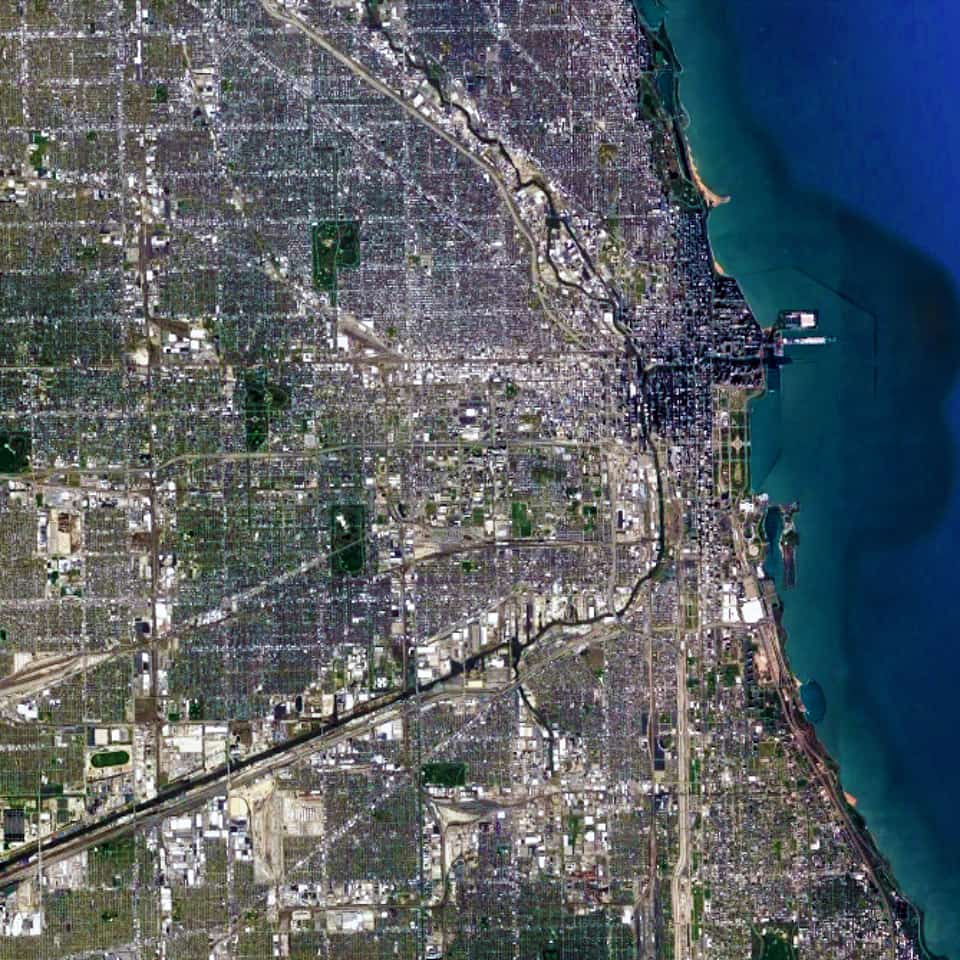
When we zoom in on the Chicago urban pattern, the crucial role of the Chicago River as a water-based transportation artery in the city becomes much more obvious. So does the multitude of skyscrapers in the central business district of the Loop (north and west of Grant Park at the shoreline of Lake Michigan). We can also see the large building footprints of Industrial land uses gathered around the entire length of the Chicago River from the southeast into the center of the city and then northward. All of these topographical, geographical, and infrastructure components are woven together within the ‘relentless’ regular gridiron layout, which serves to privilege downtown Chicago (and, in particular, The Loop) within the larger urban pattern of metropolitan Chicago. This barely begins to scratch the surface of why the Chicago grid plays such a significant role in its magnificence as one of the world’s greatest urban patterns.
Urban Patterns is a series of posts from The Outlaw Urbanist presenting interesting examples of terrestrial patterns shaped by human intervention in the urban landscape over time.

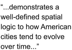
 However, in more important ways, American cities are still subject to the same processes linking street networks and human use found in all cities of the world.
 and 3) the consequences of government regulations, Euclidean zoning, modern transportation planning, and suburbanization during the post-war period in generating a hierarchal grid logic to the American regular grid planning tradition. The implications of development patterns and land consumption unseen during the history of city building over the previous 10,000 years are discussed.
 By understanding these concepts, we can better understand how “bedrock” urban attributes (such as block size and dwelling entrances) and common growth trends (such as strip malls and leapfrog development) play a role in the spatial logic of American cities. The objective of this course is to better understand the spatial implications of design decisions when intervening in the American city.
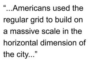 The course also compares the characteristics of block and street length in several American and European cities to demonstrate how Americans used the regular grid to build on a massive scale in the horizontal dimension of the city, which suburban sprawl has accentuated and abused since World War II. Finally, the course also discusses implications for sustainable cities in the 21st century.